Rincon Hill, San Francisco facts for kids
Quick facts for kids
Rincon Hill
|
|
|---|---|
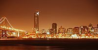
Rincon Hill neighborhood viewed from across the San Francisco Bay.
|
|
| Area | |
| • Total | 0.25 km2 (0.096 sq mi) |
| • Land | 0.25 km2 (0.096 sq mi) |
| Population
(2008)
|
|
| • Total | 1,532 |
| • Density | 6,155/km2 (15,942/sq mi) |
| ZIP code |
94105
|
| Area codes | 415/628 |
| Reference #: | 84 |
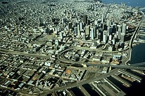
Rincon Hill is a neighborhood in San Francisco, California. Its name comes from the Spanish word Rincón, which means "corner." It's one of San Francisco's original "Seven Hills."
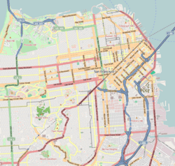
This small neighborhood is surrounded by Folsom Street, the Embarcadero, Bryant Street, and Essex Street. It's named after Rincon Point, which used to stick out into the bay. Rincon Hill is about 100 feet (30 meters) tall.
After the California Gold Rush, Rincon Hill became a popular place for fancy homes. But after the 1906 earthquake and fire, it changed into an area with factories and warehouses. In 1985, and again in 2005, the city decided to make it a place for many new homes. The goal was to house up to 10,000 people close to the city's Financial District.
Contents
The Story of Rincon Hill
The area where Rincon Hill stands today was once a sandy piece of land. It formed the southern edge of Yerba Buena Cove. This land ended at Rincon Point, which gave Rincon Hill its name. Before the California Gold Rush in 1849, not many people lived here. Most early buildings were on the north side of the cove.
From Gold Rush to the 1906 Earthquake
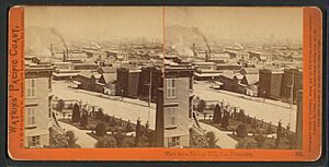
When the Gold Rush brought many people, the cove was filled in, and more streets were built. Rincon Hill became popular because of its great views and sunny weather. Wealthy families, like merchants and sea captains, built their homes here. They wanted to be away from the busy and sometimes wild Barbary Coast. In the 1850s and 1860s, Rincon Hill was one of the most important neighborhoods in the city.
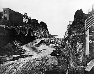
A big change happened in 1869 with the Second Street Cut. This project cut through Rincon Hill to make it easier to reach factories to the south. The 100-foot (30-meter) deep canyon split the hill. This made homes on both sides unstable and less desirable.
By the 1870s, cable cars made it easier to build homes on other hills. Wealthy families started moving to taller hills north of Market Street, like Nob Hill. Rincon Hill slowly became a less fancy area.
Changes After the 1906 Quake
The 1906 earthquake and fire destroyed the remaining large homes on Rincon Hill. Many small, temporary shelters were built in their place. While much of San Francisco was quickly rebuilt, Rincon Hill stayed mostly empty for many years. Some city plans even suggested removing the entire hill to create more flat land. These ideas made people not want to build new things there.
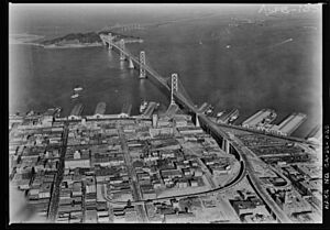
The construction of the San Francisco–Oakland Bay Bridge in the 1930s changed the area again. The bridge cleared out the old shelters. In 1933, Rincon Hill was recognized as a California Historical Landmark. The plaque mentioned that famous people like William Tecumseh Sherman once lived there. It also noted how the hill had changed over time.
With the new bridge, the area slowly became a place for factories and shipping. It was close to the Port of San Francisco. In 1934, Rincon Hill was the site of important labor protests. These protests led to a big strike by workers.
In the 1950s, the Embarcadero Freeway was built. This freeway surrounded Rincon Hill and cut it off from the Financial District. As factories and shipping jobs left the city, the area became run-down. For many years, Rincon Hill was largely forgotten.
A Modern Neighborhood for Homes
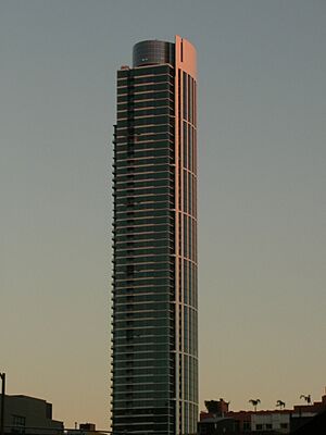
People knew Rincon Hill could be a great place for homes because it was so close to downtown. However, the old freeway and other issues slowed down new building projects. The buildings that were constructed were often bulky and blocked views. They also didn't make the streets very friendly for people walking.
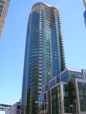
After the Embarcadero Freeway was damaged in the 1989 Loma Prieta earthquake and then removed, the area became much more attractive. In 2005, the city created a new plan for Rincon Hill. This plan focused on building tall, slender towers that were spaced out. It also included smaller buildings and townhouses. The idea was to put the tallest skyscrapers at the very top of Rincon Hill. Folsom Street was planned to be the main street for shops and businesses. The plan also aimed to make streets better for walking and create more open spaces.
The new plan allowed buildings to be much taller, up to 400 and 550 feet (122 and 168 meters). Many new residential buildings were approved. Some, like The Infinity and One Rincon Hill, were built before the 2008 financial crisis slowed things down. As the economy improved, more towers were built. These included the second tower of One Rincon Hill, 45 Lansing Street, LUMINA, and 399 Fremont Street.
In 2015, property owners created a group called the Greater Rincon Hill Community Benefit District. This group works to improve the neighborhood and make it a better place to live. In 2017, the group changed its name to the East Cut Community Benefit District. This new name includes Rincon Hill, Folsom Street, and the Transbay areas.
See also
- List of tallest buildings in San Francisco for more information about new Rincon Hill skyscrapers.
- List of San Francisco, California Hills
- Edwin Klockars' Blacksmith Shop
- Schmidt Lithography Co. Clock Tower
 | Laphonza Butler |
 | Daisy Bates |
 | Elizabeth Piper Ensley |


