Riniken facts for kids
Quick facts for kids
Riniken
|
||
|---|---|---|
 |
||
|
||
| Country | Switzerland | |
| Canton | Aargau | |
| District | Brugg | |
| Area | ||
| • Total | 4.76 km2 (1.84 sq mi) | |
| Elevation | 387 m (1,270 ft) | |
| Population
(Dec 2020 )
|
||
| • Total | 1,482 | |
| • Density | 311.3/km2 (806.4/sq mi) | |
| Postal code |
5223
|
|
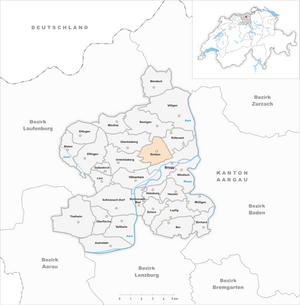
| Surrounded by | Brugg, Oberbözberg, Remigen, Rüfenach, Umiken, Unterbözberg | |
Riniken is a small town, also called a municipality, located in the Brugg district of Aargau canton in Switzerland. It's a quiet place with a rich history and beautiful natural surroundings.
Contents
History of Riniken
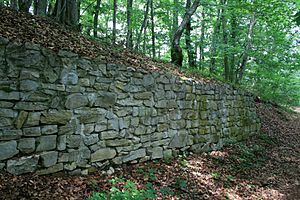
The village of Riniken was first mentioned in official papers in 1253. It was called Rinikon back then. Before the village was even named, Iberg Castle was built nearby in the 11th century. However, people stopped using the castle around the year 1200.
Who Ruled Riniken?
For a long time, the powerful Habsburg family controlled the "high justice" in Riniken. This meant they had the power to make important decisions and judge serious crimes. In 1460, these rights went to the city of Bern, specifically to an area called the bailiwick of Schenkenberg.
The "low justice" rights, which dealt with smaller local matters, were held by Königsfelden Abbey until 1406. After the Protestant Reformation (a big religious change in Europe), these rights were moved to Bözberg.
Religious Life and Changes
Riniken used to be part of the Umiken parish, which is like a church district. In 1967, the village got its own private cemetery. Later, in 1978, an ecumenical church center was built. This means it was a place where different Christian groups could worship together.
Life and Work in Riniken
Starting in 1712, some people from Riniken moved to Dättwil (which is now part of Baden). This happened because farming in Riniken didn't offer much money. Riniken never had big factories or industries. However, by 1960, about half of the people working in Riniken were in the "second sector." This means they worked in manufacturing or construction.
Today, Riniken's population has grown because many people who work in other towns choose to live there. They travel, or "commute," to their jobs.
Geography of Riniken
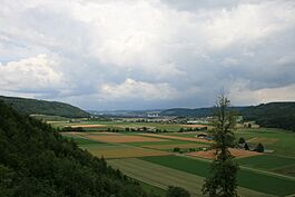
Riniken covers an area of about 4.75 square kilometers (1.83 square miles). A large part of this land is covered by nature.
How the Land is Used
- About 30.5% of the land is used for farming. This includes growing crops and having pastures for animals.
- A big part, 56.8%, is covered by forests.
- About 12.4% of the land is developed with buildings and roads.
- A very small amount, 0.2%, is unproductive land, like rocky areas.
Most of the developed area is made up of houses and other buildings (6.7%). Roads and other transport areas make up 4.0%.
Village Layout
Riniken is located in the Brugg district. It includes the main village, which used to be a "linear village." This means it was built mostly along a single road. The municipality also includes smaller settlements called "hamlets," like Neuriniken.
Riniken's Coat of Arms
Every town has a special symbol called a coat of arms. Riniken's coat of arms is described as: Or a Pine Tree Vert trunked proper issuant from Coupeaux of the second.
This means the background is gold (Or). There is a green (Vert) pine tree with a natural brown trunk (trunked proper). The tree grows from green hills (Coupeaux of the second).
People of Riniken (Demographics)
Riniken has a population of about 1,412 people (as of 2022). About 16.3% of the people living in Riniken are from other countries.
Languages Spoken
Most people in Riniken speak German, which is about 88.5% of the population. Albanian is the second most common language, spoken by 2.3% of people. Italian is the third most common, spoken by 1.5%.
Age Groups
Here's a look at the different age groups in Riniken (as of 2008):
- Children (0-9 years old): 8.9%
- Teenagers (10-19 years old): 11.7%
- Young Adults (20-29 years old): 12.3%
- Adults (30-39 years old): 12.3%
- Adults (40-49 years old): 15.6%
- Adults (50-59 years old): 13.9%
- Seniors (60-69 years old): 12.9%
- Seniors (70-79 years old): 8.9%
- Seniors (80-89 years old): 3.1%
- Seniors (90 and older): 0.4%
Homes and Housing
As of 2000, there were many homes with families. The average number of people living in each home was about 2.47. In 2008, about 43.6% of all homes were single-family houses. There were also some empty apartments, with a vacancy rate of 1.9%. This means only a small number of homes were available for rent or sale.
Politics
In the 2007 national election, the most popular political party in Riniken was the SVP. They received about 35.3% of the votes. Other popular parties included the SP, the FDP, and the CVP.
Education
Many adults in Riniken have a good education. About 79.2% of people aged 25–64 have completed either high school or a higher education degree from a university or a specialized college (Fachhochschule). In the 2008/2009 school year, 103 students from Riniken attended primary school in the municipality.
Population Over Time
Here's how Riniken's population has changed through history:
| Historical population | ||
|---|---|---|
| Year | Pop. | ±% |
| 1764 | 213 | — |
| 1831 | 424 | +99.1% |
| 1850 | 338 | −20.3% |
| 1888 | 272 | −19.5% |
| 1900 | 291 | +7.0% |
| 1950 | 300 | +3.1% |
| 1970 | 947 | +215.7% |
| 2000 | 1,369 | +44.6% |
Economy of Riniken
In 2007, Riniken had a low unemployment rate of 1.99%. This means most people who wanted to work had jobs.
Types of Jobs
- Primary Sector: In 2005, 28 people worked in the primary sector. This includes jobs like farming and forestry. There were about 10 businesses in this sector.
- Secondary Sector: 80 people worked in the secondary sector. These jobs involve making things, like in factories or construction. There were 12 businesses in this area.
- Tertiary Sector: 80 people worked in the tertiary sector. This includes jobs that provide services, like shops, offices, or healthcare. There were 21 businesses in this sector.
Commuting to Work
Many people who live in Riniken travel to other towns for work. In 2000, about 85.5% of the workers living in Riniken commuted outside the municipality. However, 73 people also traveled into Riniken for their jobs.
For getting to work, about 21.1% of the working population used public transportation, like buses or trains. A larger number, 54.1%, used their own private cars.
Religion in Riniken
Based on the 2000 census, people in Riniken follow different religions:
- About 30.4% were Roman Catholic.
- About 52.1% belonged to the Swiss Reformed Church (a Protestant church).
- A small number of people belonged to the Christian Catholic Church of Switzerland.
See also
 In Spanish: Riniken para niños
 | Ernest Everett Just |
 | Mary Jackson |
 | Emmett Chappelle |
 | Marie Maynard Daly |


