River Ashop facts for kids
Quick facts for kids River Ashop |
|
|---|---|

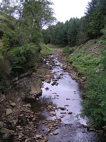
The River Ashop in Snake Woodlands
|
|
| Country | England |
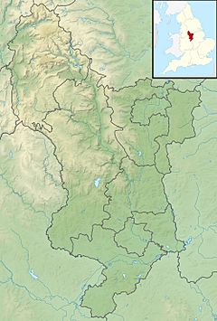
| Counties | Derbyshire |
| Physical characteristics | |
| Main source | Ashop Head, Black Ashop Moor, Derbyshire |
| River mouth | Ladybower Reservoir, Derbyshire 53°22′23″N 1°42′38″W / 53.372985°N 1.710658°W |
| Length | 10 km (6.2 mi) |
| Basin features | |
| Basin size | 49.5 km2 (19.1 sq mi) |
| Tributaries |
|
| Progression : Ashop—Derwent—Trent—Humber | |
The River Ashop is a river in the Peak District area of Derbyshire, England. It starts high up on the eastern side of Mill Hill. This spot is near Glossop and just north of Kinder Scout.
The river flows for about 10 kilometres (6 miles) towards the east. It follows the famous Snake Pass road, which connects Sheffield and Manchester. The Ashop winds through quiet countryside before flowing into Ladybower Reservoir. From there, its waters join the River Derwent.
The River Alport is the only important tributary (a smaller river or stream that flows into a larger one) of the River Ashop. Part of the Alport's water is moved by a special wall called a weir. This weir sends water into the Ashop. This was done in the 1920s to help fill the Derwent Reservoir. Later, Ladybower Reservoir was built further downstream.
The weir helps collect water. It sends the water into an open channel (like a ditch) along the side of the hill. This channel then feeds into a siphon (a pipe that moves liquid over a high point). The siphon is a 6-foot-wide iron pipe that crosses the river. After that, the water goes through a tunnel in the hill. It then flows into the Derwent Reservoir through an open waterway, joining the reservoir near its dam. You can see the concrete structure of this weir when you drive along the Snake Pass from Sheffield.
Fun on the River Ashop
The River Ashop is sometimes used for fun activities like kayaking. This usually happens after a lot of rain, when the river is full and flowing fast. Normally, the river is too shallow for kayaking.
When the river is high, it becomes quite challenging. There are many weirs (small dams) and holes in the water. The river is narrow and not very deep, so the rocky bottom can be tricky for kayakers if they tip over. The most difficult part is in the upper section, where a small stream flows quickly through a steep tunnel under the road. The river also has obstacles like fallen trees and fences across the water. These must be carefully avoided, especially when the water is high and fast.
 | Bayard Rustin |
 | Jeannette Carter |
 | Jeremiah A. Brown |


