Roche Bonhomme facts for kids
Quick facts for kids Roche Bonhomme |
|
|---|---|

Roche Bonhomme
|
|
| Highest point | |
| Elevation | 2,500 m (8,200 ft) |
| Prominence | 160 m (520 ft) |
| Parent peak | Grisette Mountain (2620 m) |
| Listing | Mountains of Alberta |
| Geography | |
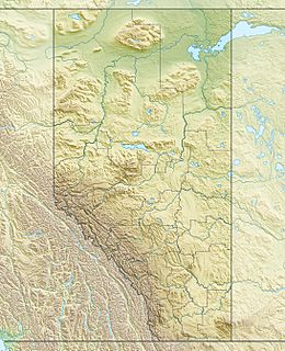
| Location | Jasper National Park Alberta, Canada |
| Parent range | Colin Range Canadian Rockies |
| Topo map | NTS 83C/13 |
| Type of rock | sedimentary rock |
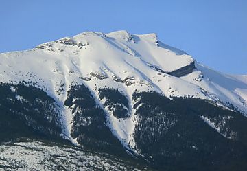
Roche Bonhomme is a tall mountain in Jasper National Park in Alberta, Canada. It stands about 2,500 meters (8,200 feet) high. This mountain is part of the Colin Range, which is a smaller group of mountains within the huge Canadian Rockies.
You can find Roche Bonhomme about 13 kilometers (8 miles) northeast of the town of Jasper. It's a very noticeable mountain in the Athabasca Valley. You can easily see it from Highway 16 and even from the Canadian passenger train. The mountain closest to Roche Bonhomme that is even taller is Grisette Mountain, located about 2.2 kilometers (1.4 miles) to the east.
What's in a Name?
Roche Bonhomme got its name in 1878 from George Munro Grant. He named it because the mountain looks a bit like a human face or figure. The name "Roche Bonhomme" comes from French and means "Rock Fellow."
The official name for the mountain was accepted in 1947 by the Geographical Names Board of Canada. Roche Bonhomme is made up of different layers of sedimentary rock. These layers were formed over millions of years from sand and mud that hardened into rock.
Mountain Weather
Roche Bonhomme has a subarctic climate. This means it has very cold and snowy winters. Temperatures can drop below -20 °C (-4 °F). With the wind, it can feel even colder, sometimes below -30 °C (-22 °F).
Summers are mild and pleasant. The best time to visit or climb the mountain is usually from June through September. Water from the melting snow and rain on Roche Bonhomme flows into streams that lead to the Maligne River. This river then flows into the larger Athabasca River.
 | Ernest Everett Just |
 | Mary Jackson |
 | Emmett Chappelle |
 | Marie Maynard Daly |


