
Rock Creek (Monocacy River tributary) facts for kids
Quick facts for kids Rock Creek |
|
|---|---|

The confluence of Rock and Marsh Creek is north of the Pennsylvania/Maryland border by 12.7 arcseconds (c. 1907 map).
|
|

On July 2, 1863, "Wiedrich's battery [of] six rifled cannon also exchanged fire with one of Jones's batteries on the opposite side of Rock Creek",[1] and snipers from a home on the East side fired on positions on the West side of the creek (on July 3, Confederates retreated across Rock Creek.)[2]
|
|
| Country | United States |
| State | Pennsylvania |
| Region | Adams County |
| Townships | West: Cumberland, East: Mount Joy & Straban |
| Cities | Gettysburg, PA, Barlow, PA |
| Physical characteristics | |
| Main source | Susquehanna drainage divide |
| River mouth | Monocacy River |
| Basin features | |
| Basin size | 65 sq mi (170 km2) |
| Tributaries |
|
| Namesakes | Civil War: Rock Creek Rangers |
Rock Creek is a stream in south-central Pennsylvania, about 18.9-mile-long (30.4 km). It flows into the Monocacy River and forms the boundary between Cumberland and Mount Joy townships.
This creek has a rich history. During the time of the Underground Railroad, people seeking freedom used Rock Creek at McAllister's Mill. They would walk through the water to make it harder for tracking dogs to follow them. The creek also flows near important sites from the Gettysburg Battlefield, like Culp's Hill, the Benner Hill artillery spot, and Barlow Knoll.
Contents
Exploring Rock Creek: Key Locations
Rock Creek starts where water drains from the Susquehanna River area. It then flows south, meeting many roads and smaller streams along the way.
Bridges and Crossings
Over the years, many bridges have been built over Rock Creek.
- One important crossing is where US 30 (the Lincoln Highway) crosses the creek. An old stone bridge from 1807 was replaced by a covered bridge, and then by modern bridges.
- PA 116 also crosses Rock Creek. This site once had a 90-foot covered bridge built in 1853.
- Near the Mason–Dixon line, there was a 192-foot bridge built in 1890. Part of it collapsed in 1946.
Historical Significance
Rock Creek played a role in the American Civil War.
- On June 27, 1863, Jubal Early's Confederate soldiers burned a railroad bridge trestle over the creek. It was rebuilt quickly.
- The creek was also a key feature during the Battle of Gettysburg. For example, on July 2, 1863, cannons fired across the creek. Snipers also used homes on the east side to shoot at positions on the west side.
- Many battle records mention the "Rock Creek Ravine."
- The 1893 Warren survey line for the Gettysburg Battlefield crossed the creek.
Mills and Fords
Historically, the creek was used for mills and had several shallow crossing points called fords.
- There were ruins of a dam from the 1798 Black's/Horner's Mill, which helped power a mill.
- Fords like "Cromer's Ford" were used for travel, though they could be dangerous during floods.
What Are Rock Creek's Tributaries?
A tributary is a smaller stream or river that flows into a larger one. Rock Creek has several important tributaries.
Blocher's Run
Blocher's Run flows from Oak Ridge on the Gettysburg Battlefield. It runs eastward into Rock Creek. During the First Day of the Battle of Gettysburg, Confederate soldiers used the trees along this stream for cover.
Guinn Run
Guinn Run flows southeast from Cemetery Hill, past the Gettysburg Museum and Visitor Center, and into Rock Creek. Bridges were built over it early on, including for the Gettysburg and Petersburg Turnpike Company. Later, the United States Department of War built bridges for roads like Hunt Avenue and Slocum Avenue. In the past, a dam on Guinn Run created a pond for a place called Fantasyland.
Spangler Spring Run
Spangler Spring Run starts near Culp's Hill and flows into Rock Creek. It runs through parts of the Gettysburg Battlefield where the Second Day of the Battle of Gettysburg took place.
Stevens Run
Stevens Run (also called Stevens Creek or Tiber) is about 2.2-mile-long (3.5 km). It flows over the Gettysburg Battlefield and through the town of Gettysburg. Inside the town, parts of the stream are in a concrete channel, some of which are covered. Historically, Samuel Gettys' Tavern was located near this run.
Winebrenner Run
Winebrenner Run is a stream in Gettysburg that flows eastward into Rock Creek. During the Battle of Gettysburg, the Confederate military line along this stream was the starting point for the battle of East Cemetery Hill. Much of the upper part of the run was put into underground pipes around 1961 to make space for a school near the Culp Farm.
White Run
White Run flows along East Cavalry Field and is the name behind the Rock Creek-White Run hospital complex. Its mouth is at Rock Creek, near the Trostle Farm, which was a hospital site during the Civil War.
Images for kids
-
US Route 15 shield
-
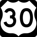
US Route 30 shield
-

Pennsylvania Route 116 shield
-
Pennsylvania Route 97 shield
-

Pennsylvania Route 134 shield


