Rockford metropolitan area, Illinois facts for kids
Quick facts for kids
Rockford–Freeport–Rochelle, IL
|
|
|---|---|
|
Combined Statistical Area
|
|
| Rockford–Freeport–Rochelle, IL | |

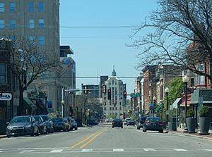
Downtown East State Street corridor
|
|
| Country | |
| State | |
| Time zone | UTC−6 (CST) |
| • Summer (DST) | UTC−5 (CDT) |
The Rockford Metropolitan Statistical Area is a special area in north-central Illinois. It's defined by the United States Census Bureau. This area includes four counties and has the city of Rockford as its main center.
In 2010, about 349,431 people lived in the Rockford Metropolitan Statistical Area. This area is close to the Janesville-Beloit Metropolitan Statistical Area and the Chicago Metropolitan Statistical Area. It's also a big part of the larger Rockford–Freeport–Rochelle Combined Statistical Area, which had an estimated population of 455,595 people.
Contents
Counties in the Area
The Rockford area includes these four counties:
Main Cities and Towns
This area is home to many different communities, from large cities to smaller towns and villages.
Major Cities
- Rockford: This is the largest city and the main center of the area.
- Belvidere
- Freeport
- Loves Park
- Machesney Park
Other Towns and Villages
There are many other places where people live in the Rockford area. These include towns like Rochelle, Rockton, Roscoe, and South Beloit. Smaller communities also include Byron, Cherry Valley, and Winnebago.
Population Changes Over Time
| Historical population | |||
|---|---|---|---|
| Census | Pop. | %± | |
| 1900 | 47,845 | — | |
| 1910 | 63,153 | 32.0% | |
| 1920 | 90,929 | 44.0% | |
| 1930 | 117,373 | 29.1% | |
| 1940 | 121,178 | 3.2% | |
| 1950 | 152,385 | 25.8% | |
| 1960 | 230,091 | 51.0% | |
| 1970 | 272,063 | 18.2% | |
| 1980 | 279,514 | 2.7% | |
| 1990 | 283,719 | 1.5% | |
| 2000 | 320,204 | 12.9% | |
| 2010 | 349,431 | 9.1% | |
| 2018 (est.) | 337,658 | −3.4% | |
| U.S. Decennial Census |
|||
In the year 2000, there were about 320,204 people living in the Rockford Metropolitan Statistical Area. This included 122,577 households and 84,896 families.
Most people in the area were White (83.46%). About 9.27% were African American, and 1.56% were Asian. People of Hispanic or Latino background made up 7.63% of the population.
The average income for a household in the area was about $48,142. For families, the average income was around $55,881.
Understanding the Combined Statistical Area
The Rockford–Freeport–Rochelle Combined Statistical Area is a larger grouping of counties in north-central Illinois. It brings together different statistical areas to give a bigger picture of the region.
This larger area includes one metropolitan area and two micropolitan areas. In 2009, this combined area had an estimated population of 455,595 people.
Metropolitan and Micropolitan Areas
- Metropolitan Statistical Area (MSA)
- Rockford: This includes Winnebago and Boone counties.
- Micropolitan Statistical Areas (µSAs)
- Freeport: This area covers Stephenson County.
- Rochelle: This area covers Ogle County.
See also
 In Spanish: Área metropolitana de Rockford para niños
 | Chris Smalls |
 | Fred Hampton |
 | Ralph Abernathy |

