
Boone County, Illinois facts for kids
Quick facts for kids
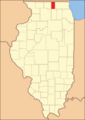
Boone County
|
|
|---|---|
.jpg)
Floyd Hopkins Block in the Belvidere North State Street Historic District
|
|

Location within the U.S. state of Illinois
|
|
 Illinois's location within the U.S. |
|
| Country | |
| State | |
| Founded | March 3, 1836 |
| Named for | Daniel Boone |
| Seat | Belvidere |
| Largest city | Belvidere |
| Area | |
| • Total | 282.039 sq mi (730.48 km2) |
| • Land | 280.741 sq mi (727.12 km2) |
| • Water | 1.298 sq mi (3.36 km2) |
| Population
(2020)
|
|
| • Total | 53,448 |
| • Estimate
(2023)
|
53,202 |
| • Density | 189.5057/sq mi (73.1686/km2) |
| Time zone | UTC−6 (Central) |
| • Summer (DST) | UTC−5 (CDT) |
| Congressional districts | 11th, 16th |
Boone County is a county in the state of Illinois, USA. It's located in the northern part of Illinois. In 2020, about 53,448 people lived here. The main town, or county seat, is Belvidere. Boone County is part of the larger Rockford area.
Contents
History of Boone County
Ancient Times and Early Settlers
Long ago, much of northern Illinois was covered by a shallow sea. But Boone County was different! Its rocks, called bedrock, are mostly from a very old time called the Ordovician period. Later, huge sheets of ice, called glaciers, covered the land. These glaciers left behind thick layers of dirt and rocks, sometimes hundreds of feet deep. This made the land what it is today.
Before European settlers arrived, the area had thick forests and wide-open grassy plains. Archeologists have found signs that people lived along the Illinois and Mississippi rivers thousands of years ago. When Europeans first explored, different Native American tribes, like the Potowatomi and Mascouten, lived in this region.
How Boone County Was Formed
Boone County was officially created on March 3, 1836. It was formed from a part of Winnebago County. The county was named after Daniel Boone, a famous American explorer and frontiersman from Kentucky.
The first non-Native American settlers came to Boone County in 1835. They arrived after the Black Hawk War ended and after the Erie Canal was finished, which made travel easier. These early settlers were mostly from New England. They were often called "Yankees" and were descendants of English Puritans. Many of them belonged to the Congregational Church, or had become Methodists or Baptists. When they first arrived, the area was mostly untouched forest and wild prairie. Later, in the late 1870s, immigrants from Germany and Ireland also began to settle here.
-
Boone County when it was created in 1836

Geography
Boone County covers about 282 square miles. Most of this area, about 280.7 square miles, is land. A small part, about 1.3 square miles, is water.
Neighboring Counties
Boone County shares borders with several other counties:
- Rock County, Wisconsin - to the north
- Walworth County, Wisconsin - to the northeast
- McHenry County - to the east
- DeKalb County - to the south
- Ogle County - to the southwest
- Winnebago County - to the west
Main Roads
These are some of the important highways that go through Boone County:
 Interstate 90
 US Route 20
 Illinois Route 76
 Illinois Route 173
- Logan Avenue (County Route 40)
- Genoa Road (T-40)
- Garden Prairie Road (County Route 41)
- Poplar Grove Road (County Route 32)
- Capron Road (T-41)
Weather and Climate
| Weather chart for Belvidere, Illinois | |||||||||||||||||||||||||||||||||||||||||||||||
|---|---|---|---|---|---|---|---|---|---|---|---|---|---|---|---|---|---|---|---|---|---|---|---|---|---|---|---|---|---|---|---|---|---|---|---|---|---|---|---|---|---|---|---|---|---|---|---|
| J | F | M | A | M | J | J | A | S | O | N | D | ||||||||||||||||||||||||||||||||||||
|
1.5
28
11
|
1.3
33
16
|
2.4
45
26
|
3.7
59
37
|
4.1
71
47
|
4.6
81
57
|
3.9
85
62
|
4.5
82
60
|
3.3
75
51
|
2.6
63
39
|
2.7
47
29
|
2
33
17
|
||||||||||||||||||||||||||||||||||||
| temperatures in °F precipitation totals in inches source: The Weather Channel |
|||||||||||||||||||||||||||||||||||||||||||||||
|
Metric conversion
|
|||||||||||||||||||||||||||||||||||||||||||||||
The weather in Boone County changes a lot with the seasons. In Belvidere, the county seat, average temperatures can be as low as 11°F (about -12°C) in January. In July, they can reach a high of 85°F (about 29°C). The coldest temperature ever recorded was -29°F (about -34°C) in January 1979, and the hottest was 109°F (about 43°C) in July 1936. The county usually gets the most rain in June.
People of Boone County (Demographics)

| Historical population | |||
|---|---|---|---|
| Census | Pop. | %± | |
| 1840 | 1,705 | — | |
| 1850 | 7,624 | 347.2% | |
| 1860 | 11,678 | 53.2% | |
| 1870 | 12,942 | 10.8% | |
| 1880 | 11,508 | −11.1% | |
| 1890 | 12,203 | 6.0% | |
| 1900 | 15,791 | 29.4% | |
| 1910 | 15,481 | −2.0% | |
| 1920 | 15,322 | −1.0% | |
| 1930 | 15,078 | −1.6% | |
| 1940 | 15,202 | 0.8% | |
| 1950 | 17,070 | 12.3% | |
| 1960 | 20,326 | 19.1% | |
| 1970 | 25,440 | 25.2% | |
| 1980 | 28,630 | 12.5% | |
| 1990 | 30,806 | 7.6% | |
| 2000 | 41,786 | 35.6% | |
| 2010 | 54,165 | 29.6% | |
| 2020 | 53,448 | −1.3% | |
| 2023 (est.) | 53,202 | −1.8% | |
| U.S. Decennial Census 1790-1960 1900-1990 1990-2000 2010-2013 |
|||
In 2020, Boone County had 53,448 people. There were about 18,799 households, which are groups of people living together. The population density was about 189.5 people per square mile.
Most people in Boone County are white (about 72.5%). About 24.1% of the population is of Hispanic or Latino background. Other groups include Black or African American (2.3%), Asian (1.2%), and American Indian (0.9%). About 11.4% of people reported being from two or more races.
The most common family backgrounds reported were German (23.7%), Irish (11.7%), Italian (7.4%), and Swedish (7.4%).
About 31.7% of households had children under 18 living with them. The average household had 2.82 people. The median age in the county was 38.7 years old. This means half the people were younger than 38.7 and half were older.
The median income for a household in Boone County was about $70,396. This means half the households earned more than this, and half earned less. About 8.2% of all people in the county lived below the poverty line.
Education
Boone County has several school districts that serve its communities:
- Belvidere Community Unit School District 100
- Harvard Community Unit School District 50
- Hiawatha Community Unit School District 426
- North Boone Community Unit School District 200
- Rockford School District 205
Communities
Boone County has several cities and villages where people live. Here are some of them:
| Community |
Community type |
Population | Total Area |
Water Area |
Land Area |
Pop. Density |
|
|---|---|---|---|---|---|---|---|
| Belvidere | city | 25,339 | 12.38 | 0.24 | 12.14 | 2,087.06 | |
| Caledonia | village | 183 | 1.03 | 0.00 | 1.03 | 176.81 | |
| Capron | village | 1,395 | 0.77 | 0.00 | 0.77 | 1,806.7 | |
| Cherry Valley | village | 2,905 | 8.66 | 0.25 | 8.40 | 345.63 | |
| Poplar Grove | village | 5,049 | 7.67 | 0.01 | 7.66 | 658.88 | |
| Timberlane | village | 906 | 1.76 | 0.02 | 1.75 | 518.90 | |
| Boone County | county | 53,448 | 282.039 | 1.298 | 280.741 | 190 |
Unincorporated Communities
These are smaller places in Boone County that are not officially part of a city or village:
- Argyle
- Beaverton Crossroads
- Blaine
- Candlewick Lake
- Edgewood
- Garden Prairie
- Herbert
- Hunter
- Irene
- Prairie View
- Russellville
Townships
Boone County is divided into nine smaller areas called townships:
- Belvidere
- Bonus
- Boone
- Caledonia
- Flora
- Leroy
- Manchester
- Poplar Grove
- Spring
See also
 In Spanish: Condado de Boone (Illinois) para niños
