Roseville Chase, New South Wales facts for kids
Quick facts for kids Roseville ChaseSydney, New South Wales |
|||||||||||||||
|---|---|---|---|---|---|---|---|---|---|---|---|---|---|---|---|

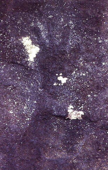
Aboriginal hand stencil in Roseville Chase
|
|||||||||||||||
| Population | 1,618 (2021 census) | ||||||||||||||
| Postcode(s) | 2069 | ||||||||||||||
| Elevation | 81 m (266 ft) | ||||||||||||||
| Location | 11 km (7 mi) north-west of Sydney CBD | ||||||||||||||
| LGA(s) | Ku-ring-gai Council | ||||||||||||||
| State electorate(s) | Davidson | ||||||||||||||
| Federal Division(s) | Bradfield | ||||||||||||||
|
|||||||||||||||
Roseville Chase is a quiet suburb located on the Upper North Shore of Sydney, in New South Wales, Australia. It is about 11 kilometres north-west of the main city centre. This area is part of the Ku-ring-gai Council local government area. It's important to know that Roseville Chase is a different suburb from Roseville, which is located to its west.
Exploring Roseville Chase's Location
Roseville Chase is found right next to Middle Harbour, which is a part of Sydney Harbour. This makes it a very private and leafy suburb, surrounded by lots of bushland.
The suburb has two main areas based on their geography. The "Chase Lowlands" are closer to the water, south of the large Roseville Bridge. The "Chase Heights" are higher up, around Ormonde Road. From here, you can get amazing views down to the harbour. These areas are also known as Upper Chase and Lower Chase.
North of Warringah Road (which is Upper Chase), there are fewer houses. This part of the suburb is mostly surrounded by natural bushland. The area is bordered by Moores Creek to the west and north, and Middle Harbour to the east. Much of the beautiful bushland around Roseville Chase is part of the Garigal National Park. This park helps protect the native plants and animals.
A Journey Through Roseville Chase's History
The land where Roseville Chase now stands was first home to Aboriginal people. They left behind special hand stencils in rock shelters. These stencils are like ancient paintings and show us that people lived here a very long time ago.
Later, in the early days of European settlement, Captain Arthur Phillip was looking for good land with plenty of water. This search led to the discovery of the shores of Roseville Chase. One of the first European settlers, Samuel Bates, built a farm at a place called Echo Point, near Middle Harbour.
Other European settlers, like David Mathew and Richard Archbold, also came to the area. Their land eventually stretched all the way to Moores Creek. This land was even used as an orchard, where fruit trees were grown.
During World War I, the area had a different purpose. It became a training ground for army engineers. These engineers were led by a person named Sir John Madsen.
During the time of the Great Depression, which was a period when many people lost their jobs and homes, some people lived in the bushland around Sydney. You can still find remains of these simple homes in the bush at Roseville Chase today.
The Roseville Chase Post Office opened its doors on March 2, 1953. It served the community for many years before closing in 1994.
Who Lives in Roseville Chase?
According to the 2021 Census, there were 1,618 people living in Roseville Chase. Most of the people, about 65.7%, were born in Australia.
When it comes to languages spoken at home, about 74.0% of residents spoke only English. For religion, the most common answers were "No Religion" (39.7%), "Catholic" (24.4%), and "Anglican" (14.4%).
 | Bessie Coleman |
 | Spann Watson |
 | Jill E. Brown |
 | Sherman W. White |


