Saline Valley facts for kids
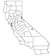
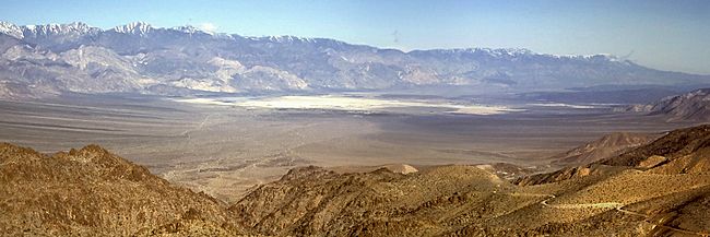
Saline Valley is a large, dry valley in the northern Mojave Desert in California. It's about 27 miles (43 km) long. This valley is like a giant ditch formed by faults in the Earth's crust. Most of Saline Valley became part of Death Valley National Park in 1994. Before that, the Bureau of Land Management looked after it.
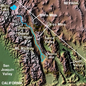
Saline Valley is located northwest of Death Valley itself. It is south of Eureka Valley and east of the Owens Valley. The lowest parts of the valley are about 1,000 feet (300 m) above sea level. The valley is in the rain shadow of the tall Sierra Nevada mountains (about 14,000 feet or 4,300 m high). The Inyo Mountains, about 11,000 feet (3,400 m) high, border the valley on the west.
Contents
Natural Wonders of Saline Valley
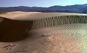
A large dry lake sits in the middle of Saline Valley. This lake bed is usually dry, but it can fill with water after heavy rains. The western end of the lake has a salt marsh. This marsh is home to many different plants and animals. A stream from Hunter Canyon keeps the marsh wet all year. North of the dry lake, you can find wide, low sand dunes.
Warm Springs: A Desert Oasis
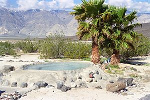
There are several hot springs in the northeast part of the valley. The water from these springs is naturally warm, usually around 107°F (42°C) at its source. The three main warm springs in Saline Valley can be reached by a road called Warm Springs Road or Painted Rock Road.
- Lower Warm Springs is the biggest and most popular spot for camping. It has been developed for visitors.
- Palm Spring is smaller and quieter. It offers great views of Saline Valley. Its water fills two soaking tubs called Wizard Pool and Volcano Pool.
- Upper Warm Spring is the smallest and most natural of the main springs. It's a deep pool of lukewarm blue water. It is surrounded by plants like cattail and grasses.
Saline Valley is a closed basin. This means water flows into it but does not flow out to the ocean. If it were filled with water, it would be over 4,000 feet (1,200 m) deep. It would form a lake about 500 square miles (1,300 km²) in size. This lake would hold about 500 million acre-feet (617 km³) of water.
History of Saline Valley
In ancient times, the Ko'ongkatün Band of the Timbisha Shoshone people lived in Saline Valley. One of their main villages was called Ko'on. So, the valley was named Ko'ongkatün after this village. The people living there were called Ko'ontsi. In the early 1900s, the village was left empty. The people moved to Darwin, California.
Mining for Minerals
Saline Valley was an important place for mining in the late 1800s and early 1900s. The Conn and Trudo Borax Company mined borax from the salt marsh. They worked there from 1874 to 1895. Today, you can still see some shallow pits from this mining near Saline Valley Road. People also started mining salt in 1903 at the south end of the lake. This continued into the 1930s.
The Amazing Salt Tram
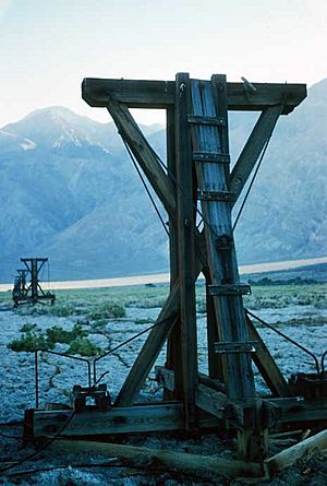
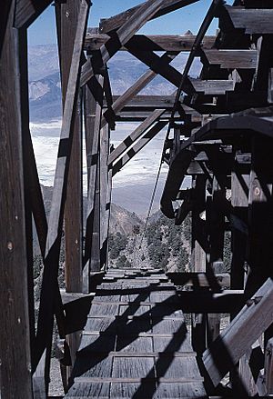
In 1911, an electric aerial tram was built to carry the salt. This tram was 14 miles (22 km) long. It went over the Inyo Mountains to a station near Keeler, California in the Owens Valley. The tram ran on and off from 1913 to 1936. But it was too expensive to keep running.
The salt tram was placed on the National Register of Historic Places in 1973. It was the steepest tram ever built in the United States. It started at 1,100 feet (340 m) in Saline Valley. Then it climbed to 8,500 feet (2,600 m) over the mountains. Finally, it went down to 3,600 feet (1,100 m). Its path went south from Salt Lake to Daisy Canyon. Then it went southwest to the Southern Pacific railroad between Dolomite and Swansea. Sadly, in recent years, parts of the tram have been damaged by vandals.
Improving the Hot Springs
In the 1960s, volunteers helped improve the hot springs in the valley. They built concrete tubs for soaking, a shower, a sink, and three outhouses. The Park Service later replaced the outhouses with stronger ones. To make it easier to get to the springs, two airstrips were built. These were called the "Chicken Strip" and "Tail-Dragger Strip." The Tail-Dragger Strip is now closed.
There are three main sections of springs: the upper, middle, and lower springs. The middle and lower springs have concrete soaking tubs and showers. The upper spring is still in its natural state. In late 2005, an earthquake affected the water flow to the lower springs. For a while, only the middle springs were working well. However, the water flow is slowly returning to the lower springs. By early 2007, the flow was about half of what it was before the earthquake, and it was still increasing. This means both the middle and lower springs are now working again.
Military Use of the Valley
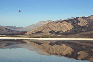
Low-flying jet aircraft have been common in Saline Valley for a long time. The sky above the valley is part of a large area used by the US military. This area is called the R-2508 Special Use Airspace complex. The Saline Military operations area (MOA) covers the entire valley. It goes from 200 feet (60 m) above the ground up to 18,000 feet (5,500 m). Even higher, from 18,000 feet (5,500 m) to 60,000 feet (18,300 m), there's another special area.
Military planes from places like Nellis AFB, Edwards AFB, NAWS China Lake, and NAS Lemoore use this airspace. They practice flying at both high and low altitudes. When flying in the Saline MOA, military aircraft use radio channels like 256.8 MHz or 123.95 MHz. For very low flights (below 1,500 feet or 460 m), they often use 315.9 MHz.
In December 2003, Edwards Air Force Base finished a study. This study looked at plans to build a radar system and a microwave repeater facility in the valley.


