Salt Fork Vermilion River facts for kids
Quick facts for kids Salt Fork |
|
|---|---|

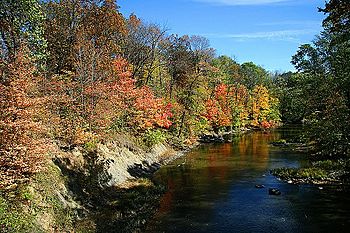
The Salt Fork near Ogden
|
|
| Physical characteristics | |
| Main source | 40°09′09″N 88°01′54″W / 40.1525342°N 88.0317044°W |
| River mouth | Confluence of the Salt Fork and the Middle Fork forming the Vermilion River west of Danville, Illinois 531 ft (162 m) 40°06′13″N 87°43′01″W / 40.1036474°N 87.716968°W |
| Length | 68 mi (109 km) |
| Basin features | |
| Progression | Salt Fork → Vermilion → Wabash → Ohio → Mississippi → Gulf of Mexico |
| Tributaries |
|
| GNIS ID | 417900 |

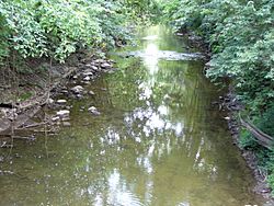
The Salt Fork is a river in Illinois. It flows into the Vermilion River. This means the Salt Fork is a "tributary" of the Vermilion River. It is located in a flat, fertile area called the Central Corn Belt Plains. This area is known for its farms, especially cornfields.
The Salt Fork gets its name from special salty springs. These "saline springs" were natural salt licks for animals. Early settlers and Native Americans also used these springs to make salt. These salty springs are found about eight miles west of Danville, near Muncie, Illinois. The parts of the Salt Fork further upstream do not have these salty springs.
Long ago, the Salt Fork flowed through a huge wet area called an "upland marsh." This marsh was located between the cities of Urbana and Rantoul. Over time, people dug "drainage ditches" to extend the river into these marshy areas. If you include these ditches, the Salt Fork is about 70 miles (110 km) long.
Cities and Towns Along the Salt Fork
Many cities and towns are located in the area drained by the Salt Fork. This area is called the river's "watershed." When rain falls in a watershed, it eventually flows into that river.
Here are some of the cities, towns, and villages in the Salt Fork watershed:
Counties in the Salt Fork Watershed
The Salt Fork river and its watershed stretch across two different counties in Illinois.
These counties are:
 | Jewel Prestage |
 | Ella Baker |
 | Fannie Lou Hamer |

