San Marcos Pass facts for kids
Quick facts for kids San Marcos Pass |
|
|---|---|

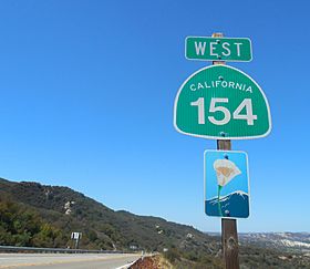
Along San Marcos Pass Rd., just west of Paradise Rd. in Los Padres National Forest
|
|
| Elevation | 2,225 ft (678 m) |
| Traversed by | |
| Location | Santa Barbara County, California, United States |
| Range | Santa Ynez Mountains |
| Coordinates | 34°30′42″N 119°49′29″W / 34.51167°N 119.82472°W |
San Marcos Pass is a mountain pass in the Santa Ynez Mountains in southern California. It's like a special road that goes through the mountains.
This pass is used by State Route 154. It helps connect the Santa Ynez Valley with Santa Barbara, California, a city right on the Pacific coast. The road goes through a part of the Los Padres National Forest. Because of how the road is, drivers are asked to keep their headlights on during the day. This helps everyone stay safe.
Contents
Exploring San Marcos Pass Geography
San Marcos Pass is one of three main routes that cross the steep Santa Ynez Mountains. It is the closest pass to the city of Santa Barbara.
Near the pass, you can find the Painted Cave community. This area is close to the Chumash Painted Cave State Historic Park. This park has ancient cave paintings made by the Chumash people. You can reach this area by taking East Camino Cielo Road from the pass.
The San Marcos Pass offers a shorter way to travel compared to Highway 101. However, it is a hillier road.
The "Battle" of Fremont's Pass
An interesting event happened at San Marcos Pass during the Mexican–American War in 1846. This event is sometimes called the "Battle" of Fremont's Pass, but no shots were actually fired.
A Tricky Mountain Crossing
On Christmas Eve, December 24, 1846, a group of American soldiers led by John C. Frémont crossed the mountains. They used San Marcos Pass, which was just a rough path back then. It was a very rainy night, and the path was muddy. The soldiers lost many horses and mules because the animals slid down the slippery slopes.
Reaching Santa Barbara
Despite the tough journey, the tired soldiers reached the Goleta Valley by the next morning. They rested there for two days. On December 27, 1846, they entered Santa Barbara. They raised the American flag at a building called the Thompson Adobe.
The town was not defended because the local men had already left. They went to join other forces in Los Angeles. These forces later surrendered to Frémont in January 1847.
A Landmark and a Legend
Today, there is a special marker that remembers this event. It is a California Historical Landmark. However, this marker is actually located at Gaviota Pass. This is because the Mexican forces had expected Frémont to come through Gaviota Pass and were waiting there.
A local Army National Guard center is named after Frémont. This is to remember his role in Santa Barbara becoming part of the United States. There is also a local story called "Frémont's Cannon" that comes from this time.
 | Jessica Watkins |
 | Robert Henry Lawrence Jr. |
 | Mae Jemison |
 | Sian Proctor |
 | Guion Bluford |

