
Sangerfield, New York facts for kids
Quick facts for kids
Sangerfield, New York
|
|
|---|---|

Entering the hamlet of Sangerfield along US 20 westbound
|
|

Location in Oneida County and the state of New York.
|
|
| Country | United States |
| State | New York |
| County | Oneida |
| Government | |
| • Type | Town Council |
| Area | |
| • Total | 30.98 sq mi (80.24 km2) |
| • Land | 30.80 sq mi (79.78 km2) |
| • Water | 0.18 sq mi (0.46 km2) |
| Elevation | 1,575 ft (480 m) |
| Population
(2010)
|
|
| • Total | 2,561 |
| • Estimate
(2016)
|
2,499 |
| • Density | 81.13/sq mi (31.32/km2) |
| Time zone | UTC-5 (Eastern (EST)) |
| • Summer (DST) | UTC-4 (EDT) |
| ZIP code |
13455
|
| Area code(s) | 315 |
| FIPS code | 36-65134 |
| GNIS feature ID | 0979458 |
Sangerfield is a town located in Oneida County, New York, in the United States. In 2010, about 2,561 people lived here. The town gets its name from Jedediah Sanger, who was one of the first people to settle in the area. Sangerfield is found on the southern edge of Oneida County.
Contents
Exploring Sangerfield's Geography
Sangerfield covers a total area of about 31 square miles (80 square kilometers). Most of this area is land, with a small part being water.
The southern and western borders of Sangerfield touch Madison County, New York. A major road, U.S. Route 20, runs through the town. The Sangerfield River is an important stream that flows south through Sangerfield.
Sangerfield's Past: A Look at History
Sangerfield was first settled around 1792.
In 1788, the State of New York bought a large area of land from the Oneida Indians. This land was known as "Clinton's Purchase." In 1789, the state surveyed a part of this land called "Township No. 20." This area was surveyed for Michael Myers, Jedediah Sanger, and John I. Morgan.
The region where Sangerfield is located had several different names and was part of different counties in its early years. Here's how its name and county changed over time:
| From Date | To Date | Town Name | County Name |
|---|---|---|---|
| February 15, 1791 | April 10, 1792 | Whitestown | Herkimer |
| April 10, 1792 | March 5, 1795 | Paris | Herkimer |
| March 5, 1795 | March 15, 1798 | Sangerfield | Herkimer |
| March 15, 1798 | April 4, 1804 | Sangerfield | Chenango |
| April 4, 1804 | Present | Sangerfield | Oneida |
Sangerfield was officially formed from the Town of Paris in 1795. This happened before Oneida County was even created. By 1920, the population of Sangerfield was 1,795 people.
People of Sangerfield: Population Facts
| Historical population | |||
|---|---|---|---|
| Census | Pop. | %± | |
| 1800 | 1,143 | — | |
| 1810 | 1,324 | 15.8% | |
| 1820 | 2,011 | 51.9% | |
| 1830 | 2,272 | 13.0% | |
| 1840 | 2,251 | −0.9% | |
| 1850 | 2,371 | 5.3% | |
| 1860 | 2,343 | −1.2% | |
| 1870 | 2,513 | 7.3% | |
| 1880 | 3,171 | 26.2% | |
| 1890 | 3,017 | −4.9% | |
| 1900 | 2,440 | −19.1% | |
| 1910 | 2,086 | −14.5% | |
| 1920 | 1,795 | −14.0% | |
| 1930 | 1,862 | 3.7% | |
| 1940 | 1,961 | 5.3% | |
| 1950 | 2,143 | 9.3% | |
| 1960 | 2,482 | 15.8% | |
| 1970 | 2,475 | −0.3% | |
| 1980 | 2,397 | −3.2% | |
| 1990 | 2,460 | 2.6% | |
| 2000 | 2,610 | 6.1% | |
| 2010 | 2,561 | −1.9% | |
| 2016 (est.) | 2,499 | −2.4% | |
| U.S. Decennial Census | |||
According to the 2000 census, there were 2,610 people living in Sangerfield. These people lived in 944 households, and 684 of these were families. The population density was about 84.7 people per square mile.
Most of the people in Sangerfield (98.31%) were White. There were also small percentages of African American, Native American, and Asian residents. About 0.54% of the population identified as Hispanic or Latino.
In terms of households, 38.2% had children under 18 living with them. About 55.2% were married couples. The average household had 2.67 people, and the average family had 3.09 people.
The population was spread out by age:
- 28.2% were under 18 years old.
- 7.0% were between 18 and 24.
- 26.9% were between 25 and 44.
- 21.5% were between 45 and 64.
- 16.3% were 65 years or older.
The average age in the town was 38 years. The median income for a household was $38,264, and for a family, it was $44,871.
Places and Communities in Sangerfield
Sangerfield is home to several interesting communities and locations:
- Chittning Pond – A small lake located near the eastern border of the town.
- Conger Corners – A spot along Route 20, found between the Sangerfield hamlet and Pleasant Valley.
- Five Corners – A small hamlet located southeast of the main Sangerfield hamlet.
- Nine-Mile Swamp (Skanawis) – A large swamp that is partly in the southwestern part of the town. It's on the east branch of the Chenango River (also known as the Sangerfield River).
- Pleasant Valley – A hamlet located west of the Sangerfield hamlet, also on US Route 20.
- Sangerfield – This is the main hamlet of Sangerfield. It's south of Waterville and on US Route 20. The Sangerfield area sits on a natural divide, meaning some streams flow north towards the Mohawk River, and others flow south towards the Susquehanna River. This is where the town government is located.
- Stockwell – A hamlet found in the southern part of the town.
- Tassel Hill – This is the highest point in all of Oneida County, New York. It's in the northeastern part of the town, near the borders of Bridgewater, Marshall, and Paris townships.
- Waterville – Part of the Village of Waterville extends into the northern part of Sangerfield. It's north of the Sangerfield village on Route 12.
- Whiskey Hollow – A short stretch of road on Route 315, close to Waterville.
Historic Places to Visit
The Pleasant Valley Grange Hall is an important building in Sangerfield. It is listed on the National Register of Historic Places, which means it's recognized for its historical importance.
Images for kids
-
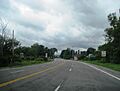
Entering the hamlet of Sangerfield along US 20 westbound
-
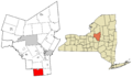
Location in Oneida County and the state of New York.
See also
 In Spanish: Sangerfield para niños
