Saskatchewan Highway 2 facts for kids
Quick facts for kids
Highway 2 |
||||
|---|---|---|---|---|
| Veterans Memorial Highway (segment) CanAm Highway (segment) |
||||
|
Highway 2 highlighted in red.
|
||||
| Route information | ||||
| Length | 797.7 km (495.7 mi) | |||
| Major junctions | ||||
| South end | ||||
|
||||
| North end | ||||
| Location | ||||
| Districts: | Northern Administration District | |||
| Rural municipalities: |
Old Post, Poplar Valley, Willow Bunch, Stonehenge, Lake of the Rivers, Sutton, Lake Johnston, Terrell, Baildon, Moose Jaw, Marquis, Dufferin, Sarnia, Big Arm, Wood Creek, Morris, Colonsay, Bayne, Hoodoo, Fish Creek, St. Louis, Prince Albert, Buckland, Paddockwood, Lakeland | |||
| Major cities: | Moose Jaw, Prince Albert | |||
| Towns: | Assiniboia, Watrous, Wakaw, La Ronge | |||
| Highway system | ||||
Provincial highways in Saskatchewan
|
||||
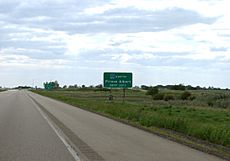
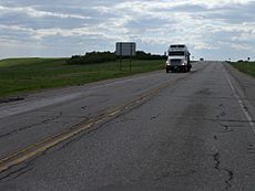
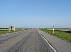
Highway 2 is a long road in the Canadian province of Saskatchewan. It is the longest highway in Saskatchewan, stretching about 809 kilometers (503 miles). Parts of the highway have two lanes going in each direction, while other parts have only one lane in each direction. For example, near Moose Jaw, about 18 km (11 mi) are divided, and near Prince Albert, about 21 km (13 mi) are divided.
Highway 2 is an important route that runs from south to north. It starts at the Canada-US border near West Poplar, where Montana Highway 24 continues south into the United States. The highway goes through big cities like Moose Jaw in the south and Prince Albert in the north. For a short part of its journey, Highway 2 shares the road with Highway 11 between Chamberlain and Findlater. This 11 km (7 mi) section is a bit unusual because the two highways go in opposite directions. Highway 2 ends in La Ronge, where it changes into Highway 102.
This highway began as a simple dirt road in the 1920s. Local farmers helped maintain it. In the 1950s, many parts were paved, making them usable in all kinds of weather. The section of Highway 2 between Moose Jaw and Prince Albert was named the Veterans Memorial Highway in 2005. This was done to honor Canadian veterans. Highway 2 is also part of the CanAm Highway, a long route that connects Canada, the United States, and Mexico.
Contents
Exploring Highway 2: South to North
Saskatchewan Highway 2 starts at the Canada–United States border and heads north. On the U.S. side, Montana Highway 24 continues south. The border crossing is at West Poplar River in Canada and Opheim, Montana, in the U.S.
Discovering the Big Muddy Badlands
Near the start of the highway, you can find campgrounds and information about the Poplar River. This area is famous for the Big Muddy Badlands, a place with a rich history. Outlaws and rum runners used to hide here in the 1800s and early 1900s. The land here was shaped by ancient glaciers, creating unique hills. Scientists have even found a 63-million-year-old sea turtle fossil in the Killdeer area!
About 12 km (7 mi) into the journey, the highway reaches Killdeer. Here, you can turn onto Highway 18 to visit the Wood Mountain Post Provincial Historical Park. This park is about 17 km (11 mi) north.
Journey Through Farmland and Towns
As you continue, you'll see fields of alfalfa, hay, and wheat. These are important crops in the area. Around 42 km (26 mi) from the border, you enter the Wood Mountain Uplands. This region has mining activities for things like coal and clay.
At 49 km (30 mi), you reach Rockglen. The highway then turns north again. Rockglen and Assiniboia are the two biggest towns between the border and Moose Jaw.
Just west of Highway 2, about 10.4 km (6.5 mi) away, is the St. Victor Petroglyph Historic Park. Here, you can see ancient carvings in sandstone, though they are slowly fading away.
At 103 km (64 mi), you arrive in Assiniboia. This is where Highway 2 meets Highway 13, also known as the Red Coat Trail. This junction gives you access to Lafleche. Further along, you'll pass near Vantage and Mossbank. Near Mossbank is the southeast part of Old Wives Lake. This lake is part of a special area that protects three salty lakes and marshes, important for shorebirds.
Near Ardill, you'll find the northern end of Lake of the Rivers. At 175 km (109 mi), Highway 2 meets Highway 36, which leads to Crestwynd and the Jean Louis Legare Regional Park.
Veterans Memorial Highway: A Special Section
As you get closer to Moose Jaw, at 202 km (126 mi), you'll find the home of the Snowbirds, Canada's famous air demonstration team, at CFB Moose Jaw. Before entering Moose Jaw, the highway becomes a divided road for about 18 km (11 mi).
Exploring Moose Jaw's Attractions
Moose Jaw is a city with about 32,000 people. It has fun roadside attractions like Capone's Car and Mac the Moose. Other popular places to visit include the Temple Gardens Mineral Spa Resort, the Tunnels of Moose Jaw, and the History of Transportation Western Development Museum.
North of Moose Jaw, Highway 2 crosses Saskatchewan Highway 1, which is part of the Trans Canada Highway. At 226 km (140 mi), you can turn east to reach Buffalo Pound Provincial Park. A little further, at 230 km (143 mi), you can access the small town of Tuxford at the Highway 42 junction.
The highway then crosses the Qu'Appelle Valley and goes past Buffalo Pound Lake. This lake was formed by glaciers about 10,000 years ago.
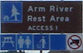
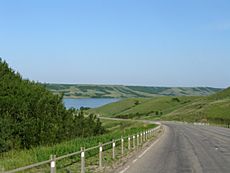
At the junction with Highway 11 in Chamberlain, Highway 2 shares the road for about 11.5 km (7 mi). This section is a divided highway. There's a rest area south of Chamberlain with a historical marker. You can also see views of the Arm River valley. At 275 km (171 mi), Highway 2 turns sharply north, leaving Highway 11.
Further north, you can access Last Mountain Lake (also known as Long Lake) by turning onto Highway 733. This lake is home to the Last Mountain Lake Sanctuary, which was Canada's first federal bird sanctuary. You'll also pass through small communities like Holdfast, Penzance, and Liberty.
Watrous and Potash Mines
The village of Simpson is along the highway, running parallel to Last Mountain Lake. There are several spots to pull over and enjoy the lake views. Highway 15 provides access to Nokomis to the east and Kenaston to the west.
Before reaching Watrous, you'll pass the small community of Amazon. Watrous is a popular place for tourists because it's close to Manitou Beach. Manitou Beach is famous for its mineral spa and the Danceland dance hall, which has a unique dance floor built on horsehair!
At 419 km (260 mi), Highway 2 meets the Yellowhead Highway. Near here, you'll find Colonsay, which is known for its potash mines. Potash is a type of salt used in fertilizers, and Saskatchewan has a lot of it!
Animals and Safety on the Road
After the Yellowhead Highway, Highway 2 continues towards Prince Albert. You'll notice that the landscape changes to the Aspen Parkland ecoregion, with small groups of trembling aspen trees.
In these areas, deer and other large animals can be a danger to drivers, especially in the fall and spring. There are over 3,500 car accidents involving deer each year in Saskatchewan. To help prevent this, there are fences, feeding programs, and even special warning systems that use lights, sounds, or smells to scare animals away when a car is coming.
At 460 km (286 mi), Highway 2 meets Highway 27, which goes west to Prud'homme and east to Muskiki Lake. Further on, at the Highway 777 intersection, you can reach Cudworth.
Lakes and Historical Sites
The intersection of Highway 41 is in Wakaw. Wakaw is a tourist town with a golf course, campground, and recreation site at Wakaw Lake.
At the junction of Highway 25, you'll find the town of St. Louis. This town is famous for a historical mystery called the St. Louis Light, also known as the St. Louis Ghost Train.
Nearby, Domremy has a park built to celebrate the province's 100th birthday. Highway 225 leads to the Batoche National Historical Site. This was where Louis Riel, a leader who fought for Metis rights, made his last stand in 1885. Recently, a large archaeological site with ancient artifacts was found in St. Louis.
Highway 2 then crosses the South Saskatchewan River using the St. Louis Bridge. Traffic increases significantly after the junction with Highway 11 (the Louis Riel Trail), which is about 4 km (2.5 mi) south of Prince Albert at 553 km (344 mi).
CanAm Highway: Connecting Continents
Highway 3 joins Highway 2 for a short distance at 559 km (347 mi). After crossing the North Saskatchewan River, the two highways separate at the interchange with Highway 55. North of Prince Albert, there's another 11 km (7 mi) section of divided highway.
From this point north, Highway 2 becomes part of the CanAm Highway, an international route. Prince Albert is a city of over 34,000 people, located where agricultural fields meet forested areas.
At 581 km (361 mi), Highway 2 meets Highway 355. To the northwest are the Little Red River and Montreal Lake Indian Reserves. Christopher Lake is at 597 km (371 mi), where you can turn onto Highway 263 to reach the Prince Albert National Park.
Further north, at 634 km (394 mi), Highway 2 meets Highway 264, another route to Waskesiu Lake in Prince Albert National Park. At 648 km (403 mi), there's an intersection with Highway 969, which also leads to the park and to the Montreal Lake Indian Reserve.
As you travel further north, there are fewer roads in the southern boreal forest. The next highway connection is at 680 km (423 mi) with Highway 916.
Saskatchewan has over 100,000 lakes, mostly in the northern part of the province. Montreal Lake is west of Highway 2, with its northern shores near Weyakwin at 704 km (437 mi). At 746 km (464 mi), Highway 2 meets Highway 165, which goes north to Morin Lake Indian Reserve.
Finally, at 798 km (496 mi), you reach the Lac la Ronge Indian Reserve before the highway ends in La Ronge at the junction with Highway 102. This marks the northern end of the CanAm Highway.
History of Highway 2
Early Days and Road Building
In the past, crossing the South Saskatchewan River at St. Louis meant taking a ferry. In 1912, a railway bridge was built, and in 1928, lanes for vehicles were added to it.
Road construction in the early 1900s was very different from today. In 1907, when the highway was built south of Chamberlain, workers used simple tools like horse-drawn scrapers and plows. By 1926, they had better equipment, including an elevating grader pulled by 16 horses, along with dump wagons.
The Saskatchewan Highway Act was created in 1922. At first, only about 10 miles (16 km) of highway were gravel, and the rest were just dirt roads. These roads often followed the straight lines of the land survey system, which meant they had many 90-degree turns. Early settlers, like John Abrey, sometimes even did road maintenance themselves. In the 1930s, seeing a car was rare. People like Alexander Black remember using four horses to pull a grain tank on the highway.
Modern Improvements and Special Names
After World War II, there was a big push to build better roads that could be used in all weather. The highway section from Chamberlain to Moose Jaw was finished in 1953, and paving projects quickly followed. By 1955, parts of Highway 2 were already paved, including sections near Moose Jaw, north of Watrous, and near Prince Albert.
In 1956, people talked about creating a North-South International Highway from El Paso, Texas, all the way to La Ronge. The northern part of the CanAm Highway, which goes into La Ronge, was completed in 1977. While the CanAm Highway doesn't go through Wakaw, Highway 2 does, and it connects to the CanAm Highway at Prince Albert. In 1952, Highway 2 was changed so it went straight along the western edge of Wakaw instead of winding through the town.
Changes in Transportation
Agriculture is Saskatchewan's main industry. In the past, farmers used horses and carts to take their grain to elevators. Around World War I, trucks started to take over. Between 1950 and 1970, long-haul trucking became very popular. Today, 95 percent of goods in Saskatchewan are transported by truck.
To keep the highways in good condition, new methods are used. In 1999, a method called "cold in-place recycling" (CIR) was tested on Highway 2 south of Watrous. This process recycles the top layer of the road, mixing it with asphalt and then compacting it back onto the highway. This helps save money and materials.
In 2001, parts of Highway 2 near Cudworth and north of the Highway 27 junction were resurfaced. Officials noted that increased truck traffic was causing wear and tear on the highway, and these improvements were important for driver safety. More improvements were made in 2002 south of the Yellowhead Highway.
Veterans Memorial Highway: A Tribute
Veterans Memorial Highway is the official name for the section of Highway 2 between Moose Jaw and Prince Albert.
This name was given to the highway on November 10, 2005, to honor Saskatchewan veterans. Premier Lorne Calvert, along with other officials, unveiled the new highway sign during Veterans Week. This special naming was part of "The Year of the Veteran" in 2005, which marked 60 years since the end of World War II.
The Royal Canadian Legion, a group that supports veterans, helped choose this highway because of the military history along its route. Many Royal Canadian Legion branches are located in towns along Highway 2, including Moose Jaw, Watrous, and Prince Albert. There's also a military history museum in Watrous, and the Royal Canadian Air Force base, CFB Moose Jaw, is near Moose Jaw.
CanAm Highway: An International Link
The northern 238.4 km (148.1 mi) of Saskatchewan Highway 2 are part of the CanAm Highway. This section runs between Prince Albert and La Ronge.
The entire CanAm Highway is about 4,122 km (2,561 mi) long. It stretches from El Paso, Texas, near the Mexican border, all the way to La Ronge, Saskatchewan, where Highway 2 meets Highway 102. This highway is part of a larger idea to connect Mexico, the United States, and Canada for trade and travel. The idea for the CanAm Highway started in the 1920s.
Major intersections
From south to north.
| Rural municipality | Location | km | mi | Destinations | Notes | |||
|---|---|---|---|---|---|---|---|---|
| Old Post No. 43 | West Poplar | Continuation into Montana | ||||||
| Canada–United States border at Opheim–West Poplar River Border Crossing | ||||||||
| Killdeer | 12.0 | 7.5 | South end of Hwy 18 concurrency | |||||
| Poplar Valley No. 12 | Rockglen | 49.2 | 30.6 | North end of Hwy 18 concurrency | ||||
| Willow Bunch No. 42 | | 69.7 | 43.3 | |||||
| Old Post No. 43 |
No major junctions | |||||||
| Stonehenge No. 73 | | 79.0 | 49.1 | St. Victor Access Road | ||||
| Lake of the Rivers No. 72 | Assiniboia | 103.4 | 64.2 | Hwy 2 branches west south end of Hwy 13 concurrency; concurrency turns north west of intersection |
||||
| 104.8 | 65.1 | North end of Hwy 13 concurrency | ||||||
| Stonehenge No. 73 |
No major junctions | |||||||
| Sutton No. 103 | | 131.0 | 81.4 | North of Vantage | ||||
| Lake Johnston No. 102 | | 137.5 | 85.4 | |||||
| Ardill | 149.1 | 92.6 | ||||||
| Terrell No. 101 |
No major junctions | |||||||
| Baildon No. 131 | | 175.3 | 108.9 | |||||
| | 182.5 | 113.4 | ||||||
| Moose Jaw No. 161 | | 202.2 | 125.6 | |||||
| City of Moose Jaw | 208.1 | 129.3 | 2nd Street NE |
Hwy 2 branches west | ||||
| 208.5 | 129.6 | Main Street N
|
Hwy 2 branches north | |||||
| Interchange | ||||||||
| South end of Veterans Memorial Highway | ||||||||
| Moose Jaw No. 161 | | 225.5 | 140.1 | Signed access to Hwy 202 for northbound Hwy 2 | ||||
| ↑ / ↓ | Tuxford | 229.3 | 142.5 | Signed access to Hwy 202 for southbound Hwy 2 | ||||
| Marquis No. 191 | 230.4 | 143.2 | ||||||
| ↑ / ↓ | | 246.5– 247.2 |
153.2– 153.6 |
Crosses Buffalo Pound Lake | ||||
| Dufferin No. 190 | | 252.2 | 156.7 | |||||
| ↑ / ↓ | | 261.9 | 162.7 | South end of Hwy 733 concurrency | ||||
| Sarnia No. 221 | Chamberlain | 263.6 | 163.8 | Hwy 2 branches southeast; north end of Hwy 11 wrong-way concurrency; north end of Hwy 733 concurrency |
||||
| Dufferin No. 190 | | 275.1 | 170.9 | Hwy 2 branches north; south end of Hwy 11 wrong-way concurrency |
||||
| Sarnia No. 221 | ||||||||
| | 294.1 | 182.7 | South end of Hwy 732 concurrency | |||||
| Penzance | 302.2 | 187.8 | North end of Hwy 732 concurrency | |||||
| Big Arm No. 251 | Liberty | 315.1 | 195.8 | |||||
| Imperial | 334.6 | 207.9 | ||||||
| Wood Creek No. 281 | | 354.0 | 220.0 | |||||
| Morris No. 312 | Watrous | 372.4 | 231.4 | |||||
| Young | 395.6 | 245.8 | ||||||
| | 397.6 | 247.1 | ||||||
| Colonsay No. 342 | | 418.7 | 260.2 | East of Colonsay | ||||
| ↑ / ↓ | | 438.6 | 272.5 | South end of Hwy 5 concurrency; north of Meacham | ||||
| Bayne No. 371 | | 444.1 | 276.0 | North end of Hwy 5 concurrency | ||||
| Sagehill | 455.2 | 282.8 | Dana access road | |||||
| | 460.2 | 286.0 | ||||||
| | 465.3 | 289.1 | ||||||
| Hoodoo No. 401 | | 476.8 | 296.3 | |||||
| Cudworth | 484.0 | 300.7 | South end of Hwy 777 concurrency | |||||
| Fish Creek No. 402 | | 487.3 | 302.8 | North end of Hwy 777 concurrency | ||||
| Wakaw | 494.8 | 307.5 | ||||||
| 495.4 | 307.8 | |||||||
| St. Louis No. 431 | | 511.7 | 318.0 | |||||
| | 512.5 | 318.5 | ||||||
| | 519.6 | 322.9 | Old Highway 2 north – Hoey, St. Louis | Former Hwy 2 alignment to the old St. Louis Bridge | ||||
| | 528.2 | 328.2 | ||||||
| ↑ / ↓ | | 529.2 | 328.8 | (New) St. Louis Bridge across South Saskatchewan River | ||||
| Prince Albert No. 461 | ||||||||
| North end of Veterans Memorial Highway | ||||||||
| City of Prince Albert | 557.1 | 346.2 | ||||||
| South end of Hwy 3 concurrency | ||||||||
| South end of |
||||||||
| 559.8 | 347.8 | River Street | Grade separated; southbound exit only | |||||
| 559.8– 560.2 |
347.8– 348.1 |
Diefenbaker Bridge across North Saskatchewan River | ||||||
| 560.2 | 348.1 | Interchange, northbound entrance and exit; northbound access to Hwy 55 east |
||||||
| 561.0 | 348.6 | Interchange North end of Hwy 3 concurrency; southbound access to Hwy 55 east |
||||||
| Buckland No. 491 | | 571.4 | 355.1 | |||||
| | 578.7 | 359.6 | Pulp Hull Road to Hwy 55 | |||||
| Spruce Home | 581.2 | 361.1 | ||||||
| Paddockwood No. 520 | Northside | 594.2 | 369.2 | |||||
| Christopher Lake | 597.4 | 371.2 | ||||||
| Lakeland No. 521 | | 622.3 | 386.7 | |||||
| | 634.3 | 394.1 | ||||||
| | 647.6 | 402.4 | Candle Lake Road | Former Hwy 969 | ||||
| Northern Administration District | | 655.7 | 407.4 | Former Hwy 930 | ||||
| | 680.0 | 422.5 | ||||||
| | 723.6 | 449.6 | ||||||
| | 745.8 | 463.4 | South end of Hwy 165 concurrency | |||||
| | 765.5 | 475.7 | North end of Hwy 165 concurrency | |||||
| La Ronge | Brown Street
|
|||||||
| 1.000 mi = 1.609 km; 1.000 km = 0.621 mi | ||||||||
 | Delilah Pierce |
 | Gordon Parks |
 | Augusta Savage |
 | Charles Ethan Porter |


