Prince Albert, Saskatchewan facts for kids
Quick facts for kids
Prince Albert
|
|||
|---|---|---|---|
|
City
|
|||
| City of Prince Albert | |||
 |
|||
|
|||
| Nickname(s):
"P.A."
|
|||
| Motto(s):
Gateway to the North
|
|||
| Country | Canada | ||
| Province | Saskatchewan | ||
| Census division | 15 | ||
| Town | 1885 | ||
| Incorporated City | October 8, 1904 | ||
| Area
(2021)
|
|||
| • Land | 67.17 km2 (25.93 sq mi) | ||
| • Population centre | 21.37 km2 (8.25 sq mi) | ||
| • Census agglomeration | 2,537.68 km2 (979.80 sq mi) | ||
| Elevation | 440 m (1,440 ft) | ||
| Population
(2021)
|
|||
| • Total | 37,756 | ||
| • Density | 562.1/km2 (1,456/sq mi) | ||
| • Population centre | 36,768 | ||
| • Population centre density | 21.37/km2 (55.3/sq mi) | ||
| • Census agglomeration | 45,718 | ||
| • Census agglomeration density | 2,537.68/km2 (6,572.6/sq mi) | ||
| Demonym(s) | Prince Albertan | ||
| Time zone | UTC−06:00 (CST) | ||
| Forward sortation area |
S6V - S6X
|
||
| Isbister Settlement | 1862 | ||
| SK HQ North-West Mounted Police | 1886 | ||
| Climate | Dfb | ||
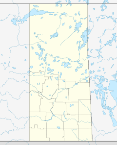
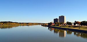
Prince Albert is the third-largest city in Saskatchewan, Canada. It is located in the middle of the province, right on the banks of the North Saskatchewan River. People often call it the "Gateway to the North." This is because it is the last big city on the way to the northern parts of Saskatchewan, which are rich in natural resources.
Just 51 kilometers north of the city is Prince Albert National Park. This park is full of beautiful lakes, thick forests, and lots of wildlife. Prince Albert itself sits in a special area where two different types of natural environments meet. These are the aspen parkland (open grassy areas with clumps of trees) and the boreal forest (dense evergreen forests). The city is surrounded by the Rural Municipality of Prince Albert No. 461, but it has its own separate government.
Contents
History of Prince Albert
Early Beginnings and Naming
The area where Prince Albert now stands was first called kistahpinanihk by the Cree people. This name means "sitting pretty place" or "great meeting place."
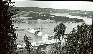
The very first trading post here was built in 1776 by a person named Peter Pond. Later, in 1862, James Isbister, who worked for the Hudson's Bay Company, settled in this spot. He started farming, and by 1866, several families had joined him. They called their small community Isbister's Settlement.
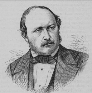
The community grew even more in 1866 when Reverend James Nisbet arrived. He was a minister who came to start a mission for the Cree people. Nisbet decided to name the mission after Albert, Prince Consort. Prince Albert was the husband of Queen Victoria, and he had passed away in 1861. This is how the city got its name.
In 1879, a school was opened at the mission by Lucy Margaret Baker. Also, the local Freemasons started their first lodge in what is now Saskatchewan that same year. The original settlement, known as "The Mission," and a community to the west called "Porter Town" eventually joined together to form Prince Albert.
Growth and Important Events
In 1884, Honore Jaxon and James Isbister helped bring Louis Riel back to Canada. Riel had been living in the United States after a political exile. Five hundred people gathered to hear him speak after his return.
During the North-West Rebellion in 1885, the Prince Albert Volunteers faced many challenges in the fighting at the Battle of Duck Lake. People living nearby sought safety with the North-West Mounted Police in a quickly built fort in Prince Albert. They were worried about an attack from Gabriel Dumont, but it never happened. After the Battle of Batoche, Major General Frederick Middleton marched to Prince Albert to help protect the town.
Prince Albert, with about 800 people, officially became a town in 1885. Its first mayor was Thomas McKay. Then, in 1904, it became a city. The city is governed by a mayor and a council.
Prince Albert was once the capital of the District of Saskatchewan. This was a part of the larger North-West Territories. The District of Saskatchewan was created in 1882, and Prince Albert was chosen as its capital. However, this changed in 1905 when Saskatchewan became a province, and Regina was made the new provincial capital.
Prince Albert was considered as a location for either the University of Saskatchewan or the Saskatchewan Federal Penitentiary. The university was built in Saskatoon, and the penitentiary (a large prison) was built in Prince Albert in 1911.
The area of Prince Albert has been represented by three prime ministers of Canada in the federal government:
- John Diefenbaker, who was the 13th Prime Minister (1957–1963). He represented Prince Albert from 1953 until he passed away in 1979.
- William Lyon Mackenzie King, the tenth Prime Minister, represented Prince Albert from 1926 to 1945.
- Sir Wilfrid Laurier, the seventh Prime Minister, represented the area in 1896.
Royal Visits to Prince Albert
Prince Albert has had the honor of welcoming members of Canada's Royal Family:
- The Princess Margaret visited in 1958 and 1980.
- The Duke and Duchess of York (Prince Andrew and Sarah) visited in 1989.
- The Earl of Wessex (Prince Edward) visited in 2003.
Geography and Climate
Prince Albert's Location
Prince Albert is located on the White Fox Plain, which is part of the Saskatchewan River lowlands. The natural plant life around the city changes as you move from south to north. To the south, you find aspen parkland, while to the north of the North Saskatchewan River, you see southern boreal forest.
The North Saskatchewan River flows right through the middle of Prince Albert. Most of the city's population and businesses are on the south side of the river. Only a few neighborhoods, an industrial area, and the airport are on the north side.
Weather in Prince Albert
Prince Albert has a humid continental climate. This means it has warm summers and cold winters. The average low temperature in January, the coldest month, is -22.8°C. July is the warmest month, with an average high of 24.2°C.
The highest temperature ever recorded in Prince Albert was 39.4°C on July 19, 1941. The coldest temperature ever recorded was -56.7°C on February 1, 1893. Winter usually lasts for five months of the year.
| Climate data for Prince Albert Airport, 1991–2020 normals, extremes 1884–present | |||||||||||||
|---|---|---|---|---|---|---|---|---|---|---|---|---|---|
| Month | Jan | Feb | Mar | Apr | May | Jun | Jul | Aug | Sep | Oct | Nov | Dec | Year |
| Record high humidex | 11.7 | 10.6 | 19.4 | 30.8 | 35.1 | 41.3 | 41.8 | 40.6 | 36.0 | 29.9 | 18.5 | 8.3 | 41.8 |
| Record high °C (°F) | 12.8 (55.0) |
12.8 (55.0) |
20.0 (68.0) |
32.2 (90.0) |
35.6 (96.1) |
38.8 (101.8) |
39.4 (102.9) |
36.7 (98.1) |
36.1 (97.0) |
30.6 (87.1) |
19.4 (66.9) |
11.1 (52.0) |
39.4 (102.9) |
| Mean daily maximum °C (°F) | −11.6 (11.1) |
−7.9 (17.8) |
−1.4 (29.5) |
9.1 (48.4) |
17.3 (63.1) |
21.5 (70.7) |
24.2 (75.6) |
23.4 (74.1) |
17.6 (63.7) |
8.5 (47.3) |
−2.0 (28.4) |
−9.2 (15.4) |
7.4 (45.3) |
| Daily mean °C (°F) | −17.2 (1.0) |
−14.1 (6.6) |
−7.4 (18.7) |
2.7 (36.9) |
10.1 (50.2) |
15.2 (59.4) |
17.9 (64.2) |
16.7 (62.1) |
10.9 (51.6) |
3.1 (37.6) |
−6.5 (20.3) |
−14.4 (6.1) |
1.4 (34.5) |
| Mean daily minimum °C (°F) | −22.8 (−9.0) |
−20.3 (−4.5) |
−13.4 (7.9) |
−3.8 (25.2) |
2.7 (36.9) |
8.7 (47.7) |
11.6 (52.9) |
9.8 (49.6) |
4.2 (39.6) |
−2.4 (27.7) |
−10.9 (12.4) |
−19.4 (−2.9) |
−4.7 (23.5) |
| Record low °C (°F) | −55.0 (−67.0) |
−56.7 (−70.1) |
−45.6 (−50.1) |
−33.9 (−29.0) |
−16.1 (3.0) |
−4.4 (24.1) |
0.6 (33.1) |
−5.6 (21.9) |
−15.6 (3.9) |
−26.1 (−15.0) |
−45.0 (−49.0) |
−49.4 (−56.9) |
−56.7 (−70.1) |
| Record low wind chill | −59.7 | −57.9 | −50.0 | −43.1 | −18.3 | −9.2 | 0.0 | −3.2 | −16.0 | −28.2 | −49.7 | −54.1 | −59.7 |
| Average precipitation mm (inches) | 18.6 (0.73) |
11.5 (0.45) |
14.5 (0.57) |
27.7 (1.09) |
43.1 (1.70) |
86.4 (3.40) |
77.2 (3.04) |
50.4 (1.98) |
41.9 (1.65) |
29.7 (1.17) |
16.0 (0.63) |
15.5 (0.61) |
432.3 (17.02) |
| Average rainfall mm (inches) | 0.3 (0.01) |
0.1 (0.00) |
1.7 (0.07) |
19.2 (0.76) |
40.3 (1.59) |
86.4 (3.40) |
79.0 (3.11) |
51.2 (2.02) |
41.5 (1.63) |
21.6 (0.85) |
2.5 (0.10) |
0.6 (0.02) |
344.3 (13.56) |
| Average snowfall cm (inches) | 23.4 (9.2) |
14.4 (5.7) |
15.3 (6.0) |
10.2 (4.0) |
2.1 (0.8) |
0.0 (0.0) |
0.0 (0.0) |
0.0 (0.0) |
0.3 (0.1) |
9.9 (3.9) |
16.1 (6.3) |
19.9 (7.8) |
111.5 (43.9) |
| Average precipitation days (≥ 0.2 mm) | 10.6 | 7.6 | 7.6 | 8.7 | 10.0 | 13.3 | 13.7 | 10.0 | 9.4 | 9.4 | 8.4 | 9.5 | 118.4 |
| Average rainy days (≥ 0.2 mm) | 0.5 | 0.3 | 2.0 | 6.1 | 9.9 | 13.3 | 13.8 | 10.1 | 9.2 | 7.3 | 1.2 | 0.6 | 74.2 |
| Average snowy days (≥ 0.2 cm) | 11.7 | 9.1 | 7.1 | 4.3 | 0.9 | 0.0 | 0.0 | 0.0 | 0.3 | 2.8 | 8.0 | 11.1 | 55.3 |
| Average relative humidity (%) (at 15:00 LST) | 70.0 | 65.5 | 60.4 | 47.4 | 40.9 | 51.0 | 54.1 | 50.8 | 51.0 | 58.3 | 71.3 | 73.8 | 57.9 |
| Mean monthly sunshine hours | 93.9 | 126.5 | 175.9 | 225.1 | 269.2 | 275.0 | 297.7 | 289.7 | 187.1 | 136.1 | 78.0 | 74.7 | 2,229 |
| Percent possible sunshine | 37.2 | 45.7 | 47.9 | 53.8 | 54.8 | 54.3 | 58.5 | 63.3 | 49.0 | 41.3 | 29.9 | 31.6 | 47.3 |
| Source: Environment and Climate Change Canada (sun 1981–2010) | |||||||||||||
Population and People
How Many People Live Here?
| Historical populations | ||
|---|---|---|
| Year | Pop. | ±% |
| 1901 | 1,785 | — |
| 1911 | 6,254 | +250.4% |
| 1921 | 7,558 | +20.9% |
| 1931 | 9,905 | +31.1% |
| 1941 | 12,299 | +24.2% |
| 1951 | 17,149 | +39.4% |
| 1961 | 24,168 | +40.9% |
| 1971 | 28,464 | +17.8% |
| 1981 | 31,380 | +10.2% |
| 1991 | 34,181 | +8.9% |
| 1996 | 34,771 | +1.7% |
| 2001 | 34,291 | −1.4% |
| 2006 | 34,138 | −0.4% |
| 2011 | 35,129 | +2.9% |
| 2016 | 35,926 | +2.3% |
| 2021 | 37,756 | +5.1% |
In 2021, Statistics Canada counted 37,756 people living in Prince Albert. This was a 5.1% increase from its population in 2016. The city covers a land area of 67.17 square kilometers. This means there were about 562 people living in each square kilometer in 2021.
| Canada census – Prince Albert community profile | |||
|---|---|---|---|
| 2011 | 2006 | ||
| Population: | 35,129 (+2.9% from 2006) | 34,138 (-0.4% from 2001) | |
| Land area: | 65.74 km2 (25.38 sq mi) | 65.68 km2 (25.36 sq mi) | |
| Population density: | 534.4/km2 (1,384/sq mi) | 519.7/km2 (1,346/sq mi) | |
| Median age: | 34.7 (M: 32.8, F: 36.4) | 35.4 (M: 33.5, F: 36.8) | |
| Total private dwellings: | 14,779 | 14,029 | |
| Median household income: | $53,083 | ||
| References: 2011 2006 earlier | |||
Most adults over 25 in Prince Albert have a high school diploma or more education. About 55.3% have a degree from a college or university.
Diverse Backgrounds
Prince Albert is known for having a large Indigenous population. In 2021, about 44.65% of the city's residents identified as Indigenous.
| Panethnic group | 2021 | 2016 | 2011 | 2006 | 2001 | |||||
|---|---|---|---|---|---|---|---|---|---|---|
| Pop. | % | Pop. | % | Pop. | % | Pop. | % | Pop. | % | |
| Indigenous | 16,120 | 44.65% | 14,830 | 42.44% | 13,930 | 40.65% | 12,140 | 36.3% | 10,180 | 30.45% |
| European | 15,765 | 43.66% | 17,280 | 49.45% | 19,210 | 56.05% | 20,420 | 61.06% | 22,640 | 67.72% |
| Southeast Asian | 1,750 | 4.85% | 1,250 | 3.58% | 395 | 1.15% | 115 | 0.34% | 140 | 0.42% |
| South Asian | 1,045 | 2.89% | 660 | 1.89% | 170 | 0.5% | 165 | 0.49% | 100 | 0.3% |
| African | 805 | 2.23% | 475 | 1.36% | 190 | 0.55% | 165 | 0.49% | 120 | 0.36% |
| East Asian | 210 | 0.58% | 180 | 0.52% | 235 | 0.69% | 250 | 0.75% | 115 | 0.34% |
| Middle Eastern | 170 | 0.47% | 120 | 0.34% | 35 | 0.1% | 95 | 0.28% | 15 | 0.04% |
| Latin American | 155 | 0.43% | 75 | 0.21% | 50 | 0.15% | 85 | 0.25% | 100 | 0.3% |
| Other/multiracial | 60 | 0.17% | 90 | 0.26% | 0 | 0% | 10 | 0.03% | 20 | 0.06% |
| Total responses | 36,105 | 95.63% | 34,945 | 97.27% | 34,270 | 97.55% | 33,445 | 97.97% | 33,430 | 97.49% |
| Total population | 37,756 | 100% | 35,926 | 100% | 35,129 | 100% | 34,138 | 100% | 34,291 | 100% |
| Note: Totals greater than 100% due to multiple origin responses | ||||||||||
In 2021, about 58.8% of people in Prince Albert identified as Christian. About 36.1% said they had no religion or had other beliefs.
Economy and Jobs
Prince Albert's Main Industries
Prince Albert's location is very important for its economy. It sits on the North Saskatchewan River, with good farming land to the south and thick forests to the north. This is why it's called the "Gateway to the North."
In the past, people thought the Transcontinental Railway would pass through Prince Albert. This would have made it a huge transportation hub. However, the railway chose a different route, which slowed the city's growth for a while.
A project to build the La Colle Falls hydroelectric power dam was started to provide cheap electricity. This was hoped to attract more businesses. However, the project was stopped in 1927 because the city almost went bankrupt. In 1945, Prince Albert National Park was created. This helped the city's economy by bringing in tourists.
Today, Prince Albert benefits from its location in many ways. It is a center for farming, forestry, tourism, mining, and retail. It serves not only its own residents but also many communities in northern Saskatchewan. The city's total trade area includes about 140,000 people.
Growing Industries
- Diamond mining is being explored east of the city in the Fort à la Corne area.
- Bio-fuels are also becoming important. The Prince Albert region is excellent for agriculture, which is key for making bio-fuels.
- Uranium mining in northern Saskatchewan could also lead to new businesses in Prince Albert.
- The forestry industry is a big part of Prince Albert's economy. The Provincial Forestry Centre, which supports wood and forestry businesses, is located here.
Prince Albert also relies on its government services. About 11% of the workforce is in this sector. The city has three correctional facilities: the Prince Albert Correctional Centre, Pine Grove Correctional Centre, and the Saskatchewan Federal Penitentiary.
Several First Nations reserves are located near the city. These include Chief Joseph Custer, Kistapinanihk 231, Northern Lights 220, Muskoday 99, and Wahpeton 94B.
The Prince Albert Pulp Company was a major employer for many years. It closed in 2006 but was later bought by Paper Excellence in 2011. They planned to reopen it, but the pulp mill was shut down again in August 2014.
Attractions and Things to Do
Prince Albert has several interesting places to visit:
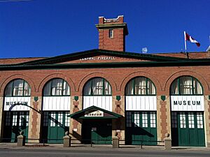
- Museums: There are three historical museums. The The Evolution of Education Museum and the Rotary Museum of Police and Corrections are together at the tourist information center. The Historical Society Museum is in an old Fire Hall downtown. The John G. Diefenbaker House, a historic home, is also open to the public.
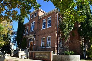
- Historic Buildings: Other important historic sites include the Blockhouse from the 1885 Rebellion, Historic St. Paul's Presbyterian Church, Honeywood Heritage Nursery, Keyhole Castle, and the Prince Albert Arts Centre. The Sacred Heart Cathedral, built in 1914, has beautiful paintings inside.
- Local Legends: The St. Louis Light is a mysterious light often visited south of the city.
- Nature and Parks: Fort de la Corne, an old French trading post, is a short drive east. The Buckland Wildlife Management Unit is very close to the city. You can also visit the Kinsmen Ski and Snowboard Centre at Little Red River Park.
Sports and Fun
Prince Albert is home to the Prince Albert Raiders, a hockey team in the Western Hockey League. They play at the 3,571-seat Art Hauser Centre. The Raiders won the Memorial Cup in 1985.
The city also has the Prince Albert Mintos, a junior hockey team. They won the Telus Cup (a national championship) in 2006, 2007, and 2014. They also play at the Art Hauser Centre.
Prince Albert has hosted several big sporting events:
- The 1993 North American Indigenous Games.
- The 2018 U-18 Men's Softball World Cup.
- The city will host the 2025 Men's Softball World Cup finals in July 2025.
- The 11th Saskatchewan Winter Games were held here from February 16-22, 2014. Over 1,800 amateur athletes participated.
City Services
Bridges and Roads
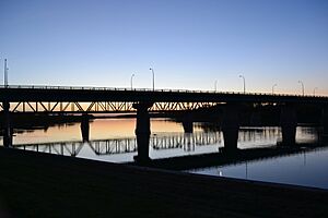
Currently, only one road bridge, the Diefenbaker Bridge, connects the north and south sides of Prince Albert. This bridge is also the only way to cross the river between southern and northern Saskatchewan for many kilometers. This has been a concern, especially after a partial closure in August 2011 when cracks were found.
Prince Albert is connected by several major highways: SK 2, SK 3, SK 11, SK 55, and SK 302.
- Part of Highway 2, from Moose Jaw to Prince Albert, is called Veterans Memorial Highway.
- Part of Highway 3 is part of the CanAm Highway.
- Highway 11 connects Prince Albert to Saskatchewan's two other largest cities, Regina and Saskatoon. This highway is also known as the Louis Riel Trail.
Public Transportation
Prince Albert Transit is the local bus service. It currently serves only the south side of the city.
Air Travel
Glass Field Airport has regular flights to Saskatoon and Regina. It also serves as a way to reach communities and mining operations in northern Saskatchewan. Many people from Prince Albert travel to Saskatoon for flights to other places.
Education in Prince Albert
Schools and Colleges
In 1879, Emmanuel College opened in Prince Albert. It was the first university in the area. Later, in 1907, Emmanuel College moved to Saskatoon to become part of the University of Saskatchewan.
Today, the Saskatchewan Rivers School Division runs 33 schools in the area. The Prince Albert Catholic School Division operates nine schools. The city has five high schools:
- St. Mary High School and Rivier Academy (a private school) are part of the Prince Albert Catholic School Division.
- Carlton Comprehensive High School (the largest high school in Saskatchewan), Wesmor, and P.A.C.I. (Prince Albert Collegiate Institute) are in the Saskatchewan Rivers School Division.
- École Valois is the only French-language school in Prince Albert, offering classes from preschool to grade 12.
For education after high school, Prince Albert has the Woodland campus of Saskatchewan Polytechnic. There are also extension campuses for the University of Regina and the University of Saskatchewan. Other post-secondary options include branches of the First Nations University of Canada, Gabriel Dumont Institute, Saskatchewan Indian Institute of Technologies (SIIT), and the Saskatchewan Urban Native Teacher Education Program (SUNTEP).
Images for kids
 | Janet Taylor Pickett |
 | Synthia Saint James |
 | Howardena Pindell |
 | Faith Ringgold |


