Sedgwick, Maine facts for kids
Quick facts for kids
Sedgwick, Maine
|
|
|---|---|

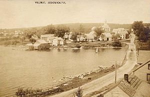
View of the village in 1909
|
|
| Country | United States |
| State | Maine |
| County | Hancock |
| Incorporated | 1789 |
| Villages | Sedgwick North Sedgwick Sargentville |
| Area | |
| • Total | 31.06 sq mi (80.45 km2) |
| • Land | 26.99 sq mi (69.90 km2) |
| • Water | 4.07 sq mi (10.54 km2) |
| Elevation | 164 ft (50 m) |
| Population
(2020)
|
|
| • Total | 1,202 |
| • Density | 45/sq mi (17.2/km2) |
| Time zone | UTC-5 (Eastern (EST)) |
| • Summer (DST) | UTC-4 (EDT) |
| ZIP Codes |
04676 (Sedgwick)
04673 (Sargentville) |
| Area code(s) | 207 |
| FIPS code | 23-67300 |
| GNIS feature ID | 0582721 |
Sedgwick is a small town in Hancock County, Maine, United States. In 2020, about 1,202 people lived there. The town also includes a village called Sargentville. Sedgwick is a great place for birdwatchers to spot birds. It's also a quiet spot for tourists, with cozy bed and breakfast places to stay.
Contents
History of Sedgwick
Sedgwick was one of six areas of land given out by Massachusetts in 1761. Each area was six miles square. The Abenaki people called this place Naskeag, which means "the end" or "extremity."
The first European settler, Andrew Black, arrived in 1759. In 1789, the area became an official town named Sedgwick. It was named after Major Robert Sedgwick. He was a military leader who captured Fort Pentagouet (now Castine) from the French in 1654.
In 1817, some land was taken from Sedgwick to create the town of Brooksville. More land was used in 1849 to form Brooklin. By 1859, Sedgwick had a population of 1,235 people.
Early Industries and Life
The land in Sedgwick was rocky, which made it better for raising animals than for growing crops. People built mills along streams to grind grain and cut wood. For many years, Sedgwick had several granite quarries. Here, workers dug out stone for important public buildings. Most of these quarries are now closed.
Two companies also mined for a type of rock called argentiferous galena. This rock is a source of silver. However, the town's main activities were fishing, digging for clams, building ships, and working on the sea. Other businesses included tanning animal hides and making barrels.
In March 2011, Sedgwick became well-known for passing a special rule. This rule declared "food sovereignty" for its citizens. This means the town's people have the right to produce and sell their own food directly.
Geography and Location
Sedgwick covers about 31.06 square miles (80.45 square kilometers). About 26.99 square miles (69.90 square kilometers) is land, and 4.07 square miles (10.54 square kilometers) is water. The Benjamin River flows through the town and separates it from Brooklin. Sedgwick also has views of Penobscot Bay.
The Deer Isle Bridge connects Sedgwick to the towns of Deer Isle and Stonington. This bridge crosses a body of water called Eggemoggin Reach. Several state roads pass through Sedgwick, including Route 15, Route 172, Route 175, and Route 176.
Sedgwick's Climate
Sedgwick has a humid continental climate. This means it has big differences in temperature between seasons. Summers are usually warm to hot and can be humid. Winters are cold, and sometimes very cold.
Population Changes Over Time
| Historical population | |||
|---|---|---|---|
| Census | Pop. | %± | |
| 1790 | 569 | — | |
| 1800 | 760 | 33.6% | |
| 1810 | 1,352 | 77.9% | |
| 1820 | 1,420 | 5.0% | |
| 1830 | 1,604 | 13.0% | |
| 1840 | 1,922 | 19.8% | |
| 1850 | 1,235 | −35.7% | |
| 1860 | 1,263 | 2.3% | |
| 1870 | 1,113 | −11.9% | |
| 1880 | 1,128 | 1.3% | |
| 1890 | 1,012 | −10.3% | |
| 1900 | 902 | −10.9% | |
| 1910 | 909 | 0.8% | |
| 1920 | 830 | −8.7% | |
| 1930 | 699 | −15.8% | |
| 1940 | 718 | 2.7% | |
| 1950 | 614 | −14.5% | |
| 1960 | 574 | −6.5% | |
| 1970 | 578 | 0.7% | |
| 1980 | 795 | 37.5% | |
| 1990 | 905 | 13.8% | |
| 2000 | 1,102 | 21.8% | |
| 2010 | 1,196 | 8.5% | |
| 2020 | 1,202 | 0.5% | |
| U.S. Decennial Census | |||
Sedgwick's Population in 2010
In 2010, the town of Sedgwick had 1,196 people living in 529 households. About 344 of these households were families. The population density was about 44.3 people per square mile. There were 800 housing units in total.
Most of the people living in Sedgwick were White (98.4%). A small number were African American (0.3%), Native American (0.2%), or Asian (0.5%). About 1.8% of the population identified as Hispanic or Latino.
In 2010, 26.3% of households had children under 18. About 50.7% were married couples living together. The average household had 2.26 people, and the average family had 2.73 people. The median age in Sedgwick was 45.9 years old.
Famous People from Sedgwick
- Doris Grumbach – A writer who wrote novels, biographies, and essays.
- Thomas N. Schroth – An editor who founded The National Journal.
- Stan Waterman – An award-winning filmmaker known for underwater movies.
- James Russell Wiggins – A US representative to the United Nations.
See also
 In Spanish: Sedgwick (Maine) para niños


