Seton Portage facts for kids
Quick facts for kids
Seton Portage
|
|
|---|---|
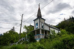
Church in Seton Portage
|
|
| Country | Canada |
| Province | British Columbia |
| Regional District | Squamish-Lillooet |
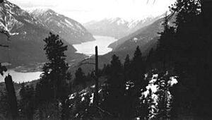
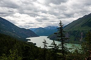
Seton Portage is a community in British Columbia, Canada. It sits on a narrow strip of land between two lakes: Anderson Lake and Seton Lake. This area is part of the Squamish-Lillooet Regional District.
The community is home to two Seton Lake First Nation groups. They live at opposite ends of the portage (the land strip). A non-native community is located between them. Seton Portage has local services like a post office, fire department, library, and a general store. It is also where you'll find Seton Portage Historic Provincial Park. This park protects an important old railway section.
Contents
How Seton Portage Was Formed
Seton Portage was formed about 10,000 years ago. A huge landslide from the Cayoosh Range slid into a large lake. This event split the lake into two separate lakes. Now, it's a narrow strip of land between two long, deep lakes, like a fjord.
You can still see parts of the old lake bottom. These flat areas, called benchlands, line the north sides of Seton and Anderson Lakes. The water level of Seton Lake is now a bit higher. This is because of the Bridge River Power Project, which was finished in 1958.
Early History and People
Before the Fraser Canyon Gold Rush, the Seton Portage area was home to many St'at'imc people. They lived in special pit-houses called kekuli or quiggly holes. Some people believe hundreds of these houses were once here. One person described seeing the Portage from a mountain pass. They said it looked like "many stars in the sky." This suggests a very large population lived there.
However, diseases like smallpox brought by newcomers greatly reduced the St'at'imc population. Also, conflicts with other tribes and famine had already affected them. Later, farming and gold mining changed the land. This removed many signs of the St'at'imc settlements.
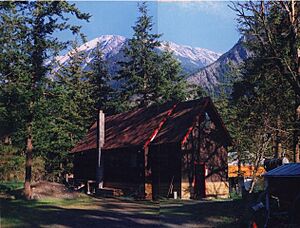
Two churches built in the 1890s by missionaries still stand today. One at Slosh, St. Christopher's, is old and decaying. The other, at Nkait, has been restored by the Seton Lake Indian Band.
Population Changes Over Time
It's hard to know exactly how many St'at'imc people lived here long ago. Some stories suggest thousands lived around the lakes. But the land has been dug up and farmed many times. This makes it difficult for archaeologists to find old evidence.
During the Fraser Canyon Gold Rush in 1858, many gold seekers passed through Seton Portage. About 30,000 men traveled the "Lakes Route" during the rush. The beaches of the Portage were so busy they were named Wapping and Flushing. These names came from busy train stations in London.
After a few years, the gold rush traffic ended. The non-native population became very small. In the early 1900s, new settlers arrived. This led to the Declaration of the Lillooet Tribe in 1911. This declaration protested the taking of native lands at "the Short Portage."
More people came when the Pacific Great Eastern Railway was built. The railway opened through the lakes in 1914. It needed many workers, which also started the Bridge River Power Project.
After World War II, the power project grew. Thousands of temporary workers moved to the valley. Many lived in temporary homes in the Portage. After the project finished, the non-native population dropped to about 400. It can reach 500 in summer with visitors. The total population of the Band, including nearby Shalalth, is about 500.
History of Seton Portage
In 1828, two Hudson's Bay Company workers explored this area. Later, in 1846, a Scottish explorer named Alexander Caulfield Anderson mapped it. Anderson Lake is named after him.
Seton Lake, and therefore Seton Portage, was named after a friend of Anderson's. This friend died when a ship called HMS Birkenhead sank. Other places nearby, like Mount Birkenhead and the Birkenhead River, are also named after this ship.
In 1858, gold was found in British Columbia. Steamships began running on both Seton and Anderson Lakes. Seton Portage became a busy spot. Gold seekers had to carry their goods for about 2 kilometers between the lakes. This is called a portage.
In 1861, Carl Dozier built British Columbia's first railway here. It was called Dozier's Way. It likely used horses and mules to pull carts in one direction. Gravity helped them go the other way. This railway moved people and goods across the Portage.
However, the railway wasn't used much after 1864. The government built a new road, the Cariboo Road, which bypassed Seton Portage. Dozier's Way was abandoned around 1870. But its old path is still used today as Portage Road.
After the gold rush, the Seton valley became quiet. In the 1890s, more gold exploration happened. In 1914, the British Columbia Railway was built through Seton Portage. It also went through its twin community, Shalalth.
The valley became important for food during the Bridge River goldfields boom (1920s-1950s). Its lower elevation means warmer weather and a long growing season. This makes it great for growing fruit. McIntosh apples from here are considered excellent.
During the Bridge River Power Project construction, many temporary homes were brought in. These housed workers and their families. In 1958, during the province's Centennial, "Short Portage" was officially renamed Seton Portage. Locals still sometimes call the whole valley "Seton." This includes Seton Portage, Shalalth, and the hydro company townsite.
Land Claims and the Railway
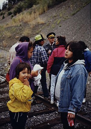
In August 1990, members of the Seton Lake Indian Band blocked the railway line at Seton Portage. They were showing support for the Mohawks during the Oka Crisis. The Royal Canadian Mounted Police later ended the blockade. This event was shown on TV news and led to protests across the province. These protests supported land claims by Indigenous peoples. Soon after, someone burned down the main railway bridge in Seton Portage.
Getting to Seton Portage
You can reach Seton Portage by a road called the Mission Mountain Road. This road goes over a high pass from the Bridge River area. Another way is the "High Line" powerline road. This road is about 25 kilometers long and comes from D'Arcy at the far end of Anderson Lake. It is sometimes called the Douglas Trail.
There is no road along Seton Lake. However, the British Columbia Railway (now CN) uses that route. The Seton Lake First Nation runs a special train called the Kaoham Shuttle. This shuttle travels between the Seton communities. It goes from the Seton Portage railway station to and from Lillooet. Sometimes, it also goes to D'Arcy if arranged beforehand.
| Preceding station | Canadian National Railway | Following station | ||
|---|---|---|---|---|
| Terminus | Kaoham Shuttle | Shalalth
toward Lillooet
|
||
| D'Arcy
Limited service
Terminus
|
||||
 | William Lucy |
 | Charles Hayes |
 | Cleveland Robinson |


