Shalalth facts for kids
Quick facts for kids
Shalalth
|
|
|---|---|
| Country | |
| Province | BC/BCE |
| Region | Lillooet-Fraser Canyon |
| Regional District | Squamish-Lillooet |
| Area codes | 250, 778, 236, & 672 |
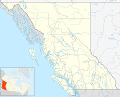
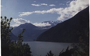
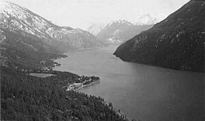
Shalalth and South Shalalth are small communities in British Columbia, Canada. They are located on the north side of Seton Lake. These areas are part of the Squamish-Lillooet Regional District. You can find them about 63 kilometers (39 miles) northwest of Lillooet by road. By train, they are much closer, only 15 kilometers (9 miles) away.
Contents
First Nations History
The name Shalalth comes from the Lillooet language, St'at'imcets. It is spelled Tsal’álh and simply means "lake." It refers especially to Seton Lake. Most people living in this valley are Indigenous peoples. Shalalth is one of the main communities for the Seton Lake First Nation Band. This band is part of the larger St'at'imc (Lillooet) Nation. The community has a First Nations school, a small timber mill, and other local businesses.
In the 1990s, the Seton Lake First Nation built a new neighborhood called Ohin. This area is east of the older Shalalth rancherie. The name Ohin (pronounced OO(kh)win) means "frostbite." It reminds people of how cold the Seton valley can get in winter. Roads do not go much further east than Ohin. Some private properties and isolated reserves beyond Ohin can only be reached by water or train.
Lake Travel and Ferries
During the Fraser Canyon Gold Rush, people used ferries on Seton Lake to bypass Shalalth. This was part of the Douglas Road route. Starting in the 1880s, equipment for mines in the Bridge River Country was brought by barge across the lake. It was then unloaded at Shalalth. Later, a ferry service ran between Lillooet and Shalalth until 1934. That's when a train shuttle began.
Today, you can still find water taxi services on Seton Lake. However, they do not have a regular schedule.
Mission Mountain Roads
An early Oblate mission was located at Shalalth. It was one of the first missions in the BC Interior. This mission gave its name to the nearby Mission Pass, ridge, and road.
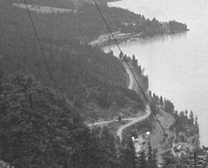
A trail connected Shalalth to Seton Portage. This trail was improved into a wagon road in the early 1900s. By the late 1890s, miners wanted the 14-mile (23 km) trail over the pass to be wider. They needed it to be a wagon road. This was for moving heavy supplies to the Bridge River mines. For example, a stamp mill was once sledded from the Mission when snow fell.
Around 1912, this trail became the Mission Mountain Road. Large teams of eight horses pulled freight up the steep, winding route. It could take seven days to reach the Bridge River. The first regular passenger service started in 1925. It was a packtrain that also carried mail. A 16-passenger bus began service in 1934. Important mining activities in the area ended in 1971.
Railway Arrives
The Pacific Great Eastern Railway (PGE) reached the end of Anderson Lake in December 1914. It arrived at Seton Lake the next month. The Bridge River (South Shalalth) train station became the new way to get to the goldfields. This station was on the west side of the bay.
Hydroelectric Power and Mining
In 1912, a land surveyor named Geoffrey Downton saw something important. He stood on Mission Mountain, which is about 5,000 feet (1,524 meters) high. He noticed the big height difference between the Bridge River and Seton Lake. They are only separated by Mission Ridge. This difference meant there was a lot of hydropower potential.
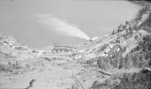
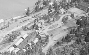
A "model village" was built at Bridge River (South Shalalth). Work on a 2.5-mile (4 km) tunnel began in 1927. It was supposed to finish by 1930. But construction stopped in 1929 because of the Great Depression. The project lost its money. The townsite was mostly empty during the 1930s. However, hotels stayed busy due to traffic to the mines.
Train Shuttle Service
When the Bralorne Mine opened in 1934, the road from the train station was fixed. The PGE railway started a gas car service in September. This was to handle more mining traffic to and from Lillooet. Two special passenger cars were used. They pulled two flatcars that carried vehicles and freight. Trains made four round trips daily. They loaded and unloaded at the Bridge River station. In 1936, the service was cut to two round trips. In 1938, a better road was built to Shalalth station. The train's western end point moved 0.9 miles (1.4 km) east.
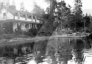
Craig Lodge, built in 1915, was a stop for the train. It burned down around 1948. The shuttle would also stop at any small community if asked. The train always stayed overnight in Lillooet. In the early 1940s, Sunday trips were stopped. In 1958, the western end of the line moved to Seton Portage. Shalalth was an important station for many years. By the 2000s, it became a flag stop. This means the train only stops if someone asks. In 2002, BC Rail stopped all passenger services. However, the Kaoham Shuttle, run by Indigenous people, still serves Shalalth.
| Preceding station | Canadian National Railway | Following station | ||
|---|---|---|---|---|
| Seton Portage
Terminus
|
Kaoham Shuttle | Lillooet
Terminus
|
||
Japanese Internment During WWII
During World War II, many Japanese-Canadians were forced to move from the coast. The mostly empty village at South Shalalth was one of four places in the Lillooet area where they were sent. One person who moved to Shalalth was Dr. Masajiro Miyazaki. He was a doctor who stayed after the war. He later became one of Lillooet's two Companions of the Order of Canada.
Hydroelectric Project Completion
After World War II, the Bridge River Power Project started again. A new mining boom also began. This caused a huge increase in traffic. For the next 20 years, Shalalth was a very busy transportation center. There was heavy traffic almost 24 hours a day over the pass. Places like Seton House and Shalalth Lodge offered accommodation. A large hotel was built near the hydro townsite train station. It was for project workers and mine visitors. This hotel burned down around 1949.
In the 1950s, the number of people living in the townsite and Seton Portage grew to thousands. School enrollments also increased greatly. Other hydro townsites were at Terzaghi Dam and Lajoie. This activity also led to a building boom in Lillooet. The two main powerhouses for the project are located at South Shalalth.
Road Access Today
Local people paid for almost all the costs to build the Mission Mountain Road and the Bridge River Road. They also paid for the "New Road" through the canyon.
A health emergency in Bralorne, a gold town, led to efforts to build a direct road to Lillooet. When the hydroelectric project finished in 1962, the Mission Mountain Road became less important. Shalalth also became less central.
Shalalth still does not have easy road access. The only two ways in and out of the valley are difficult mountain roads. These are the Mission Mountain Road and a BC Hydro road along Anderson Lake. This second road is called the High-Line Road. It leads to D'Arcy, which connects to Highway 99. From there, you can reach places like Pemberton, Whistler, Squamish, and Vancouver.
The railway does not want people walking on the tracks to Lillooet. Old walkways on the cliffs above the rail line are not safe. You can often see mountain goats and sheep on the slopes above Shalalth. They are especially common around Retaskit and Seton Beach.
Climate and Weather
| Climate data for Shalalth (1971–2000) | |||||||||||||
|---|---|---|---|---|---|---|---|---|---|---|---|---|---|
| Month | Jan | Feb | Mar | Apr | May | Jun | Jul | Aug | Sep | Oct | Nov | Dec | Year |
| Record high °C (°F) | 16.0 (60.8) |
15.6 (60.1) |
22.0 (71.6) |
27.2 (81.0) |
34.5 (94.1) |
38.0 (100.4) |
40.5 (104.9) |
38.9 (102.0) |
35.0 (95.0) |
29.0 (84.2) |
19.0 (66.2) |
17.2 (63.0) |
40.5 (104.9) |
| Mean daily maximum °C (°F) | 1.1 (34.0) |
4.6 (40.3) |
10.0 (50.0) |
15.7 (60.3) |
20.4 (68.7) |
24.5 (76.1) |
27.8 (82.0) |
27.2 (81.0) |
21.0 (69.8) |
13.8 (56.8) |
5.9 (42.6) |
1.6 (34.9) |
14.5 (58.1) |
| Daily mean °C (°F) | −1.8 (28.8) |
1.1 (34.0) |
5.3 (41.5) |
9.9 (49.8) |
14.1 (57.4) |
18.1 (64.6) |
21.0 (69.8) |
20.8 (69.4) |
15.7 (60.3) |
9.7 (49.5) |
3.2 (37.8) |
−0.7 (30.7) |
9.7 (49.5) |
| Mean daily minimum °C (°F) | −4.6 (23.7) |
−2.4 (27.7) |
0.5 (32.9) |
4.0 (39.2) |
7.8 (46.0) |
11.8 (53.2) |
14.2 (57.6) |
14.3 (57.7) |
10.2 (50.4) |
5.7 (42.3) |
0.5 (32.9) |
−3 (27) |
4.9 (40.8) |
| Record low °C (°F) | −26.7 (−16.1) |
−21.5 (−6.7) |
−15.0 (5.0) |
−3.0 (26.6) |
−1.7 (28.9) |
3.9 (39.0) |
6.0 (42.8) |
3.9 (39.0) |
−0.6 (30.9) |
−12.5 (9.5) |
−24.5 (−12.1) |
−26.1 (−15.0) |
−26.7 (−16.1) |
| Average precipitation mm (inches) | 78.3 (3.08) |
48.3 (1.90) |
32.6 (1.28) |
20.6 (0.81) |
24.8 (0.98) |
27.0 (1.06) |
31.2 (1.23) |
29.2 (1.15) |
26.6 (1.05) |
52.1 (2.05) |
81.1 (3.19) |
66.9 (2.63) |
518.6 (20.42) |
| Average snowfall cm (inches) | 31.6 (12.4) |
13.7 (5.4) |
3.7 (1.5) |
0.2 (0.1) |
0.0 (0.0) |
0.0 (0.0) |
0.0 (0.0) |
0.0 (0.0) |
0.0 (0.0) |
0.9 (0.4) |
9.1 (3.6) |
22.5 (8.9) |
81.7 (32.3) |
| Average precipitation days (≥ 0.2 mm) | 11.9 | 10.4 | 10.0 | 8.8 | 9.3 | 8.3 | 7.4 | 7.5 | 7.6 | 11.1 | 14.4 | 12.6 | 119.3 |
| Average snowy days | 5.9 | 3.4 | 0.69 | 0.03 | 0.0 | 0.0 | 0.0 | 0.0 | 0.0 | 0.17 | 2.1 | 5.9 | 18.19 |
| Source: Environment and Climate Change Canada | |||||||||||||
 | Jessica Watkins |
 | Robert Henry Lawrence Jr. |
 | Mae Jemison |
 | Sian Proctor |
 | Guion Bluford |


