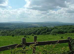
Shatterford Hill facts for kids
Shatterford Hill is a long, narrow hill in England. It stretches from the town of Bewdley in northern Worcestershire all the way to Birdsgreen in Shropshire. This hill is like a ridge running along the eastern side of the beautiful Severn Valley.
The highest point of Shatterford Hill is 202 meters (about 663 feet) high. This peak is close to the village of Shatterford, which is located on the A442 road between Kidderminster and Bridgnorth.
Contents
Amazing Views from Shatterford Hill
Shatterford Hill offers incredible views in every direction. From the top, you can see far across the Severn Valley.
Views to the West
Looking west, you can spot several famous hills:
- The Clee Hills
- Caer Caradoc
- The Long Mynd
On very clear days, you might even see the distant hills of Wales!
Views to the East and North
To the east, you can see the town of Kidderminster and the Clent Hills. Beyond them are the bigger urban areas of the West Midlands, like Dudley. If you look north, the large hill called The Wrekin stands out near Telford.
Views to the South
To the south, you can see the distinctive outline of the Malvern Hills.
Even though the very top of the hill (marked by a special pillar) is on private land, there's a great public viewpoint. You can find it on the road between Shatterford and Trimpley, with a small place to pull over.
Villages and Old Roads
Several villages are located along Shatterford Hill, from south to north:
- Trimpley
- Shatterford
- Romsley
The Ancient "Great Road"
An old road that followed the top of this hill was likely called the Micclan strete. This Anglo-Saxon name means "great made-road." Experts believe this might have been part of a very old route. This route could have connected important cities like Gloucester and Worcester to Chester in the north.
Later, the section of this road from Shatterford through Romsley and Quatt became part of a "turnpike" road. Turnpike roads were private roads where people paid a fee (a toll) to use them. This particular turnpike connected Kidderminster to Bridgnorth. However, in the 1830s, a new, easier road (now the A442 road) was built, and the old turnpike became less important.
Wassell Wood and Its History
The southern end of Shatterford Hill finishes quite suddenly at a place called Wassell Wood. Here, you can still see old earthworks. These are like ancient ditches and mounds that were once part of a fortified area. We don't know exactly when this fort was built.
The Meaning of "Wassell"
The name "Wassell" comes from an old Anglo-Saxon word, "Weardsetl." This word means "a watchplace." Wassell Wood was the most western point in a chain of these watchplaces. Other watchplaces in this chain included Wassell Grove (near Wychbury Hill), Waseley Hills, and Wast Hills in Alvechurch. These places were likely used to keep an eye on the surrounding land.
Habberley Valley: A Natural Gem
Below Wassell Wood, on its eastern side, is Habberley Valley. This area is a special local nature reserve. It's known for its lowland heathland, which is a unique type of open land with small shrubs. Habberley Valley is a very popular spot for picnics and enjoying nature with family and friends.
 | Aurelia Browder |
 | Nannie Helen Burroughs |
 | Michelle Alexander |


