Long Mynd facts for kids
Quick facts for kids Long Mynd |
|
|---|---|
| Welsh: Mynydd Hir | |
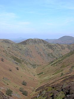
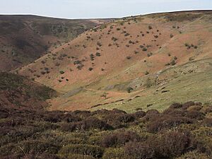
View down Townbrook Valley toward Burway Hill
|
|
| Highest point | |
| Peak | Pole Bank |
| Elevation | 516 m (1,693 ft) |
| Dimensions | |
| Length | 11.26 km (7.00 mi) N-S |
| Width | 4.8 km (3.0 mi) E-W |
| Area | 54 km2 (21 sq mi) |
| Geography | |
| Country | England |
| Range coordinates | 52°32′51.90″N 2°50′20.02″W / 52.5477500°N 2.8388944°W |
| Biome | Heathland Moorland |
| Geology | |
| Formed by | Glaciation |
| Age of rock | Quaternary |
| Type of rock | Sandstone |
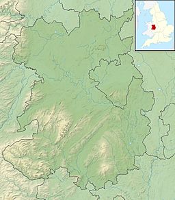
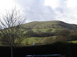
The Long Mynd is a beautiful area of heath and moorland in Shropshire, England. It's like a big, flat-topped mountain, also known as a plateau. This special place is part of the Shropshire Hills and is famous for its natural beauty. It sits between the Stiperstones hills to the west and the Stretton Hills and Wenlock Edge to the east. A lot of the Long Mynd is looked after by the National Trust, which helps protect its amazing landscapes.
The Long Mynd is about 7 miles (11 km) long and 3 miles (5 km) wide. It has steep valleys on its eastern side and a long, gentle slope on its western side. Nearby towns and villages include Church Stretton, Little Stretton, and All Stretton. The highest point on the Long Mynd is called Pole Bank, which is 1,693 ft (516 m) high. Another nearby hill, Caer Caradoc, is also very tall at 1,506 ft (459 m).
Contents
What Does "Long Mynd" Mean?
The name Long Mynd simply means "Long Mountain." The word "Mynd" comes from an old language called Common Brittonic. In modern Welsh, it's called Mynydd Hir, which means the exact same thing.
How the Long Mynd Was Formed
The rocks of the Long Mynd are incredibly old, dating back to a time called the Precambrian period. Imagine, back then, this area was far south of the equator, similar to where the Falkland Islands are today!
Shropshire was on the edge of a huge continent, near the sea. The Earth's movements caused volcanoes to form, and big rivers flowed into the sea, creating wide estuaries. Over time, mud and sand built up, and ash from volcanic eruptions settled in layers between them. The main rock you see on the Long Mynd is sandstone, often purple or grey.
The volcanoes that created the nearby Stretton Hills and The Wrekin were very active. Scientists have found special marks in the rocks of the Long Mynd. They used to think these were raindrop marks, but now we know they are fossils made by tiny, ancient creatures from the Ediacaran period. You can see examples of these fossils at the National Trust exhibition in Carding Mill Valley. All these layers of sand, mud, and ash built up to be about 23,000 ft (7,000 m) thick!
Later, the volcanoes stopped erupting, and the rivers dried up. The same forces that made the volcanoes then pushed and folded the new rocks, creating mountains and valleys. Much of the rock melted deep underground, causing the mountains to keep changing. The Church Stretton Fault zone, which is still active today, likely formed during this time. Caer Caradoc, a nearby hill, is a leftover piece of a huge ancient mountain chain.
During the Cambrian period, about 545 million years ago, Shropshire was covered by the sea after a huge ice age ended. Thick layers of pebbles and white sand formed along the ancient sea cliffs. This shallow sea was home to an explosion of new life. Shropshire has very important fossils from this time, including Trilobites, which help scientists understand how the Cambrian period is divided.
In the Ordovician period, Shropshire saw more volcanic activity. The land was temporarily split in two by a fault line. West of this line was ocean, while the east was dry land. The Iapetus Ocean was closing, bringing parts of Britain closer together, and volcanoes created mountains like those in the Lake District and Snowdonia. Shropshire also had its own volcanoes. Over time, the land was worn down, and the sea slowly covered it again, leaving only the tops of hills like Caer Caradoc visible. Another ice age caused sea levels to drop towards the end of this period.
The Silurian period, about 439 million years ago, is well-preserved nearby at Wenlock Edge. Shropshire was again covered by a shallow sea. Wenlock Edge formed then, and you can find fossils of ancient corals and shellfish in its limestone. By the end of the Silurian, England and Scotland had joined together. This event was very important for the geology of Great Britain, as it caused many of our hills and mountains to line up in a specific direction.
During the Devonian period, new rivers flowed across the land, bringing thick deposits of red sandstone rich in iron. This area was known as the Old Red Sandstone Continent. You can even find traces of fossilized fish in these river sediments. Shropshire stayed above water until the end of the Devonian, when the seas rose again.
The Carboniferous period brought big changes. Shropshire was near the equator, and the Old Red Sandstone continent had worn away. At first, the county was under a shallow sea. But then, Earth's movements pushed Britain out of the sea. Huge deltas formed, covered by tropical forests with giant tree ferns and horsetails. Shropshire eventually moved across the equator and became part of the supercontinent Pangaea during the Permian period. The area would have been like a hot, dry desert, similar to the Sahara Desert today.
The Triassic, Jurassic, Cretaceous, and Tertiary periods were very quiet in Shropshire, with little evidence left from those times. However, the last Ice Age during the Quaternary period shaped the landscape we see today. The Long Mynd was covered by a thick ice sheet. As the ice melted, it carved out the valleys and hills of the Long Mynd. Even today, small rivers and streams continue to slowly shape these valleys.
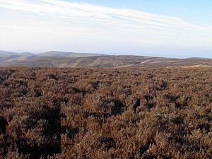
Today, the steep, narrow valleys have a thin layer of acidic soil. Only tough grasses, rushes, and heathers can grow there. But beneath the soil, you can see the amazing layers of ancient rock in the rocky outcrops and scree slopes.
Since 2006, scientists from the University of Cambridge have been watching for earthquake activity on the Long Mynd. They use a special tool called a seismometer to monitor the ground.
Long Mynd's Past: A Look Back in Time
Bronze Age Discoveries
The Bronze Age is the period with the most ancient remains found on the Long Mynd. There are many burial mounds, called tumuli, scattered across the moorland. Some are small, like the remains of old tombs. Others are quite large, including earthworks (dykes) and barrows.
Barristers Plain Cross-Ridge Dyke is a long earthwork, about 170 m (560 ft) long. It crosses a narrow ridge between Grindle Hill and Round Hill. This dyke is now covered in heather and is about 5.5 m (18 ft) wide and 0.5 m (1 ft 8 in) high. On its western side, it has a 3 m (10 ft) wide ditch. It was likely built to block access to Grindle Hill and create a barrier from the west.
Devil's Mouth Cross-Ridge Dyke is located between Cardingmill Valley and Townbrook Valley. This dyke is 140 m (460 ft) long, but parts of it are missing due to the Burway road and a car park. It was made from stone and earth, about 6 m (20 ft) wide and 1.5 m (5 ft) high, with shallow ditches on both sides. It's about 1,500 years old. People think it was built to control who could use an ancient path that still crosses the Long Mynd today.
High Park Cross-Ridge Dyke is the longest dyke on the Long Mynd, stretching for 380 m (1,250 ft). It's about 6 m (20 ft) wide, but in some places, you can only see its outline. The highest part of this dyke is 1.2 m (4 ft) high. Like Barristers Plain, a trackway cuts through this dyke.
The Long Mynd Barrows are over twenty burial mounds found across the plateau. The best ones are in the northern part of the Long Mynd. Robin Hood's Butts, near Duckley Nap, are two famous barrows. They are the largest on the Long Mynd, about 36 m (118 ft) wide and 4 m (13 ft) high.
The Shooting Box Barrow is special because it's the only known "disc barrow" in Shropshire. It's named after a hut that used to be there. This mound is 21 m (69 ft) wide and 2.3 m (8 ft) high, sitting in the middle of a flat, circular area 54 m (177 ft) wide. It was built around c. 1950–1700 BC.
The Port Way is a very old trackway that runs for over 5 miles (8 km) along the Long Mynd. It's the biggest historical feature here and is still used today as part of the Shropshire Way walking path and a road to the Gliding Club. Many people think it goes over Pole Bank, but it actually goes around the hill.
Iron Age Forts
Not much evidence of human activity from the Iron Age has been found on the Long Mynd, but there is one important ancient site.
Bodbury Ring Hill Fort is an old fort located on top of Bodbury Hill, at 380 m (1,250 ft), above Cardingmill Valley. This fort dates back to the Iron Age, around c. 500 BC. Another similar hill fort is on the top of Caer Caradoc. The National Trust now looks after Bodbury Ring.
The Long Mynd in the 18th Century
In the 1700s, Church Stretton began to grow into a busy market town and later a spa town. It sits in the wide valley between the Long Mynd and Caer Caradoc. Historically, Church Stretton was known for making textiles, especially in Cardingmill Valley.
The Carding Mill was built in the 18th century. It was named after "carding," one of the steps in making cloth. Carding involved using wooden blocks with metal spikes to untangle raw fibers. Children often did this job. After carding, the material would be spun into thread and then woven into fabric. The old mill building is still in the valley today, but it has been turned into apartments. The Long Mynd Hotel in Church Stretton was built in 1900, originally as a "Hydro" (a health spa), when the town was popular for its healing waters.
The Long Mynd in the 20th Century
In 1965, the National Trust bought a large part of the Long Mynd, almost all of its high ground. The area was officially named an AONB in 1958, as part of the Shropshire Hills. This means it's a special place protected for its beautiful landscape.
Highest Points of the Long Mynd
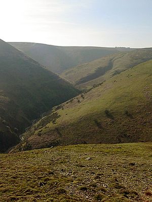
The Long Mynd has many hills and open moorlands. From the top of almost every hill, you can see amazing views of the surrounding area and even other counties. To the north, you might see as far as Cheshire. To the west, you can see the Stiperstones and the Welsh Cambrian Mountains in Powys, and on clear days, even Snowdonia. Views to the east are partly blocked by other Shropshire Hills like Caer Caradoc, the Wrekin, and the Clee Hills. From some spots, you can even see parts of the West Midlands. Looking south, you'll see the Clun Forest and areas towards Craven Arms and Ludlow.
Here are some of the highest points on the Long Mynd, along with other nearby hills and the level of Church Stretton (shown in bold):
- Brown Clee Hill 546 m (1,791 ft)
- Stiperstones 536 m (1,759 ft)
- Pole Bank 516 m (1,693 ft)
- Long Synalds 490 m (1,608 ft)
- Wild Moor 487 m (1,598 ft)
- Calf Ridge 468 m (1,535 ft)
- Haddon Hill 467 m (1,532 ft)
- Yearlet 465 m (1,526 ft)
- Round Hill 463 m (1,519 ft)
- Caer Caradoc 459 m (1,506 ft)
- Grindle 459 m (1,506 ft)
- Knolls 456 m (1,496 ft)
- Minton Hill 453 m (1,486 ft)
- Cow Ridge 450 m (1,476 ft)
- Packetstone Hill 437 m (1,434 ft)
- Nills 427 m (1,401 ft)
- Ashlet 415 m (1,362 ft)
- Black Knoll 415 m (1,362 ft)
- Callow 411 m (1,348 ft)
- The Wrekin 407 m (1,335 ft)
- Burway Hill 391 m (1,283 ft)
- Churchmoor Hill 394 m (1,293 ft)
- Bodbury Hill 388 m (1,273 ft)
- Priors Holt Hill 383 m (1,257 ft)
- Adstone Hill 369 m (1,211 ft)
- Shooters Knoll 365 m (1,198 ft)
- Stanyeld 334 m (1,096 ft)
- Novers Hill 305 m (1,001 ft)
- Castle Hill 218 m (715 ft)
- Church Stretton 192 m (630 ft)
Valleys and Hollows of the Long Mynd
The Long Mynd has many beautiful valleys, especially along its eastern side near Church Stretton. Many of the larger valleys run from northwest to southeast. Some of the main valleys include:
- Ashes Hollow
- Barristers Batch
- Bilbatch
- Broadhill Dale
- Burnells Brook
- Callow Hollow
- Carding Mill Valley
- Catbatch Brook
- Cwmdale
- Devils Mouth Hollow
- Gogbatch
- Grindle Hollow
- Hawkham Hollow
- Hens Batch
- High Park Hollow
- Jonathon’s Hollow
- Light Spout Hollow
- Long Batch
- Minton Batch
- Motts Road
- Mount Gutter
- New Pool Hollow
- Nut Batch
- Pike Hollow
- Rams Batch
- Sleekstone Bank Hollow
- Stanbatch
- Stony Batch
- Townsbrook Valley
- Woolers Batch
- Yewtree Batch
Fun Things to Do on the Long Mynd
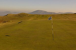
The Long Mynd is part of the Shropshire Hills Area of Outstanding Natural Beauty (AONB), making it a popular spot for visitors. People love to come here for the many footpaths, different types of land, and amazing views. Two well-known walking paths are the Shropshire Way and the Jack Mytton Way. The wide-open spaces of the Long Mynd are also great for horse riding and mountain biking on the special bridleways.
Cardingmill Valley is the busiest part of the Long Mynd because it has the National Trust's visitor center for the area.
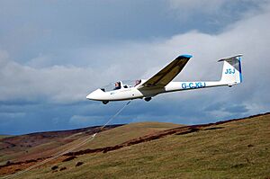
The western slopes, where the wind blows, are popular with people who fly gliders, hang-gliders, and paragliders.
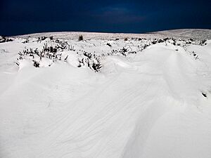
In winter, some valley slopes become makeshift ski slopes. However, the Long Mynd can be dangerous in bad weather, and sadly, it has claimed lives. In 2015, "snow gates" were put in place at different entrances to the Long Mynd to stop drivers from using the roads when it's snowy or icy.
The Longmynd Hike is a challenging 50-mile (80 km) race that crosses the Long Mynd twice. Participants must finish it in under 24 hours. This race has been held every year since 1967, usually on the first weekend of October.
There's also a golf course, the Church Stretton Golf Club, located near Cardingmill Valley. It's on the slopes of Stanyeld Hill and Bodbury Hill. The clubhouse is about 230 metres (750 ft) above sea level, and the course goes up to about 375m (1,230 ft). It's the oldest 18-hole golf course in Shropshire, opened in 1898, and one of the highest in the country.
Gliding on the Long Mynd
The Long Mynd has been home to the Midland Gliding Club since 1934. The club owns 136 hectares (340 acres) of land on the south end and flies gliders there all year round. They offer training courses and trial flights for visitors. Many long glider flights have started from the Long Mynd, including one that went 750 kilometres (470 mi) in 2007! This gliding club is one of the few places in Europe that still regularly launches gliders using a "bungee" system.
Plants and Animals of the Long Mynd
The Long Mynd Commoners have special rights to graze 48 ponies on the land. These ponies help keep the area healthy by eating scrub and bracken, which stops trees from taking over the heathland. They also graze in the pools, eating pondweed. Because of this, there are healthy numbers of brown trout (Salmo trutta) and otter (Lutra lutra) in the waters. You can also find birds like the Tree pipit (Anthus trivialis) and red grouse (Lagopus lagopus scotica) here. The grayling butterfly (Hipparchia semele) has also recently arrived in the area.
 | Bessie Coleman |
 | Spann Watson |
 | Jill E. Brown |
 | Sherman W. White |


