Shebandowan River facts for kids
Quick facts for kids Shebandowan River |
|
|---|---|
 |
|
|
Location of the mouth of the Shebandowan River in Ontario
|
|
| Country | Canada |
| Province | Ontario |
| Region | Northeastern Ontario |
| District | Thunder Bay |
| Physical characteristics | |
| Main source | Lower Shebandowan Lake Conacher Township 449 m (1,473 ft) 48°37′11″N 90°03′45″W / 48.61972°N 90.06250°W |
| River mouth | Matawin River Horne Township 366 m (1,201 ft) 48°32′56″N 89°53′27″W / 48.54889°N 89.89083°W |
| Basin features | |
| River system | Great Lakes Basin |
| Tributaries |
|
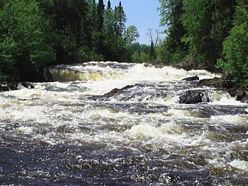
The Shebandowan River is a river located in the Thunder Bay District of Northwestern Ontario, Canada. This river is part of the huge Great Lakes Basin, which means its waters eventually flow into the Great Lakes. It is a "left tributary" of the Matawin River, meaning it joins the Matawin River from the left side when looking downstream.
For most of its journey, the Shebandowan River flows right next to Ontario Highway 11. This highway is also part of the Trans-Canada Highway, a major road that crosses Canada. A Canadian National Railway train line also runs alongside the entire river. This railway was originally built as part of the Canadian Northern Railway's transcontinental main line, connecting different parts of the country.
Contents
Journey of the Shebandowan River
The Shebandowan River starts its flow from Lower Shebandowan Lake. This lake is one of three connected lakes, along with Upper and Middle Shebandowan Lakes. These lakes are found in an area called Conacher Township.
From Lake to River
The river begins its journey by flowing east over a dam near the community of Shebandowan. A dam is a barrier built across a river to control the flow of water. After leaving the lake, the river enters Blackwell Township. It continues to flow east into Dawson Road Lots Township. Here, another river, the Oskondaga River, joins it from the left side, south of a place called Shabaqua Corners.
Turning South and Reaching the Mouth
The Shebandowan River then turns away from Ontario Highway 11 and heads southeast into Laurie Township. It flows past the community of Shabaqua. Finally, the river enters Horne Township and reaches its end, or "mouth," where it flows into the Matawin River. The Matawin River then carries these waters to the Kaministiquia River, which eventually empties into Lake Superior.
Rivers Joining the Shebandowan
- Oskondaga River (joins from the left side)
 | Georgia Louise Harris Brown |
 | Julian Abele |
 | Norma Merrick Sklarek |
 | William Sidney Pittman |


