Smugglers' Notch State Park facts for kids
Quick facts for kids Smugglers' Notch State Park |
|
|---|---|
|
IUCN Category III (Natural Monument)
|
|
 |
|
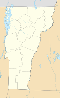
| Location | Lamoille County, Vermont, United States |
| Elevation | 2,119 ft (646 m) |
| Designation | State park |
| Named for | Smugglers Notch |
| Operator | Vermont State Parks |
| Website | Smugglers' Notch State Park |
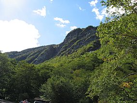
Smugglers' Notch State Park is a cool state park in Vermont, USA. It's located near the town of Stowe in Lamoille County, Vermont. The park sits high up, about 2,119 feet (646 meters) above sea level. It's named after a famous mountain pass called Smugglers Notch. This notch is a gap between Mount Mansfield (Vermont's tallest mountain) and other peaks like Spruce Peak.
Contents
A Secret History
Smugglers' Notch has a really interesting past! It got its name because people used it for smuggling goods.
Why Smuggling Happened
Back in 1807, the U.S. President Thomas Jefferson wanted to keep America out of big wars happening in Europe, called the Napoleonic Wars. To do this, the U.S. Congress passed a law called the Embargo Act of 1807. This law stopped American trade with countries like Great Britain and Canada.
But people in Vermont still needed to trade! So, British goods were brought to Canada. Then, brave Vermonters secretly carried these goods, and even livestock, through the mountain trails of Smugglers' Notch. The area was perfect for this because it was remote and had many hidden caves. These caves were great places for smugglers to hide their secret stashes! This illegal trade slowed down when the War of 1812 began.
A Path to Freedom
Later, Smugglers' Notch became part of the Underground Railroad. This was a secret network of safe paths and hiding spots. People who were escaping slavery used the notch as a way to reach freedom in Canada.
From Horses to Cars
In 1922, the route through Smugglers' Notch was made better for cars. This new road was used during a time called Prohibition. During Prohibition, it was illegal to make or sell alcohol in the U.S. So, people used the notch to bring alcohol secretly from Canada.
Building the Park
Smugglers' Notch State Park was built in 1936 by a group called the Civilian Conservation Corps. This group was created by President Franklin D. Roosevelt during the Great Depression. It gave jobs to young men who needed work. They built many of the park's first structures. In 2003, the park was moved to a new spot. But don't worry, all the original buildings made by the Civilian Conservation Corps were carefully moved too!
Exploring the Mountains
Smugglers' Notch State Park is located in the beautiful Green Mountains. These mountains are part of the larger Appalachian Mountains range. This huge mountain range stretches all the way from Canada down to Georgia in the southern U.S.
The Green Mountains have five peaks that are over 4,000 feet (1,219 meters) tall. Three of these tall peaks, Mount Mansfield, Camel's Hump, and Mount Abraham, have special plants that only grow in cold, high places.
Hiking Trails
A famous long hiking path called the Long Trail goes through all the major peaks. It runs from the very south to the very north of Vermont. Part of the Long Trail even joins up with the famous Appalachian Trail!
Fun Things to Do!
Smugglers' Notch State Park is open all year round. But in winter, you can only get around on snowmobiles or by skiing.
Camping and Hiking
The park has fourteen lean-to shelters and twenty campsites right off Route 108. It's a great place to start many hiking adventures!
One popular path is the Sterling Pond Trail. It goes through a thick, young forest and climbs about 900 feet (274 meters) up to Sterling Pond. You can go fishing and swimming in the pond.
Many trails also start here and go up Mount Mansfield. If you like adventure, you can even try Mountain climbing and spelunking (exploring caves) in the park. You'll find many large boulders and caves. There are also tall cliffs on Mount Mansfield and a rock formation called Elephant's Head.
 | Kyle Baker |
 | Joseph Yoakum |
 | Laura Wheeler Waring |
 | Henry Ossawa Tanner |


