Sombrerete, Zacatecas facts for kids
Quick facts for kids
Sombrerete, Zacatecas
|
||
|---|---|---|
|
City and municipality
|
||
| Sombrerete | ||
|
Sombrerete
|
||
|
||
| Country | ||
| State | Zacatecas | |
| Founded | 1555 | |
| Elevation
(of seat)
|
2,500 m (8,200 ft) | |
| Population
(2010) Municipality
|
||
| • Municipality | 58,201 | |
| Time zone | UTC-6 (Central (US Central)) | |
| • Summer (DST) | UTC-5 (Central) | |
| Postal code (of seat) |
99100
|
|
| Area code(s) | 433 | |
| Website | [1] | |
| Official name: Ensamble of the city of Sombrerete | ||
| Type: | Cultural | |
| Criteria: | ii, iv | |
| Designated: | 2010 (32nd session) | |
| Reference #: | 1351-043 | |
| Region: | Latin America and the Caribbean | |
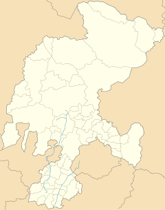
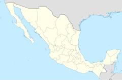
Sombrerete is a town and municipality in the northwest of Zacatecas, a state in Mexico. It borders the state of Durango.
This town was started in 1555 by a Spanish explorer named Juan de Tolosa. He founded it as a mining center. Because of its rich mines, Sombrerete became one of the most important towns in New Spain (colonial Mexico).
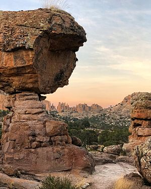
In 2010, parts of Sombrerete were recognized as a UNESCO World Heritage Site. This includes the historic center, La Noria de San Pantaleón, and the Sierra de Órganos National Park. These sites are part of the Camino Real de Tierra Adentro, an old Spanish road.
Later, in 2012, Sombrerete was also named a Pueblo Mágico, which means 'magical town'. This special title is given by the Mexican Secretariat of Tourism to places with unique natural beauty, cultural richness, or historical importance.
Contents
Exploring the Town of Sombrerete
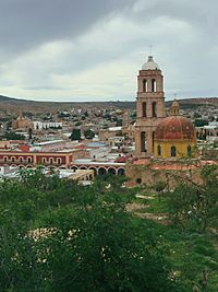
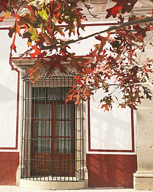
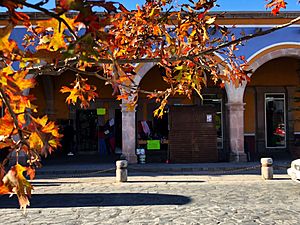
The town of Sombrerete still looks much like it did during the colonial period. It has wide main streets that connect to smaller streets and alleys. You'll find many plazas (public squares) scattered throughout the town. The main plaza is surrounded by the government building. A stream called Diezmo runs through the middle of the town.
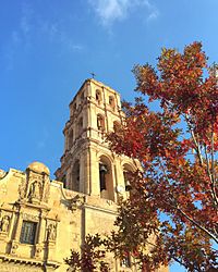
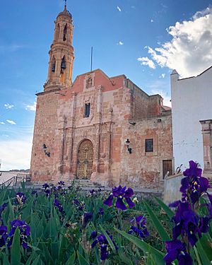
Sombrerete has many old buildings from the colonial era. The biggest is the San Mateo monastery complex. It includes a church dedicated to Saint Francis of Assisi. This monastery was built in the 1500s. It was the main religious center in the area until the 1800s. The main church has a beautiful altar made of wood covered in gold.
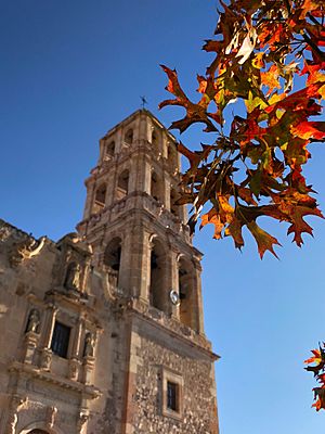
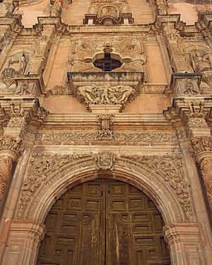
Other important churches include the Santo Domingo Church, started in the 1700s. It has a Baroque style and holds valuable religious art inside. The San Juan Bautista Church, built in 1777, also features a Baroque facade with detailed carvings.
What are the Oldest Chapels?
The La Capilla de la Candelaria is a small chapel dedicated to a wooden statue of the Virgin Mary. This statue was brought from Seville, Spain, in 1556 by Juan de Tolosa. The chapel has a stone altar and a roof supported by many thick beams. Every year, a special festival celebrates this image.
The Santa Veracruz Chapel was built in the 1500s. It is unique because its interior is completely empty, with no pews. On the floor, there are more than a hundred graves of unidentified people. This chapel has not been restored and shows its age.
The La Soledad Church, from the 1700s, stands out with its Moorish bell tower. It also has a fancy Churrigueresque facade.
Museums and Festivals
Sombrerete has one museum, which opened in 2000. It tells the story of the region's history, from ancient times to its economic and cultural growth.
The town celebrates two main festivals. One celebrates its founding on June 6th. The other honors the Virgin of Candelaria in February. During these festivals, you can hear traditional music called tamborazo. Another important event is the Noria de San Pantaleón Festival on July 27th.
Understanding the Municipality
The town of Sombrerete is the main center for a larger area, also called Sombrerete. This municipality covers about 3,571 square kilometers. Many smaller communities within the municipality used to be large haciendas (estates).
Important communities include Colonia González, Charco Blanco, and Villa Insurgentes. These communities mostly focus on farming, raising animals, and some trade. The municipality shares borders with several other municipalities in Zacatecas. It also borders the state of Durango to the west and north.
Geography and Climate of Sombrerete
The town and municipality of Sombrerete are in the northwest of Zacatecas. They are about 168 kilometers from the state capital, Zacatecas City.
This region is located between the Sierra Madre Occidental mountains and the central highlands of Mexico. The town sits in a valley surrounded by smaller mountain ranges. These include the Sierra de Sombrerete and the Sierra de Santa María. Some notable peaks are Cerro Grande and Cerro Sombreretillo. The town itself is about 2,300 meters (7,500 feet) above sea level. Some higher points reach over 2,500 meters (8,200 feet).
Rivers and Water Sources
The main river in the area is the San Antonio-Barajas. It flows through several towns like Parade and Los Sauces. Other important streams include Grande-Las Adjuntas and El Pino-Linares. The main bodies of water are lakes and dams such as Charco Blanco and Dolores.
What is the Weather Like?
About half of the municipality has a mild and somewhat humid climate. Most of the rain falls during the summer. The other half of the area is a bit drier. The average temperature for the municipality is about 22.1 degrees Celsius (71.8 degrees Fahrenheit). The area gets about 635.6 millimeters (25 inches) of rain each year.
Plants and Animals of Sombrerete
The most common type of plant life here is grass. It covers about a third of the land and is used to feed animals. About 26% of the area is covered by forests. These forests have trees like pine, holm oak, and other types of oak.
Dry areas with cacti make up only a small part of the land. The rest of the land is used for farming. Farmers grow crops like corn, beans, oats, and wheat.
Culture and Traditions
Sombrerete is known for its strong traditions. Many social events are linked to religious celebrations. Local saints' days are popular festivals. They usually include religious ceremonies, traditional dances, special foods, and carnival rides.
One important local figure is the Señor de los Trabajos (Our Lord of Work). People believe he helps in difficult situations. On the night of his celebration, there's a fireworks show. A tree is also burned in the Plaza San Francisco. Many surrounding peaks have crosses, placed there by people as a sign of faith. People also say that religious treasures are hidden in the Sierra de Órganos.
What are the Local Foods?
Typical dishes in Sombrerete are similar to other parts of Zacatecas. These include birria (a meat stew), pozole (a hearty soup), and asado de boda (pork in a red chili sauce with chocolate).
A unique street food in Sombrerete is called brujitas. These are fried turnovers made from thick corn dough. They are filled with beans or shredded meat. The name, which means 'little witches', comes from the idea that they "fly" out of the baskets when sold at the market.
Traditional drinks include fruit wines, like those made from quince. Another popular drink is rompope, a type of eggnog. Pan ranchero is a special bread made with lard. It's baked in traditional ovens, often for Holy Week.
Economy of Sombrerete
The economy of Sombrerete mainly depends on three things: mining, ranching (raising livestock), and agriculture (farming). The area is rich in minerals, especially silver, and mines are still active. Since the 1940s, new deposits of mercury have also been found and explored.
A Brief History of Sombrerete
The earliest known people in this region were the Chalchihuites. They lived here from ancient times until about 900 AD. They were mostly settled farmers. We don't know exactly why their settlements were abandoned. It might have been due to climate change, attacks from nomadic groups, or the decline of large cities in central Mexico. After them, nomadic groups called Chichimecas controlled the area until the Spanish arrived.
In 1555, Juan de Tolosa and a small group of Spaniards came looking for more silver. They settled near a spring and called the place Real y Minas de Sombrerete. The name came from a friar who thought one of the mountains looked like a common three-cornered hat.
Soon, the mines became very important for producing gold, silver, lead, tin, and mercury. By 1570, the settlement had grown enough to be officially called Villa de Llerena. In 1567, the San Mateo monastery was built. It became the main religious center for the region.
During the time Mexico was a Spanish colony, the town and region continued to grow. Farming and ranching became important, but mining remained the main activity. The Pabellón and Vetanegre mines were very productive. They made the Fagoaga family very rich. In the 1600s, Sombrerete became even more important. A Royal House was set up to collect taxes from far-off places. By the early 1800s, the town had about 30,000 people.
Sombrerete in Modern Times
During the Mexican War of Independence, many miners secretly supported the fight for freedom. In 1824, Sombrerete was officially declared a city by the state of Zacatecas. It became a regional capital.
The area remained important in the 1800s. It was even the temporary capital of Zacatecas during the French Intervention and Reform War. Benito Juárez, a famous Mexican president, visited in 1866. The first newspaper, La Campana, was published in 1867.
The Mexican Revolution (early 1900s) brought challenges. Farms and mines were attacked, which hurt the economy. However, Sombrerete was again a temporary capital of Zacatecas from 1913 to 1914. Venustiano Carranza, another important leader, visited during this time.
After the Revolution, the old hacienda system ended. Later, efforts to control the Catholic Church led to the Cristero War. This war mostly affected the rural communities around Sombrerete.
Since then, Sombrerete has continued to be an important mining and farming center for Zacatecas. It also serves as a commercial hub for the northern part of the state.
See also
 In Spanish: Sombrerete para niños


