South Leinster Way facts for kids
Quick facts for kids South Leinster Way |
|
|---|---|

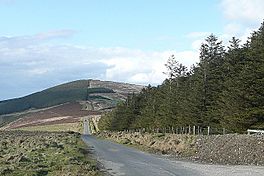
Trail near Croaghaun, Blackstairs Mountains
|
|
| Length | 104 kilometres (65 miles) |
| Location | South-east Ireland |
| Designation | National Waymarked Trail |
| Trailheads | Kildavin, County Carlow Carrick-on-Suir, County Tipperary |
| Use | Hiking |
| Elevation gain/loss | +1,490 m (4,888 ft) |
| Difficulty | Moderate |
| Season | Any |
| Website | http://www.southleinsterway.com/ |
The South Leinster Way is a long-distance walking path in the south-east of Ireland. It is about 104 kilometres (65 miles) long. This trail starts in Kildavin, which is in County Carlow. It then goes through County Kilkenny and finishes in Carrick-on-Suir, located in County Tipperary. Most people take about five days to walk the entire trail.
This path is officially known as a National Waymarked Trail. This means it's a special route for walkers. It is looked after by several groups. These include the National Trails Office, the Irish Sports Council, and local councils like Carlow County Council, Kilkenny County Council, and Tipperary County Council. Other groups like Carlow Local Sports Partnership, Kilkenny Trails, and Coillte also help manage it. The South Leinster Way was first opened on November 30, 1985. Donal Creed, who was a government minister at the time, officially opened it.
Contents
Exploring the South Leinster Way
The South Leinster Way takes you through different types of landscapes. It's a great way to see the natural beauty of Ireland.
Mountains and Rivers
The first part of the trail goes through the Blackstairs Mountains. You will walk along the sides of Mount Leinster. This is the highest mountain in that area. The path then leads you to the village of Borris.
From Borris, the trail follows a path next to the River Barrow. This type of path is called a towpath. It takes you to the town of Graiguenamanagh. Here, the trail crosses into County Kilkenny.
Hills and Forests
After Graiguenamanagh, the route continues towards Inistioge. You will walk on the northern slopes of Brandon Hill. This is the highest mountain in County Kilkenny.
From Inistioge, the trail goes through forests on various tracks. These tracks lead you to a place called Mullinavat. The very last part of the trail follows a road from Mullinavat to Carrick-on-Suir.
Connecting with Other Trails
The South Leinster Way is part of a much bigger network of walking paths. It connects to several other long-distance trails.
European Walking Route E8
The South Leinster Way is a section of the European walking route E8. This amazing route stretches a very long way! It starts on Dursey Island in County Cork, Ireland. It then goes all the way to Istanbul in Turkey.
The Irish part of the E8 route includes several trails. These are the Wicklow Way, the South Leinster Way, the East Munster Way, the Blackwater Way, and parts of the Kerry Way and the Beara Way. There's a road walk that connects the end of the Wicklow Way in Clonegal, County Carlow, to the start of the South Leinster Way in Kildavin.
Local Trail Connections
The South Leinster Way also links up with other trails in Ireland. The East Munster Way begins exactly where the South Leinster Way finishes in Carrick-on-Suir.
You can also connect to the Barrow Way when you are in Graiguenamanagh. And if you are in Inistioge, you can join the Nore Valley Way. These connections make it easy to explore more of Ireland's beautiful countryside.
 | James B. Knighten |
 | Azellia White |
 | Willa Brown |

