Stafford, Ohio facts for kids
Quick facts for kids
Stafford, Ohio
|
|
|---|---|
|
Village
|
|

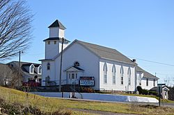
Methodist church, State Route 145 and Main Street
|
|

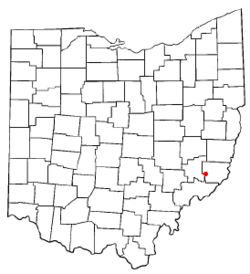
Location of Stafford, Ohio
|
|

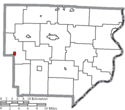
Location of Stafford in Monroe County
|
|
| Country | United States |
| State | Ohio |
| County | Monroe |
| Township | Franklin |
| Area | |
| • Total | 0.34 sq mi (0.88 km2) |
| • Land | 0.34 sq mi (0.88 km2) |
| • Water | 0.00 sq mi (0.00 km2) |
| Elevation | 1,063 ft (324 m) |
| Population
(2020)
|
|
| • Total | 71 |
| • Density | 208.82/sq mi (80.67/km2) |
| Time zone | UTC-5 (Eastern (EST)) |
| • Summer (DST) | UTC-4 (EDT) |
| ZIP code |
43786
|
| Area code(s) | 740 |
| FIPS code | 39-74300 |
| GNIS feature ID | 2399882 |
Stafford is a small village located in Monroe County, Ohio, in the United States. In 2020, the census counted 71 people living there.
Contents
A Look at Stafford's Past
Stafford was first called Bethel. It was planned out by John Jones in 1838. Later, a man named William Steel helped change its name to Stafford. He was from Scotland and worked to end slavery.
William Steel also helped create a good school system in Stafford. This school system was special because it allowed both Black and white students to learn together.
Stafford and the Underground Railroad
Stafford has an important history with the Underground Railroad. This was a secret network that helped enslaved people escape to freedom. Stafford was known as a "free Black" settlement because many African Americans lived there. Both Black and white people in Stafford strongly opposed slavery.
It is believed that almost everyone in the village helped protect people escaping slavery. A common route for freedom seekers went from Marietta, Ohio, through Stafford, and then to Summerfield, Ohio. These paths continued all the way into Ontario, Canada.
Where is Stafford Located?
Stafford is a small village. According to the United States Census Bureau, its total area is about 0.34 square miles (0.88 square kilometers). All of this area is land.
How Many People Live in Stafford?
| Historical population | |||
|---|---|---|---|
| Census | Pop. | %± | |
| 1850 | 124 | — | |
| 1860 | 197 | 58.9% | |
| 1870 | 150 | −23.9% | |
| 1880 | 172 | 14.7% | |
| 1910 | 174 | — | |
| 1920 | 158 | −9.2% | |
| 1930 | 145 | −8.2% | |
| 1940 | 163 | 12.4% | |
| 1950 | 141 | −13.5% | |
| 1960 | 113 | −19.9% | |
| 1970 | 120 | 6.2% | |
| 1980 | 98 | −18.3% | |
| 1990 | 89 | −9.2% | |
| 2000 | 86 | −3.4% | |
| 2010 | 81 | −5.8% | |
| 2020 | 71 | −12.3% | |
| U.S. Decennial Census | |||
Stafford's Population in 2010
In 2010, the census showed that 81 people lived in Stafford. There were 34 households and 25 families. The village had about 238 people per square mile (92 people per square kilometer).
Most people in Stafford were White (93.8%). A smaller number were African American (4.9%) or Native American (1.2%).
- About 20.6% of households had children under 18.
- Most households (64.7%) were married couples.
- The average household had 2.32 people.
- The average family had 2.52 people.
The average age in the village was 47.2 years.
- 18.5% of residents were under 18.
- 19.8% were 65 years or older.
- The village had slightly more females (51.9%) than males (48.1%).
Famous People from Stafford
Stafford was the hometown of AIDS activist David Kirby. His life and death were shown in Life Magazine in the 1990s.
See also
 In Spanish: Stafford (Ohio) para niños
 | Ernest Everett Just |
 | Mary Jackson |
 | Emmett Chappelle |
 | Marie Maynard Daly |


