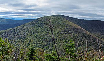
Sugarloaf Mountain (Greene County, New York) facts for kids
Quick facts for kids Sugarloaf Mountain |
|
|---|---|

Sugarloaf from the summit of Twin Mountain to the east
|
|
| Highest point | |
| Elevation | 3,810 feet (1,160 m) |
| Prominence | 1,200 ft (370 m) |
| Listing | Catskill High Peaks 13th |
| Geography | |
| Location | Greene County, New York |
| Parent range | Devil's Path (Catskills) |
| Topo map | USGS Hunter |
Sugarloaf Mountain is an exciting mountain located in Greene County, New York. It's a big part of the Devil's Path mountain range, which is found within the larger Catskill Mountains. This mountain is a favorite for hikers and people who love exploring nature.
Contents
About Sugarloaf Mountain
Sugarloaf Mountain is a tall peak in the beautiful Catskill Mountains of New York. It stands at about 3,810 feet (1,161 meters) high! It's known for being part of the challenging Devil's Path, a famous hiking trail. To the northwest, Sugarloaf is separated from Plateau Mountain by a dip called Mink Hollow Notch. To the southeast, it's separated from Twin Mountain by Pecoy Notch.
Where is Sugarloaf Mountain?
Sugarloaf Mountain is located in Greene County, New York. It's nestled within the Catskill State Park, which is a huge area protected for its natural beauty. This park is a great place for outdoor activities like hiking, camping, and enjoying wildlife.
Water Flow: The Watershed
Imagine all the rain and snow that falls on a mountain. Where does it go? Sugarloaf Mountain is part of the watershed of the Hudson River. A watershed is like a giant funnel where all the water eventually flows into one main river or body of water.
- Water from the northeastern parts of Sugarloaf Mountain flows into Schoharie Creek.
- From Schoharie Creek, the water then joins the Mohawk River.
- Finally, the Mohawk River flows into the mighty Hudson River, which eventually reaches New York Bay.
- Water from the northwestern slopes of Sugarloaf drains into a smaller stream called Roaring Kill, which also flows into Schoharie Creek.
- The southwestern and southeastern parts of the mountain send their water into Beaver Kill.
- Beaver Kill then flows into Esopus Creek, which also makes its way to the Hudson River.
So, all the water from Sugarloaf Mountain ends up in the Hudson River!
Exploring the Trails
If you love hiking, Sugarloaf Mountain is a great place to visit! The famous Devil's Path hiking trail goes right over the top of Sugarloaf. This trail is known for being tough, with steep climbs and rocky sections, but it offers amazing views.
Another long-distance trail, called the Long Path, also uses this same part of the Devil's Path. The Long Path is a super long trail, stretching about 357 miles (575 kilometers) through southeastern New York. It's a fantastic way to explore the region's natural beauty.
 | Janet Taylor Pickett |
 | Synthia Saint James |
 | Howardena Pindell |
 | Faith Ringgold |

