kids encyclopedia robot

Surf City, New Jersey facts for kids

Kids Encyclopedia Facts
Quick facts for kids
Surf City, New Jersey
Borough
Borough of Surf City
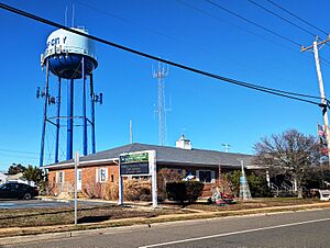
Leonard T. Connors Jr. Municipal Complex and borough water tower
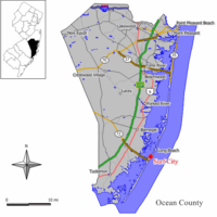
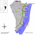
Map of Surf City in Ocean County. Inset: Location of Ocean County highlighted in the State of New Jersey.
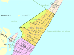
Census Bureau map of Surf City, New Jersey
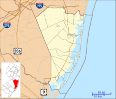
Surf City, New Jersey is located in Ocean County, New Jersey
Surf City, New Jersey
Location in Ocean County, New Jersey
Surf City, New Jersey is located in New Jersey
Surf City, New Jersey
Location in New Jersey
Surf City, New Jersey is located in the United States
Surf City, New Jersey
Location in the United States
Country  United States
State  New Jersey
County Ocean
Incorporated September 19, 1894 as Long Beach City
Renamed May 26, 1899 as Surf City
Government
 • Type Borough
 • Body Borough Council
Area
 • Total 1.32 sq mi (3.43 km2)
 • Land 0.74 sq mi (1.93 km2)
 • Water 0.58 sq mi (1.50 km2)  43.94%
Area rank 468th of 565 in state
20th of 33 in county
Elevation
3 ft (0.9 m)
Population
 (2020)
 • Total 1,243
 • Estimate 
(2023)
1,288
 • Rank 523rd of 565 in state
27th of 33 in county
 • Density 1,670.6/sq mi (645.0/km2)
 • Density rank 323rd of 565 in state
15th of 33 in county
Time zone UTC−05:00 (Eastern (EST))
 • Summer (DST) UTC−04:00 (Eastern (EDT))
ZIP Code
08008 – Beach Haven
Area code(s) 609
FIPS code 3402971640
GNIS feature ID 0885413

Surf City is a borough situated on the Jersey Shore in southern Ocean County, within the U.S. state of New Jersey. As of the 2020 United States census, the borough's population was 1,243, an increase of 38 (+3.2%) from the 2010 census count of 1,205, which in turn had reflected a decline of 237 (−16.4%) from the 1,442 counted in the 2000 census. The borough borders the Atlantic Ocean on Long Beach Island.

What is now Surf City was originally formed as Long Beach City borough by an act of the New Jersey Legislature on September 19, 1894, from portions of Stafford Township, based on the results of a referendum held the previous day. The borough was renamed Surf City by a resolution of the Borough Council as of May 26, 1899. The name was changed to avoid confusion with other places on the island and along the Jersey Shore.

History

Present-day Surf City was home to one of the earliest big boarding hotels on the Jersey Shore, called the Mansion of Health, one of whose owners was Hudson Buzby. In the 1830s and 1840s, the area surrounding this hotel was called "Buzby's Place". The Mansion of Health burned down in 1874, but some old-timers still call the cove at the foot of South First Street on the bay side "Mansion Cove."

In 1875, the 20 or so permanent residents of the area decided to call the area Long Beach City, even though the area was still part of Stafford Township. In 1894, Surf City was incorporated, changing its name to Surf City in 1899 after the United States Postal Service required a name change before the town could incorporate, preventing it from being confused with Long Branch in Monmouth County.

Geography

According to the United States Census Bureau, the borough had a total area of 1.32 square miles (3.43 km2), including 0.74 square miles (1.93 km2) of land and 0.58 square miles (1.5 km2) of water (43.94%).

The borough is located 57 mi (92 km) east-southeast of Philadelphia and 71 mi (114 km) south of New York City. Surf City is also 60 mi (97 km) from the capitol of New Jersey, Trenton.

The borough borders the Ocean County municipalities of Long Beach Township, Ship Bottom and Stafford Township.

Climate

According to the Köppen climate classification system, Surf City has a humid subtropical climate (Cfa) with hot, moderately humid summers, cool winters and year-around precipitation. Cfa climates are characterized by all months having an average mean temperature above 32.0 °F (0.0 °C), at least four months with an average mean temperature at or above 50.0 °F (10.0 °C), at least one month with an average mean temperature at or above 71.6 °F (22.0 °C) and no significant precipitation difference between seasons. During the summer months in Surf City, a cooling afternoon sea breeze is present on most days, but episodes of extreme heat and humidity can occur with heat index values at or above 95.0 °F (35.0 °C). During the winter months, episodes of extreme cold and wind can occur with wind chill values below 0.0 °F (−17.8 °C). The plant hardiness zone at Surf City Beach is 7a with an average annual extreme minimum air temperature of 3.7 °F (−15.7 °C). The average seasonal (November–April) snowfall total is 12 to 18 in (30 to 46 cm) and the average snowiest month is February which corresponds with the annual peak in nor'easter activity.

Climate data for Surf City Beach, NJ (1981–2010 Averages)
Month Jan Feb Mar Apr May Jun Jul Aug Sep Oct Nov Dec Year
Mean daily maximum °F (°C) 40.2
(4.6)
42.5
(5.8)
49.2
(9.6)
57.8
(14.3)
68.1
(20.1)
77.2
(25.1)
82.7
(28.2)
81.5
(27.5)
75.6
(24.2)
65.0
(18.3)
55.0
(12.8)
45.2
(7.3)
61.8
(16.6)
Daily mean °F (°C) 33.1
(0.6)
35.2
(1.8)
41.5
(5.3)
50.3
(10.2)
60.3
(15.7)
69.6
(20.9)
75.3
(24.1)
74.2
(23.4)
67.9
(19.9)
56.8
(13.8)
47.5
(8.6)
37.9
(3.3)
54.2
(12.3)
Mean daily minimum °F (°C) 25.9
(−3.4)
27.9
(−2.3)
33.9
(1.1)
42.8
(6.0)
52.4
(11.3)
62.0
(16.7)
68.0
(20.0)
67.0
(19.4)
60.2
(15.7)
48.6
(9.2)
39.9
(4.4)
30.6
(−0.8)
46.7
(8.2)
Average precipitation inches (mm) 3.35
(85)
3.01
(76)
4.11
(104)
3.62
(92)
3.13
(80)
3.03
(77)
3.97
(101)
4.24
(108)
3.12
(79)
3.54
(90)
3.19
(81)
3.59
(91)
41.90
(1,064)
Average relative humidity (%) 66.6 64.7 63.2 64.3 67.3 71.6 70.9 72.5 71.1 69.9 68.6 67.5 68.2
Average dew point °F (°C) 23.2
(−4.9)
24.5
(−4.2)
29.9
(−1.2)
38.7
(3.7)
49.4
(9.7)
60.0
(15.6)
65.2
(18.4)
64.8
(18.2)
58.2
(14.6)
47.1
(8.4)
37.7
(3.2)
28.1
(−2.2)
44.0
(6.7)
Source: PRISM
Climate data for Atlantic City, NJ Ocean Water Temperature (25 SW Surf City)
Month Jan Feb Mar Apr May Jun Jul Aug Sep Oct Nov Dec Year
Daily mean °F (°C) 37
(3)
35
(2)
42
(6)
48
(9)
56
(13)
63
(17)
70
(21)
73
(23)
70
(21)
61
(16)
53
(12)
44
(7)
54
(12)
Source: NOAA

Ecology

According to the A. W. Kuchler U.S. potential natural vegetation types, Surf City would have a dominant vegetation type of Northern Cordgrass (73) with a dominant vegetation form of Coastal Prairie (20).

Demographics

Historical population
Census Pop.
1900 9
1910 40 344.4%
1920 43 7.5%
1930 76 76.7%
1940 129 69.7%
1950 291 125.6%
1960 419 44.0%
1970 1,129 169.5%
1980 1,571 39.1%
1990 1,375 −12.5%
2000 1,442 4.9%
2010 1,205 −16.4%
2020 1,243 3.2%
2023 (est.) 1,288 6.9%
Population sources:
1900–2000 1900–1920
1900–1910 1910–1930
1940–2000 2000
2010 2020

2010 census

The 2010 United States census counted 1,205 people, 622 households, and 366 families in the borough. The population density was 1,616.5 inhabitants per square mile (624.1/km2). There were 2,566 housing units at an average density of 3,442.4 per square mile (1,329.1/km2). The racial makeup was 95.52% (1,151) White, 1.33% (16) Black or African American, 0.00% (0) Native American, 0.58% (7) Asian, 0.33% (4) Pacific Islander, 1.41% (17) from other races, and 0.83% (10) from two or more races. Hispanic or Latino of any race were 5.06% (61) of the population.

Of the 622 households, 10.5% had children under the age of 18; 48.6% were married couples living together; 5.9% had a female householder with no husband present and 41.2% were non-families. Of all households, 35.9% were made up of individuals and 22.7% had someone living alone who was 65 years of age or older. The average household size was 1.94 and the average family size was 2.45.

9.4% of the population were under the age of 18, 4.5% from 18 to 24, 14.6% from 25 to 44, 32.9% from 45 to 64, and 38.6% who were 65 years of age or older. The median age was 59.4 years. For every 100 females, the population had 95.6 males. For every 100 females ages 18 and older there were 96.4 males.

The Census Bureau's 2006–2010 American Community Survey showed that (in 2010 inflation-adjusted dollars) median household income was $63,375 (with a margin of error of +/− $12,908) and the median family income was $74,479 (+/− $16,901). Males had a median income of $58,750 (+/− $18,197) versus $51,000 (+/− $27,120) for females. The per capita income for the borough was $42,677 (+/− $4,230). About 2.9% of families and 5.0% of the population were below the poverty line, including 11.7% of those under age 18 and 4.8% of those age 65 or over.

Sports

The Surf City Yacht Club participates in weekly races against other yacht clubs throughout the Island, with many sailors and swimmers ranging in age dedicating their summers to the Yacht Club.

The Surf City Beach Patrol won the Surf City Epic, Lavallette, Ortley Beach, Island Beach State Park, the Midway Beach, and "Islands" Tournaments in 2008, narrowly missing out on victories at Sandy Hook (2nd) and the Ship Bottom (2nd) "State Tournament" losing by only a combined 4.5 points. The SCBP squad were back-to-back LBIBPA Island Champions (2007 & 2008) for the first time in the last 25+ years. The high point of the season came during the IBSP tournament when Surf City won by 23 points.

Education

From pre-kindergarten through sixth grade, public school students attend the Long Beach Island Consolidated School District, which also serves students from Barnegat Light, Harvey Cedars, Long Beach Township and Ship Bottom. As of the 2020–21 school year, the district, comprised of two schools, had an enrollment of 215 students and 30.7 classroom teachers (on an FTE basis), for a student–teacher ratio of 7.0:1. Schools in the district (with 2020–21 enrollment data from the National Center for Education Statistics) are Ethel Jacobsen School in Surf City with 111 students in pre-kindergarten to second grade and Long Beach Island Grade School in Ship Bottom with 125 students in grades 3–6. The district's board of education is comprised of nine members who are directly elected from the constituent municipalities on a staggered basis, with three members elected each year. Of the nine seats, one is elected from Surf City.

Students in public school for the seventh through twelfth grades attend the Southern Regional School District, which serves the five municipalities in the Long Beach Island Consolidated School District, along with students from Beach Haven and Stafford Township, as well as students from Ocean Township (including its Waretown section) who attend as part of a sending/receiving relationship. Schools in the district (with 2020–21 enrollment data from the National Center for Education Statistics) are Southern Regional Middle School with 902 students in grades 7–8 and Southern Regional High School with 1,975 students in grades 9–12. Both schools are in the Manahawkin section of Stafford Township.

Transportation

Roads and highways

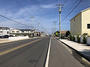
2018-10-04 12 13 30 View north along Ocean County Route 607 (Long Beach Boulevard) between South Second Street and South First Street in Surf City, Ocean County, New Jersey
Northbound County Route 607 (Long Beach Boulevard) in Surf City

As of May 2010, the borough had a total of 16.97 mi (27.31 km) of roadways, of which 15.30 mi (24.62 km) were maintained by the municipality and 1.67 mi (2.69 km) by Ocean County.

No Interstate, U.S. or state highways serve Surf City. The main road serving the borough is County Route 607 (Long Beach Boulevard).

Public transportation

TransportAzumah offers weekend service during the summer season between Midtown Manhattan in New York City and Long Beach Island with a stop at Newark Liberty International Airport.

Ocean Ride local service is provided on the OC9 Long Beach Island route.

The LBI Shuttle operates along Long Beach Boulevard, providing free service every 5 to 20 minutes from 10:00 AM to 10:00 PM. It serves the Long Beach Island municipalities / communities of Barnegat Light, Loveladies, Harvey Cedars, North Beach, Surf City, Ship Bottom, Long Beach Township, Beach Haven and Holgate.

Media

Surf City is served primarily by Philadelphia and New York television stations, Atlantic City and Philadelphia-based radio stations and two daily newspapers, The Press of Atlantic City and Asbury Park Press.

Notable people

See also (related category): People from Surf City, New Jersey

People who were born in, residents of, or otherwise closely associated with Surf City include:

  • Francis L. Bodine (1936–2023), politician who represented the 8th Legislative District in the New Jersey General Assembly from 1994 to 2008
  • Christopher J. Connors (born 1956), member of the New Jersey Senate from the 9th Legislative District since 2008, when he succeeded his father
  • Leonard T. Connors (1929–2016), politician who served in the state senate from 1982 to 2008 representing the 9th Legislative District, and served for nearly 50 years as mayor of Surf City, from 1966 to 2015

See also

Kids robot.svg In Spanish: Surf City (Nueva Jersey) para niños

kids search engine
Surf City, New Jersey Facts for Kids. Kiddle Encyclopedia.