Tamayo, Dominican Republic facts for kids
Quick facts for kids
Tamayo
|
||
|---|---|---|
|
||
| Country | Dominican Republic | |
| Province | Baoruco | |
| Municipality | 1943 | |
| Area | ||
| • City | 455.85 km2 (176.00 sq mi) | |
| Elevation | 10 m (30 ft) | |
| Population | ||
| • City | 23,294 | |
| • Density | 51.1001/km2 (132.349/sq mi) | |
| • Urban | 8,812 | |
| • Demonym | Tamayense | |
| Municipal districts | 6 | |
| Distance to - Santo Domingo |
217 km |
|
Tamayo is a city and a municipality (a type of local government area) in the Baoruco province of the Dominican Republic. It's known for being the driest place in the Dominican Republic, with a desert climate.
Contents
Where is Tamayo?
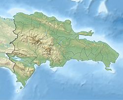
Tamayo is a small town with interesting people. It is part of the Baoruco province. You can find it on the eastern side of the Neyba valley. It's in the mountains west of the Yaque del Sur River. This river separates Tamayo from the town of Vicente Noble in the Barahona province. Tamayo is south of San Juan de la Maguana and east of the Galván town.
Tamayo's Climate
Tamayo has a desert climate (called BWh by Köppen climate classification). This is because it's located behind several rain shadows. These are areas where mountains block most of the rain from the northeasterly trade winds. So, it doesn't rain much for most of the year. The only times it gets a bit more rain are between May and June, and again from August to September.
- The average rainfall each year is about 392.9 millimetres (15.47 in).
- The average temperature each year is about 26.8 °C (80.2 °F).
| Climate data for Tamayo, Dominican Republic (1961–1990) | |||||||||||||
|---|---|---|---|---|---|---|---|---|---|---|---|---|---|
| Month | Jan | Feb | Mar | Apr | May | Jun | Jul | Aug | Sep | Oct | Nov | Dec | Year |
| Record high °C (°F) | 37.0 (98.6) |
36.0 (96.8) |
35.8 (96.4) |
36.6 (97.9) |
36.2 (97.2) |
36.1 (97.0) |
39.9 (103.8) |
39.5 (103.1) |
38.4 (101.1) |
38.7 (101.7) |
38.2 (100.8) |
35.5 (95.9) |
39.9 (103.8) |
| Mean daily maximum °C (°F) | 31.0 (87.8) |
31.1 (88.0) |
31.3 (88.3) |
31.5 (88.7) |
31.9 (89.4) |
32.4 (90.3) |
33.3 (91.9) |
33.3 (91.9) |
33.2 (91.8) |
32.8 (91.0) |
32.5 (90.5) |
31.6 (88.9) |
32.2 (90.0) |
| Daily mean °C (°F) | 25.2 (77.4) |
25.4 (77.7) |
25.8 (78.4) |
26.5 (79.7) |
27.1 (80.8) |
27.6 (81.7) |
28.1 (82.6) |
28.0 (82.4) |
28.0 (82.4) |
27.7 (81.9) |
27.0 (80.6) |
25.8 (78.4) |
26.9 (80.4) |
| Mean daily minimum °C (°F) | 19.4 (66.9) |
19.8 (67.6) |
20.4 (68.7) |
21.5 (70.7) |
22.4 (72.3) |
22.8 (73.0) |
22.9 (73.2) |
22.8 (73.0) |
22.9 (73.2) |
22.6 (72.7) |
21.6 (70.9) |
20.0 (68.0) |
21.6 (70.9) |
| Record low °C (°F) | 13.9 (57.0) |
12.6 (54.7) |
12.4 (54.3) |
15.5 (59.9) |
19.0 (66.2) |
19.8 (67.6) |
19.8 (67.6) |
19.8 (67.6) |
19.3 (66.7) |
19.0 (66.2) |
16.0 (60.8) |
14.8 (58.6) |
12.4 (54.3) |
| Average rainfall mm (inches) | 7.0 (0.28) |
8.8 (0.35) |
15.5 (0.61) |
30.8 (1.21) |
64.3 (2.53) |
61.8 (2.43) |
23.6 (0.93) |
60.4 (2.38) |
61.4 (2.42) |
59.6 (2.35) |
30.7 (1.21) |
19.4 (0.76) |
443.3 (17.45) |
| Average rainy days (≥ 1.0 mm) | 1.2 | 1.2 | 1.7 | 3.1 | 5.1 | 3.9 | 2.0 | 3.3 | 5.0 | 4.8 | 2.7 | 1.1 | 35.1 |
| Source: NOAA | |||||||||||||
People of Tamayo
The municipality of Tamayo has six main areas called municipal districts. These are Cabeza de Toro, Mena, Monserrate, Santa Barbara (also known as Batey 6), Santana, and Uvilla.
- Cabeza de Toro includes areas like Guanarate, Mangito, and El Granado.
- Mena is made up of Mena Up, Down Mena, Los Robles, Mena Batey, and Los Blocks of Mena.
- Monserrate includes Santa Maria and Hato Nuevo.
- Santana contains Bayahonda, Batey Santana, Los Conuquitos, San Ramon, and Barranca. Barranca itself includes Vuelta Grande and Honduras.
- Uvilla also contains the Jobo section.
In 2002, a census (a count of people) showed that about 9,895 people lived in the municipality. About 6,609 of them lived in urban areas (cities and towns), and 3,286 lived in rural areas (the countryside).
Tamayo's History
People first started living in this area during the 1700s. The land was untouched, with beautiful plants and animals. The first settlers came from Cambronal. They built their first homes, called Bohíos, and started raising animals in a small pen they called Hatice. This is how Hatice, which is now Tamayo, began. The first people who lived there were very hardworking, but not many of them could read and write.
Some of the first families were:
- Manuel Medina and Menecita Reyes
- Juan Rodriguez and Remedy Salome Mateo
- Simon Altagracia Medina and Reyes Brito
- Pedro Brito
Many of these families are related to the people who live there today. They soon built the first canal to bring water to their land. This helped irrigate areas like Hatice, Palmar, The Figs, UC, and Monserrate.
In 1908, a big cyclone hit the area. The Yaque del Sur River overflowed and flooded Hatice, destroying the town. It was a huge flood, and the news reported that animals drowned even in the trees. Four goats that survived helped feed the children until help arrived from San Juan de la Maguana and El Cercado.
The first houses were traditional Hatice Tejamaní homes. The first wooden house was built by General Joaquin Campos. The second wooden house belonged to Mrs. Maria Antonia Gomez. She also built the first school and was the town's first teacher. Today, the town's high school is named after her.
On March 10, 1943, the town, which was then called Hatice, became part of the Baoruco province. It was renamed Tamayo in honor of an Indian person.
The first president of the local council was Michael Humberto. The first mayor (called a syndic) was Fabian Matos, who built the city park.
What Tamayo Produces
Tamayo is a very important area for growing bananas. It produces a large amount of bananas, especially the type called "barahoneros." This is because, for farming purposes, Tamayo is part of the agricultural region of Barahona.
Like the nearby municipality of Vicente Noble, Tamayo's economy has been growing in recent years.
In 2007, the local government (City Council) received money each month from the national budget. Each of the six municipal districts also received $500,000.00 (Five Hundred Thousand Pesos) from the same fund.
Learning in Tamayo
The municipality of Tamayo has 17 elementary schools. Most of these schools have two shifts, meaning some students go in the morning and others in the afternoon. There is also one high school and one secondary school for older students.
Tamayo's Culture and Religion
The patron saint of Tamayo is San Antonio. The townspeople celebrate their main festival in his honor on June 13th each year.
See also
 In Spanish: Tamayo (República Dominicana) para niños


