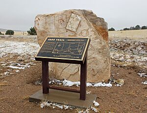
Taos Mountain Trail facts for kids
The Taos Mountain Trail was an old path used for trading and travel. It connected Taos Pueblo in New Mexico with the Great Plains in Colorado. People used this trail for hundreds of years, starting around 1100 A.D. It was important during the time of the Spanish Colonial period and when Europeans and Americans arrived.
This trail linked traders from the high mountains with their partners to the north and south of the Sangre de Cristo Mountains. It was also known as the Trapper's Trail. The path was narrow, only wide enough for people walking or riding horses in a single line. But it made trips much faster! A journey from Taos to the northern plains that used to take almost two weeks could be done in just three days in good weather. The Taos Mountain Trail was also called the Sangre de Cristo Trail and the Aztec Trail.
Contents
Early Travelers and Trade
For many years, from about 1100 A.D. to 1500 A.D., this trail connected the Pueblo people of northern New Mexico with the Plains Indians. Tribes like the Ute, Arapaho, Apache, Cheyenne, and Kiowa used it.
The Pueblo people lived in settled villages and grew crops. They traded things like corn, squash, melons, and beans. They exchanged these with the traveling Plains tribes. In return, they received goods like buffalo meat, animal hides, and other items. This trade was very important for both groups.
Legends of the Trail
There's a story that traders from a far-off city called Tenochtitlan used this trail. Tenochtitlan was the capital of the Aztecs, near where Mexico City is today. The legend says they left piles of stones, called cairns, to mark their way.
While we know that people from Mesoamerica (like the Aztecs) traded north into places like Mesa Verde in Colorado, there isn't much proof that the Tarahumara people from Mexico came this far north. However, a professor named William A. Weber found a plant of Mexican origin at the top of the pass. Also, a local resident, Charlie Charlefue, said he knew of Tarahumara Indians in the area before Americans arrived.
Taos as a Trading Hub
Taos Pueblo was a very busy trading center. It hosted big trade fairs every spring and fall. These fairs were happening even before and during the Spanish Colonial period. When the weather was good, the Taos Mountain Trail was the main way to travel from the eastern plains to the wide areas around Taos Pueblo.
Trading Companies and Posts
Later, trading companies became interested in furs and animal hides. They found it was better to send their own traders out to meet Native American groups. This was more efficient than building trading posts and waiting for people to visit.
Traders would get their goods from stores in Taos or Santa Fe. Then, they would travel the Taos Mountain Trail to trade with Native Americans. After trading, they would return to sell the hides they had collected. This made the Taos Mountain Trail even more important.
To help with this trade, two famous trading posts were built:
- Bent's Fort was built in 1833.
- El Pueblo Trading Post followed in 1842.
Traders based at Bent's Fort and El Pueblo still used the Taos Mountain Trail. It gave them a quick way to reach the settled community of Taos.
The Trail in Times of Change
The Taos Mountain Trail played a role during important historical events.
The Taos Revolt
During the Mexican–American War, in January 1847, people in Taos had a revolt. Both Native American and Spanish residents of Taos were involved. They killed many Americans living there, including the American governor, Charles Bent.
People who survived an attack at a nearby place called Turley's Mill used the Taos Mountain Trail. They walked across it in the winter to tell others about the revolt at El Pueblo Trading Post and Bent's Fort. The trail helped spread the news quickly.
Railroad Surveys
From 1848 to 1853, people were looking for good routes to build railroads. The Taos Mountain Trail, also known as the Sangre de Cristo Pass, was considered as a possible railway path.
In 1853, a surveyor named E.G. Beckwith was sent to check out the area. Richard Kern, who was a mapmaker and artist, traveled with Beckwith. He drew pictures of the land for their report. Even though the trail was too steep for a railroad, their report provided important information about the Taos Mountain Trail.
 | Kyle Baker |
 | Joseph Yoakum |
 | Laura Wheeler Waring |
 | Henry Ossawa Tanner |


