Taranaki facts for kids
Quick facts for kids
Taranaki
|
||
|---|---|---|
|
Region of New Zealand
|
||
|
||

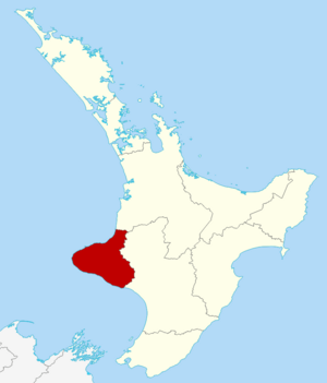
Taranaki within the North Island, New Zealand
|
||
| Country | New Zealand | |
| Island | North Island | |
| Seat | Stratford | |
| Territorial authorities |
List
New Plymouth District
South Taranaki District Stratford District (part) |
|
| Government | ||
| • Body | Taranaki Regional Council | |
| Area | ||
| • Region | 7,257 km2 (2,802 sq mi) | |
| • Land | 7,254.51 km2 (2,800.98 sq mi) | |
| Population
(June 2023)
|
||
| • Region | 128,700 | |
| • Density | 17.735/km2 (45.932/sq mi) | |
| GDP | ||
| • Total | NZ$ 9.599 billion (2021) | |
| • Per capita | NZ$ 75,643 (2021) | |
| Time zone | UTC+12 (NZST) | |
| • Summer (DST) | UTC+13 (NZDT) | |
| ISO 3166 code | NZ-TKI | |
| HDI (2021) | 0.939 very high · 3rd |
|
Taranaki is a region on the west side of New Zealand's North Island. It gets its name from its most famous landmark, Mount Taranaki. This mountain is also known as Mount Egmont.
The biggest city in Taranaki is New Plymouth. Over 65% of the people in Taranaki live in the New Plymouth area. Other towns in North Taranaki include Inglewood and Waitara. In South Taranaki, you'll find towns like Hāwera, Manaia, Stratford, Eltham, and Ōpunake.
Since 2005, Taranaki has used the slogan "Like no other" to promote itself.
Contents
Exploring Taranaki's Geography
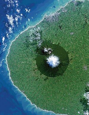
Taranaki is located on the west coast of the North Island. It wraps around the volcanic peak of Mount Taranaki. The region covers an area of about 7,258 square kilometers. It has two large bays, the North Taranaki Bight and the South Taranaki Bight, near Cape Egmont.
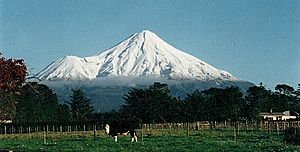
Mount Taranaki is the second tallest mountain on the North Island. It is the most important natural feature of the region. A Māori legend says that Mount Taranaki once lived with other mountains in the central North Island. But it moved to its current spot after a fight with Tongariro. The mountain looks like a perfect cone. It last erupted in the mid-1700s. The mountain and the land around it are part of Egmont National Park.
For many centuries, Māori people called the mountain Taranaki. Later, Captain James Cook gave it the English name Egmont. This was to honor the Earl of Egmont, who had supported his journey. Today, the mountain has two official names: "Mount Taranaki" and "Mount Egmont."
The Taranaki region has very rich volcanic soil and lots of rain. This makes the land very fertile. Dairy farming is a major industry here. The Fonterra factory near Hāwera makes the most dairy ingredients of any single factory in the world.
Taranaki also has oil and gas underground and offshore. The Maui gas field used to supply most of New Zealand's gas. New offshore fields like Kupe and Pohokura are now being used. These resources help produce fuel and fertilizer.
The region's coastline, with its northern, western, and southern sides facing the Tasman Sea, offers many great places for surfing and windsurfing. Some of these spots are known worldwide.
People and Culture in Taranaki
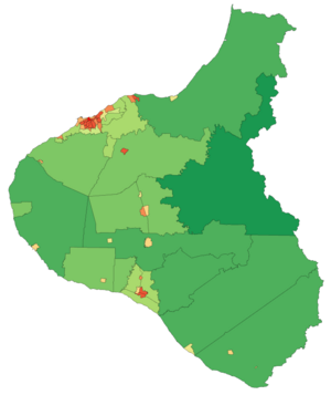
Taranaki covers about 7,254 square kilometers. It has a population of about 126,015 people as of the 2023 census. This means about 20.2% of the people are under 15 years old. The region is the tenth most populated region in New Zealand.
| Urban area | Population (June 2023) |
% of region |
|---|---|---|
| New Plymouth | 59,600 | 46.3% |
| Hāwera | 10,350 | 100.0% |
| Waitara | 7,550 | 100.0% |
| Stratford | 6,320 | 100.0% |
| Inglewood | 3,870 | 100.0% |
| Eltham | 2,080 | 100.0% |
| Ōakura | 1,730 | 100.0% |
| Ōpunake | 1,440 | 100.0% |
| Patea | 1,270 | 100.0% |
| Normanby | 1,130 | 100.0% |
Urban Areas and Population
Almost half of Taranaki's residents live in New Plymouth. Hāwera is the next largest town.
Taranaki's Rich Culture and Identity
| Largest groups of overseas-born residents | |
|---|---|
| Nationality | Population (2018) |
| England | 4,179 |
| Australia | 1,965 |
| South Africa | 1,311 |
| India | 972 |
| Philippines | 918 |
| Scotland | 549 |
| Fiji | 498 |
| China | 480 |
| United States | 480 |
| Netherlands | 420 |
The Māori people have lived in Taranaki for many centuries. The local Māori tribes, called iwi, include Ngāti Mutunga, Ngāti Maru, Ngāti Ruanui, Taranaki, Te Āti Awa, Ngā Rauru, Ngāruahinerangi, and Ngāti Tama.
In the 2023 census, most people identified as European/Pākehā (83.6%). About 21.8% identified as Māori. Other groups included Pasifika (2.6%) and Asian (5.7%). People can identify with more than one ethnicity.
In 2018, about 13.6% of people in Taranaki were born overseas. This is less than the national average of 27.1%.
When asked about religion, 51.7% of people said they had no religion. About 36.0% were Christian. Smaller numbers followed other religions like Hindu, Muslim, and Buddhist.
A Look Back: Taranaki's History
Māori tribes settled in this area starting in the 1200s. Around 1823, Māori began meeting European whalers and traders. These traders came by ship to buy flax. In the 1820s and 1830s, whalers hunted Southern right whales in the South Taranaki Bight.
In 1828, a trader named Richard "Dicky" Barrett set up a trading post at Ngamotu, which is now New Plymouth. The local Āti Awa tribe welcomed Barrett and his friends. They had muskets and cannons, which helped the tribe in their wars with Waikato Māori. After a battle in 1832, most of the 2,000 Āti Awa people near Ngamotu moved south. Barrett also moved with them.
In 1839, Barrett came back to Taranaki. He worked for the New Zealand Company, which was selling land to settlers in England. Barrett claimed he bought a large area of land. This land stretched from Mokau to Cape Egmont, and inland to the Whanganui River. It included Mount Taranaki. Later, another agreement included New Plymouth and all the coastal land of North Taranaki, including Waitara.
European settlers first arrived in New Plymouth in March 1841. However, Māori people did not want to sell their land. This feeling grew stronger as they connected with the King Movement. Tensions over land ownership increased. This led to the start of the First Taranaki War at Waitara in March 1860. The main reason for the conflict was the government's desire to control Māori land and impose British laws.
More than 3,500 soldiers from Australia fought in the war. They were joined by local volunteer soldiers. The Māori forces had between a few hundred and 1,500 fighters. About 238 soldiers from the British side died. Around 200 Māori also died.
A peace agreement was made a year later, but it did not last. In April 1863, fighting started again in the Second Taranaki War. About 5,000 soldiers fought against around 1,500 Māori people, including women and children. The army began taking Māori land. They destroyed villages and farms, whether the Māori were fighting or not. As the soldiers moved forward, the government built forts. Settlers then built homes and farms behind these forts. This led to the taking of almost a million acres (4,000 square kilometers) of Māori land.
The main highway around Mount Taranaki today follows the path taken by colonial forces in 1866. They marched from Patea to New Plymouth.
Māori resistance continued in South Taranaki until 1869. The warrior Tītokowaru led this resistance. A decade later, the spiritual leader Te Whiti o Rongomai started a peaceful protest against the government taking land. This ended when colonial troops raided his village, Parihaka, on November 5, 1881.
The New Zealand Government later admitted that these land confiscations were unfair and illegal. They began in 1865 and soon included the entire Taranaki district. Towns like Normanby, Hāwera, and Carlyle (Patea) were built on this confiscated land.
Taranaki's Economy
Taranaki's economy is mainly based on dairy farming, finding oil and gas, and manufacturing. These industries make up about 40% of the region's economy. Taranaki has often had the highest economic output per person in New Zealand.
In 2019–2020, there were 468,000 milking cows in Taranaki. This was 9.5% of all the cows in New Zealand. These cows produced a lot of milk, which was worth over a billion dollars. Dairy farming is the biggest employer in Taranaki. The Fonterra plant near Hawera is the world's largest milk production factory. It makes milk powder, butter, cheese, and other dairy products. Taranaki also has a high-tech plant that makes special lactose for medicines.
Natural gas from Taranaki provides about 20% of New Zealand's energy. It helps heat homes and businesses. The company Methanex, also in Taranaki, uses natural gas to make methanol for export. Taranaki's natural gas is also used to make urea, a fertilizer for farms. Many energy companies have their main offices in the region. There are also many companies that provide services like shipping, engineering, and safety advice.
How Taranaki is Governed
Taranaki Regional Council
The Taranaki Regional Council was created in November 1989. Its job is to manage the region's natural resources. It took over from several smaller local groups. The council's main office is in Stratford. This central location was chosen to help bring together the northern and southern parts of Taranaki.
Chairs of the Council
- Ross Allen (1989–2001)
- David Walter (2001–2007)
- David MacLeod (2007–2022)
- Charlotte Littlewood (2022–present)
Taranaki in Movies
Taranaki's beautiful landscape and the way Mount Taranaki looks like Mount Fuji made it a perfect spot for the movie The Last Samurai. This film was set in 19th-century Japan and starred Tom Cruise.
Keeping Taranaki Safe
Taranaki has 20 fire stations. New Plymouth Central Fire Station has a team of full-time firefighters. They work 24/7 and help other volunteer fire brigades in nearby towns. New Plymouth has four fire trucks and other special vehicles. There are also 17 volunteer fire brigades and two rural brigades in the region.
Taranaki Base Hospital in New Plymouth is the biggest hospital. It has an emergency room open 24 hours a day. It also has wards for children, older people, and different types of surgery. The hospital is being expanded to offer even more services. Hawera Hospital is smaller but also has a 24-hour emergency room and maternity services. There are also health centers in other towns like Waitara, Opunake, and Stratford.
St John Ambulance provides all ambulance services in Taranaki. Their main station is in New Plymouth. They have emergency ambulances and rapid response vehicles. Volunteer first response units are in Opunake and Urenui.
There are 13 police stations in the region, including three in New Plymouth.
The Taranaki Rescue Helicopter Trust helps with search, rescue, and patient transfers. Their helicopter is based at Taranaki Base Hospital. It is very important for missions on the mountain, in the hilly inland areas, and at sea.
Taranaki Sports Teams
Here are some well-known sports teams from Taranaki:
- Yarrows Taranaki Bulls – A rugby union team in the National Provincial Championship.
- Taranaki Airs – A basketball team in the NBL.
- Taranaki Thunder – A women's basketball team.
- Taranaki Cricket – A men's cricket team.
Famous People from Taranaki
- Harry Atkinson – A former Premier of New Zealand.
- Peter Buck (Te Rangi Hīroa) – A Māori scholar, politician, and anthropologist, born in Urenui.
- Richard Faull – A New Zealand neuroscientist, born and raised in Tikorangi.
- Māui Wiremu Pita Naera Pōmare – A politician and Minister of Health.
- Frederic Carrington – A surveyor and one of the founders of New Plymouth.
- William Douglas Cook – Founder of famous gardens like Eastwoodhill Arboretum and Pukeiti.
- Wiremu Kīngi – A Māori Chief and leader in the First Taranaki War.
- William Malone – A First World War officer.
- Len Lye – A famous artist and filmmaker.
- Michael Smither – An artist.
- Ronald Syme – A scholar of ancient history.
- Riwha Titokowaru – A Māori military leader.
- Te Whiti o Rongomai – A spiritual leader from Parihaka known for peaceful protests.
Sports Stars from Taranaki
- All Blacks (rugby): Beauden Barrett, Scott Barrett, Jordie Barrett, Grant Fox, Luke McAlister, Graham Mourie, Conrad Smith, Carl Hayman.
- Rugby League: Issac Luke, Curtis Rona, Howie Tamati.
- Michael Campbell – A professional golfer.
- Paige Hareb – A professional surfer.
- Peter Snell – A gold medal-winning athlete, born in Ōpunake.
- Hannah Bromley – A former professional footballer.
- Brian Symes – Commonwealth gold medalist in Bowls.
- Gayle Broughton & Mikalya Blyde – World, Commonwealth, and Olympic gold medalists in Rugby Sevens.
- Ardean Harper – A Silver Ferns netball player.
See also
 In Spanish: Región de Taranaki para niños


