Tecolotlán facts for kids
Quick facts for kids
Tecolotlán
|
|
|---|---|
|
Town and municipality
|
|
 |
|

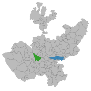
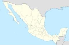
Location of the municipality in Jalisco
|
|
| Country | |
| State | Jalisco |
| Area | |
| • Total | 765.1 km2 (295.4 sq mi) |
| • Town | 5.69 km2 (2.20 sq mi) |
| Population
(2020 census)
|
|
| • Total | 16,603 |
| • Density | 21.7004/km2 (56.204/sq mi) |
| • Town | 9,668 |
| • Town density | 1,699.1/km2 (4,401/sq mi) |
| Time zone | UTC-6 (Central Standard Time) |
| • Summer (DST) | UTC-5 (Central Daylight Time) |
| Website | http://www.tecolotlan.gob.mx/ |
Tecolotlán is a town and municipality located in the state of Jalisco, in central-western Mexico. Its name comes from the Nahuatl language, meaning "place of owls." The municipality covers an area of about 765.1 square kilometers.
As of the 2020 census, the municipality had a total population of 16,603 people. The town of Tecolotlán itself had a population of 9,668.
Contents
Fun Places to Visit
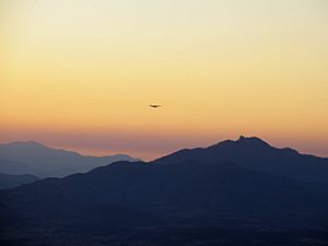
Tecolotlán has several interesting places to explore. These include La Presa El Pochote, El Carril, El Malecón, El Punto, La Perla, and the beautiful Sierra de Quila.
History of Tecolotlán
The name Tecolotlán means "town of owls." This is why the current coat of arms, approved in 1999, features an owl with its wings spread wide. This symbol represents the municipality.
Early Beginnings
The area was first taken over in 1524 by a Spanish explorer named Francisco Cortés. He placed the area, including what is now San Buenaventura, under the control of his trusted helpers, Pedro Gómez and Martín Monje.
Between 1525 and 1526, Christian missionaries arrived to teach the native people. In 1599, the San Agustín convent was built in Tecolotlán.
Becoming a Municipality
By 1825, Tecolotlán included several smaller towns and ranches. On July 9, 1835, Tecolotlán officially became a municipality. At that time, it was still a small village.
In 1844, the town hall in Tecolotlán was updated. An important battle happened on November 10, 1866, where a small group of three local men bravely faced a much larger group of 1,500 soldiers.
Life in Tecolotlán Town
The town of Tecolotlán provides many services for its residents. These include clean drinking water, proper sewage systems, street lighting, markets, and public transportation. Most homes have access to drinking water, good sanitation, and electricity. The town also has a post office, telephone services, radio, and television.
Important Buildings
- La Purísima Sanctuary: This church is dedicated to the Virgin of Tecolotlán. It was built over many years, from 1821 to 1869.
- Temple of La Santisima Trinidad: This church dates back to the 1800s. It was first built by Franciscan monks in 1599 as the Parish of San Agustín. When it was rebuilt, it was dedicated to the Holy Trinity.
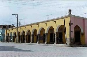
- Tecolotlán Cultural Center: This building was constructed in the mid-1800s. It has beautiful arches and columns. The center hosts art shows and displays of old fossils and ancient items.
Festivals and Celebrations
- Carnaval: This lively festival lasts for ten days. People celebrate with music bands in the main square. Men sing to women, confetti is thrown, and dances are held. There are also fireworks and a Carnaval Queen is crowned.
- Patron Saint Festivities: These celebrations take place from August 20 to 30. They honor the town's patron saints, St. Augustine and Santa Rosa de Lima. The festivities include fun carnival rides like a Ferris wheel.
The Tecolotlán Municipality
Tecolotlán is located in the middle-west part of Jalisco, about 1,285 meters above sea level. The municipality covers an area of 795.55 square kilometers. It shares borders with several other municipalities. The most important communities within Tecolotlán are the capital town itself, Tamazulita, Quila, Ayotitlán, and Cofradía de Duendes.
Land and Hills
The municipality has many flat areas, but also some hilly regions to the north and southeast. These hills range from 1,200 to 2,400 meters high. Some notable hills include El Huehuentón (2,000 meters) and El Pichacho (1,700 meters).
Rivers and Water
The main river in Tecolotlán is the Ferrería River. Many smaller streams flow into it, such as El Jabalí and Tamazula. The San Pedro Dam is located in the southern part of the municipality. Other water features include Presa El Pochote and several beautiful waterfalls.
Plants and Trees
The municipality is covered with large forests of pine and oak trees, along with some fruit trees. In the Sierra de Quila, there is a very old tree called the Arbol de la Lira (Lyre Tree), which is about 600 years old. This special tree is protected by the state. The forest around it is also protected and watched 24 hours a day. This forest is also home to the Cienega spring, which has lots of green plants around it.
Animals and Wildlife
The region is home to many animals. You might see deer, badgers, raccoons, wolfs, foxes, coyotes, and rabbits. There are also small reptiles and many different kinds of birds.
Protecting Nature
Several areas in Tecolotlán are protected to preserve their natural beauty and wildlife. These include La Ciénega, Las Juntas, Las Piedras de Quila, and Sierra de Quila. There's also an important site called Gliptodonte where ancient animal fossils have been found. Many of these fossils are displayed in the "Museo Comunitario" in the main town.
Weather and Climate
Tecolotlán has a moderately warm and semi-dry climate. It's dry during autumn and winter. The average temperature throughout the year is 23°C, with highs around 31°C and lows around 15°C. Most of the rain falls in June and July. The winds usually come from the south.
Getting Around
The main road for transportation in the municipality connects to Guadalajara and Barra de Navidad. This road is about 107 kilometers from the state capital. People travel within the town and rural areas using rental cars or private vehicles.
Natural Attractions
Many of Tecolotlán's attractions are natural, with beautiful landscapes, especially in the Sierra de Quila. This area is great for outdoor activities like mountain biking, horseback riding, and camping. There are two main dams, Presa del Ahogado and Presa del Pochote. Both have places for camping, picnicking, and water sports like boating and fishing. Presa del Pochote is especially popular with people from Guadalajara.
Religion in Tecolotlán
The main religion in Tecolotlán is Roman Catholicism. There are many notable churches in the municipality, including the Parroquia del Sagrado Corazón, Santuario de la Purísima, and Capilla de San José.
Economy and Jobs
The economy of Tecolotlán is mostly based on farming, with some trade and services.
Farming and Livestock
Farmers raise animals like cattle, goats, horses, pigs, and bees. They grow crops such as corn, chickpeas, alfalfa, peaches, avocados, mangoes, and pitayas.
Industry and Resources
There is also some manufacturing and mining. The area has factories that make lime and cement. Miners dig for marble, limestone, barite, quartz, and lime. Fishing for carp and bass is also done, and pine and oak trees are harvested for wood. In 2005, there were about 30,900 hectares of forest.
Local Crafts
The municipality is known for its handmade goods. People make baskets, pottery, clay pots, and wooden furniture. Tecolotlán also produces dairy products like cheese and cream.
Famous People from Tecolotlán
- Juan Salvador Agraz – A chemical engineer who started the National School of Chemical Science (now part of the National Autonomous University of Mexico (UNAM)).
- Gabriel Agraz García de Alba – A well-known historian.
- Ruperto García de Alba – A general who served as acting governor of Jalisco from 1930 to 1931.
- Esteban García de Alba Larios – A lawyer and politician who was president of the Mexican Senate. He also worked as an ambassador for Mexico.
- Ana Bertha Lepe – An actress and Miss Mexico in 1954.
See also
 In Spanish: Municipio de Tecolotlán para niños
 | Valerie Thomas |
 | Frederick McKinley Jones |
 | George Edward Alcorn Jr. |
 | Thomas Mensah |


