Ten Mile River (Seekonk River tributary) facts for kids
Quick facts for kids Ten Mile River (Seekonk River) |
|
|---|---|

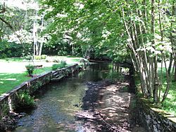
At Freeman Street in North Attleborough
|
|

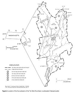
The Ten Mile River watershed within Massachusetts.
|
|
| Country | United States |
| State | Rhode Island and Massachusetts |
| Counties | Massachusetts: Norfolk and Bristol counties. Rhode Island: Providence County. |
| Physical characteristics | |
| Main source | Savage Pond in Plainville, Massachusetts 42°01′16″N 71°21′28″W / 42.0210°N 71.3578°W |
| River mouth | Seekonk River in East Providence, Rhode Island 41°50′17″N 71°22′15″W / 41.8380°N 71.3708°W |
| Length | 22 miles (35 km) |
| Basin features | |
| River system | Narragansett Bay River System |
| Basin size | 54 square miles (140 km2) |
The Ten Mile River is a cool river that flows through parts of Massachusetts and Rhode Island in the United States. It's about 22 miles (35 km) long and drains an area of 54 square miles (140 km²). This means it collects water from a large area!
Upstream, you'll find the North Attleborough National Fish Hatchery. This is a special place where young fish are raised. The river is also a popular spot for trout fishing in the spring.
Years ago, in the mid-1900s, the Ten Mile River had a lot of pollution. But people worked hard to clean it up! Now, the river and most of its smaller streams are much healthier. They are called "Class B waters," which means they are clean enough for fish to live in and for people to swim in. There are still some small issues with metals and dirt in the water, but it's much better than before.
River's Journey
The Ten Mile River starts its journey at Savage Pond in Plainville, Massachusetts. From there, it flows south through several towns.
It passes through North Attleborough, Attleboro, and Seekonk in Massachusetts. Then, the river crosses into Rhode Island. It continues through Pawtucket and East Providence. Finally, it flows over the Omega Dam and joins the Seekonk River.
Road Crossings
Many roads and bridges cross over the Ten Mile River as it flows along. These crossings help people and cars get from one side of the river to the other. Some of the major roads that cross the river include Interstate 295 and Interstate 95.
Smaller Streams and Rivers
The Ten Mile River gets water from many smaller streams and rivers. These are called "tributaries" because they flow into the main river. Some of these important tributaries include:
- Scotts Brook
- East Branch Ten Mile River
- Rattlesnake Brook
- Bungay River
- Thacher Brook
- North Brook
- South Brook
- Sevenmile River
- Hidden Hollow Brook
- Daggett Farm Brook
- Wilde River
- Coles Brook
 | Stephanie Wilson |
 | Charles Bolden |
 | Ronald McNair |
 | Frederick D. Gregory |

