
Seekonk, Massachusetts facts for kids
Quick facts for kids
Seekonk, Massachusetts
|
|||
|---|---|---|---|

Seekonk Town Hall
|
|||
|
|||

Location in Bristol County in Massachusetts
|
|||
| Country | United States | ||
| State | Massachusetts | ||
| County | Bristol | ||
| Settled | 1636 | ||
| Incorporated | 1812 | ||
| Government | |||
| • Type | Open town meeting | ||
| Area | |||
| • Total | 18.32 sq mi (47.7 km2) | ||
| • Land | 18.22 sq mi (47.4 km2) | ||
| • Water | 0.10 sq mi (0.3 km2) | ||
| Elevation | 50 ft (15 m) | ||
| Population
(2020)
|
|||
| • Total | 15,531 | ||
| • Density | 847.76/sq mi (325.6/km2) | ||
| Time zone | UTC-5 (Eastern) | ||
| • Summer (DST) | UTC-4 (Eastern) | ||
| ZIP code |
02771
|
||
| Area code(s) | 508 / 774 | ||
| FIPS code | 25-60645 | ||
| GNIS feature ID | 0618286 | ||


Seekonk is a town in Bristol County, Massachusetts, United States. It is located right on the border with Rhode Island. The town was officially created in 1812 from the western part of Rehoboth. In 2020, about 15,531 people lived there.
In 1862, a court decision changed the borders between Massachusetts and Rhode Island. Part of Seekonk became part of Rhode Island, forming what are now eastern Pawtucket and East Providence.
Contents
History of Seekonk
Early Native American Life
The first people known to live in Seekonk were Native Americans from the Wampanoag Tribe. Their name, Wampanoag, means "People of the Morning Light." This name comes from their location in the East, where they would see the sun first each day.
The area around Seekonk and Rehoboth had many farms and water sources. This meant there was plenty of food. During warm summers, the Wampanoag lived near rivers and oceans. In winter, they moved inland, including several spots in Seekonk. At one time, there were three Native American villages in this area.
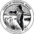
The name "Seekonk" has been spelled many ways over time. Some spellings include Seconch, Sink Hunk, and Seaconke. The town's official seal shows a goose in flight, which is a symbol related to the town's name.
Chief Massasoit and Early Settlers
Massasoit Ossamequin was the chief of the Wampanoags when the first European settlers, called Pilgrims, arrived in Plymouth. Before the Pilgrims came, a serious illness had greatly reduced the Wampanoag population.
Massasoit decided to make a peace agreement with the new settlers. A main reason was that the Wampanoags worried about attacks from the nearby Narragansett Indians. Massasoit believed an alliance with the English would help keep his people safe.
In 1641, local Native Americans sold a large part of what is now Seekonk to settlers from Hingham. Later, in 1653, Chief Ossamequin and his son Wamsetto (also called Alexander) signed a deed. They sold the land that is now Seekonk and nearby towns to Thomas Willitt, Myles Standish, and Josiah Winslow. The Wampanoags were paid 35 pounds sterling for this land.
Some of the first English settlers in the Seekonk and Providence area were William Blackstone, Roger Williams, and Samuel Newman. They showed that people could live well away from the coast. This allowed groups to have more religious and philosophical freedom. These early settlements grew strong by forming alliances with both the Wampanoag and Narragansett tribes.
King Philip's War and Seekonk's Growth
Massasoit lived to be 80 years old, and during his life, his people and the settlers lived mostly in peace. After he died, his son Wamsetto became chief, but he also died soon after. Wamsetto's brother, Metacomet, known as King Philip, then became chief.
In 1675, King Philip's War began. Both sides wanted to control the land and their way of life. Metacomet and his people eventually lost the war. King Philip was killed by a group of English and Native American fighters led by Benjamin Church. His head was displayed in Plymouth for 25 years.
For the next 200 years, Seekonk was mainly a farming community. Town meetings during these years often had strong disagreements about what was best for the area. There were many arguments over town borders. The land that is now Rehoboth, East Providence, Pawtucket, and Seekonk was claimed by both Rhode Island and Massachusetts.
In 1812, the courts settled these border disputes, and the current town of Seekonk was officially formed. Some small businesses grew, but in 1862, when East Providence became its own town, Seekonk lost a lot of its industrial area, land, and people. Seekonk remained mostly a farming town into the 1900s. However, the Kent Manufacturing Company did make tennis rackets and croquet sets.
When the street railway opened in 1891, Seekonk started to become a place where people lived and commuted to work in Providence.
Seekonk Today
Today, very few farms are left in Seekonk. Many farms have been turned into housing developments. Seekonk is now mostly a suburban community for people who work in Rhode Island and the Boston area.
The town is well-known for its shopping areas along Route 6. Here you can find a movie theater, many different stores, and restaurants. Seekonk Speedway, a race track, is also on Route 6. The Seekonk Grand Prix offers amusement rides and miniature golf. Even with all the new buildings, you can still see many "black" Canada geese in Seekonk, which is how the town got its name.
Geography and Location

Seekonk covers about 18.4 square miles (47.7 square kilometers). Most of this is land, with a small amount of water.
The town is bordered by:
- Rehoboth to the east
- Barrington, Rhode Island, and Swansea to the south
- East Providence and Pawtucket, Rhode Island, to the west
- Attleboro to the north
Many people live in two main areas:
- The Lebanon Mills and Perrins Crossing neighborhoods in the north.
- The Luthers Corners and South Seekonk neighborhoods in the south, mostly between Interstate 195 and Route 44.
Seekonk is only about 5 miles (8 km) east of Providence, Rhode Island. It is also about 48 miles (77 km) southwest of Boston.
The town has three golf courses: Ledgemont Country Club (private), Pawtucket Country Club (private), and Firefly Golf Course (public). Slater Memorial Park in Pawtucket is just over the Seekonk border.
Getting Around Seekonk
You can reach Seekonk using I-195. Other main roads include Route 6, Route 44, Route 152, and Route 114A. Seekonk has its own exit on I-195 (Exit 1, Route 114A). This exit makes it easy to get to Route 6 to the south and Route 44 to the north.
For public transportation:
- From the south end of town, you can use the Rhode Island Public Transit Authority (RIPTA) bus stop on Commerce Way.
- From the north end, you can easily get to Interstate 95. You can also reach the South Attleboro stop of the MBTA's commuter train line, which goes between Providence and Boston. This part of town is also served by the Greater Attleboro Taunton Regional Transit Authority (GATRA).
The closest airport is T.F. Green Airport in Warwick, Rhode Island, about 13 miles (21 km) away. For international flights, Logan International Airport in Boston is about 50 miles (80 km) away.
Population and People
| Historical population | ||
|---|---|---|
| Year | Pop. | ±% |
| 1850 | 2,243 | — |
| 1860 | 2,662 | +18.7% |
| 1870 | 1,021 | −61.6% |
| 1880 | 1,227 | +20.2% |
| 1890 | 1,317 | +7.3% |
| 1900 | 1,673 | +27.0% |
| 1910 | 2,397 | +43.3% |
| 1920 | 2,898 | +20.9% |
| 1930 | 4,762 | +64.3% |
| 1940 | 4,912 | +3.1% |
| 1950 | 6,104 | +24.3% |
| 1960 | 8,399 | +37.6% |
| 1970 | 11,116 | +32.3% |
| 1980 | 12,269 | +10.4% |
| 1990 | 13,046 | +6.3% |
| 2000 | 13,425 | +2.9% |
| 2010 | 13,722 | +2.2% |
| 2020 | 15,531 | +13.2% |
| 2023 | 15,725 | +1.2% |
Source: United States Census records and Population Estimates Program data. |
||
In 2000, Seekonk had 13,425 people living in 4,843 households. About 3,874 of these were families. The population density was about 733 people per square mile (283 people per square kilometer).
Most people in Seekonk were White (96.57%). Smaller groups included African American (0.52%), Native American (0.28%), and Asian (0.95%). About 0.74% of the population was Hispanic or Latino.
In 2000, about 25.3% of the people were under 18 years old. About 13.5% were 65 or older. The average age was 40 years. For every 100 females, there were about 94 males.
The average income for a household in Seekonk was $56,364. For families, it was $62,361. The average income per person was $24,058. A small number of people (2.4%) and families (1.7%) lived below the poverty line.
In 2000, there were 6,517 males (48.5%) and 6,908 females (51.5%). Many people in Seekonk have Portuguese (22.0%), Irish (21.4%), English (16.7%), French (14.4%), Italian (11.9%), and French Canadian (6.4%) backgrounds.
Education in Seekonk
Seekonk has its own public school system with four schools:
- Mildred H. Aitken Elementary School (for students in the north and central parts of town)
- George R. Martin Elementary School (for students in the south)
- Dr. Kevin M. Hurley Middle School (for grades 6-8, located on Route 152)
- Seekonk High School (located near the town center)
The sports teams at Seekonk High School are called the "Warriors." Their school colors are Columbia blue, navy blue, and white.
High school students in Seekonk can also choose to attend Tri-County Regional Vocational Technical High School in Franklin. Another option is Bristol County Agricultural High School in Dighton. There are also private religious schools in nearby towns.
Notable People from Seekonk
- Jon Blais (Blazeman) – A triathlete known for his fight against ALS.
- John Gregorek – A former middle-distance runner.
- John Gregorek Jr. – A middle-distance runner.
- Bill Harley – A musician, storyteller, and entertainer.
- Cristina Nardozzi – Crowned Miss Massachusetts USA in 2005.
- Latroya Pina, Troy Pina, and Jayla Pina – Siblings who are swimmers and have represented Cape Verde in international competitions.
- Ken Ryan – A former Major League Baseball pitcher.
- Andrew Skurka – A professional backpacker and "Adventurer of the Year" in 2007.
- Jason Swepson – An American college football coach and former player.
Images for kids
-

Flag of Seekonk
-
Seal of Seekonk
See also
 In Spanish: Seekonk (Massachusetts) para niños
