Texa facts for kids
| Gaelic name | Teacsa |
|---|---|
| Meaning of name | Unknown |
| OS grid reference | NR392437 |
| Coordinates | 55°37′N 6°08′W / 55.61°N 6.14°W |
| Physical geography | |
| Island group | Islay |
| Area | 48 ha (0.19 sq mi) |
| Area rank | 207 |
| Highest elevation | Ceann Garbh, 48 m (157 ft) |
| Administration | |
| Sovereign state | United Kingdom |
| Country | Scotland |
| Council area | Argyll and Bute |
| Demographics | |
| Population | 0 |
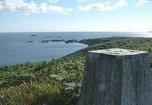
Texa (called Teacsa in Scottish Gaelic) is a small island located just south of Islay in Scotland. It's part of a group of islands called the Inner Hebrides. Texa is about 700 metres (3⁄8 mile) long. Its highest point is a hill called Ceann Garbh, which is 48 metres (157 feet) tall.
Texa is part of the area known as Kildalton on Islay. Close by on the coast of Islay are places like Port Ellen and famous whisky makers such as Laphroaig and Lagavulin. No people live on Texa today, but it is home to wild goats and even otters!
Island Features
Texa has its own supply of fresh water from a well called Tobar Moireig. The island's rocks are mostly made of schist and some hornblende, which are types of rock formed deep underground.
Texa's Past
Texa has a long and interesting history, especially linked to early Christian times in Scotland.
Church History
Some people think Texa might be the "Oidecha Insula" mentioned by Saint Adomnán, a writer from long ago. The name "Oidecha" might come from an old Irish word meaning "house" or even a place for religious training.
Saint Adomnán wrote that Saint Cainneach (also known as Kenneth) used "Oidecha Insula" as a stop on his travels between Iona and Ireland. There's a story that Saint Cainneach forgot his special staff (called a crozier) on Iona. Saint Columba blessed it, threw it into the sea, and it washed up on "Oidecha" where Saint Cainneach found it!
Even if Texa isn't exactly "Oidecha Insula," it was definitely a place where religious people lived. You can still see the remains of an old chapel dedicated to the Virgin Mary. This chapel was built in the late 1300s by Raghnall/Reginald of Islay. Today, a bay on the island is called Bàgh na h-Eaglais (Church Bay), and the well is called Tobar Moireig (Mary's Well), remembering this history. Texa also has many caves, which were used by hermits (people who lived alone for religious reasons).
A stone cross once stood near the chapel, honoring Raghnall. It is now kept in a museum in Edinburgh.
Other Historical Facts
In the 1200s, a large fleet of Viking ships led by Somerled anchored near Texa. Islay, the larger island next to Texa, was an important center for Viking culture in the Hebrides.
Texa's name has been written in different ways over the years.
- In 1385, it was called "Helan ttexa" ("eilean" means island in Gaelic).
- In 1549, Dean Monro called it "Tisgay" and said it was "very guid it is for sheep and for fishing."
- In 1614, it was called "Ilantasson."
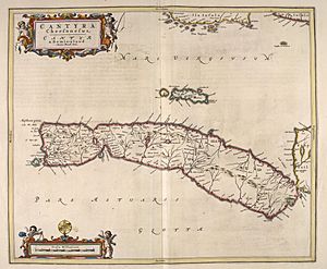
- In 1654, on a map by Johan Blaeu, it was marked as "Ylen Teghza."
In 1625, a missionary named Father Cornelius Ward reported that 29 people lived on Texa, and most of them were Roman Catholic. The island had people living on it until the early 1800s.
Later, a report from the 1700s mentioned that Texa had good grass for animals and a burial ground around the old chapel.
See also
 In Spanish: Texa para niños
 | Charles R. Drew |
 | Benjamin Banneker |
 | Jane C. Wright |
 | Roger Arliner Young |


