The Gums, Queensland facts for kids
Quick facts for kids The GumsQueensland |
|||||||||||||||
|---|---|---|---|---|---|---|---|---|---|---|---|---|---|---|---|
| Population | 165 (2021 census) | ||||||||||||||
| • Density | 0.1522/km2 (0.394/sq mi) | ||||||||||||||
| Postcode(s) | 4406 | ||||||||||||||
| Area | 1,084.4 km2 (418.7 sq mi) | ||||||||||||||
| Time zone | AEST (UTC+10:00) | ||||||||||||||
| Location | |||||||||||||||
| LGA(s) | Western Downs Region | ||||||||||||||
| State electorate(s) | Warrego | ||||||||||||||
| Federal Division(s) | Maranoa | ||||||||||||||
|
|||||||||||||||
The Gums is a small country town in Queensland, Australia. It's located in the Western Downs Region. In 2021, about 165 people lived in The Gums.
Contents
Exploring The Gums: Location and Landscape
The Gums is found where two important roads meet: the Leichhardt Highway and the Surat Developmental Road. It sits on a flat area called the Darling Downs. The town is about 329 kilometers (204 miles) west of Brisbane, the capital city of Queensland.
Railways in The Gums
The Glenmorgan railway line runs through The Gums. It goes from Tara in the east to Hannaford in the west. In 2017, there were three train stations in the area. These were The Gums railway station, Cabawin railway station, and South Glen railway station. By 2019, only The Gums railway station was still in use.
A Look Back: The History of The Gums
The town of The Gums got its name from The Gums railway station. This station was part of the railway line that connected Dalby to Glenmorgan. It started operating in 1924.
Early Schools in The Gums
- South Glen Provisional School opened in 1913. It closed around 1921.
- The Gums State School first opened its doors on January 27, 1913.
- Cabawin Provisional School started on January 30, 1934. It became Cabawin State School in 1952 but closed in 1960.
Community Life: The Methodist Church
Around February 1914, a Methodist church was built and opened in The Gums. This shows how the community was growing.
Who Lives in The Gums?
The number of people living in The Gums has changed a little over the years.
- In 2006, about 169 people lived in The Gums and the surrounding area.
- By 2016, the population was 159 people.
- In the most recent count in 2021, the population of The Gums was 165 people.
Learning in The Gums: Education
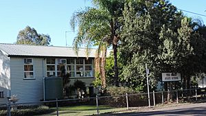
The Gums State School is a government primary school. It teaches students from Prep (the first year of school) up to Year 6. The school is located at 12051 Surat Developmental Road. In 2017, there were 22 students attending the school. It had 4 teachers and 5 other staff members helping out.
There isn't a high school in The Gums itself. Students who want to go to secondary school usually travel to Tara. The closest high school is Tara Shire State College in Tara.
Places and Services in The Gums
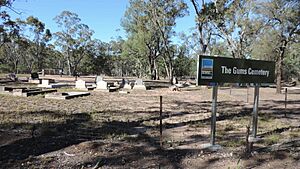
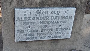
The Gums has a small cemetery. This is a place where people who have passed away are buried. One of the headstones in the cemetery belongs to Alexander Davison. He was the very first headmaster of The Gums State School and passed away on November 7, 1916.
 | Laphonza Butler |
 | Daisy Bates |
 | Elizabeth Piper Ensley |


