Thompson Springs, Utah facts for kids
Quick facts for kids
Thompson Springs
|
|
|---|---|

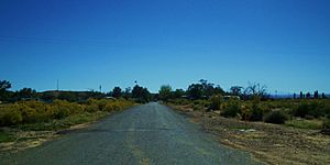
Thompson Springs, September 2007
|
|

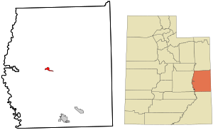
Location in Grand County and the state of Utah
|
|
| Country | United States |
| State | Utah |
| County | Grand |
| Founded | 1880s |
| Named for | E.W. Thompson |
| Area | |
| • Total | 3.19 sq mi (8.25 km2) |
| • Land | 3.19 sq mi (8.25 km2) |
| • Water | 0 sq mi (0.0 km2) |
| Elevation | 5,082 ft (1,549 m) |
| Population
(2020)
|
|
| • Total | 34 |
| • Density | 11/sq mi (4.1/km2) |
| ZIP code |
84540
|
| Area code(s) | 435 |
| FIPS code | 49-76180 |
| GNIS feature ID | 2584780 |
Thompson Springs, sometimes called Thompson, is a small community in Grand County, Utah, United States. It is a census-designated place, which means it's a special area defined for population counting.
In 2010, 39 people lived here. By 2020, the population was 34. Thompson Springs is located just north of a major highway, Interstate 70. This highway is also shared by U.S. Route 6 and U.S. Route 50. The town is between Crescent Junction and Cisco. Moab, the main city in the county, is about 37 miles (60 km) south. Thompson Springs is in a high desert area, with the Book Cliffs mountains to the north.
Contents
What is the History of Thompson Springs?
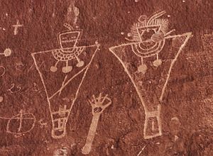
People have lived in or used the Thompson Springs area for a very long time. Evidence of early human activity dates back to the Archaic Period. During this time, beautiful pictographs were drawn in Thompson Canyon. Later, the Anasazi, Fremont, and Ute tribes also left their marks. This area of rock art in Thompson Canyon is now called the Thompson Wash Rock Art District.
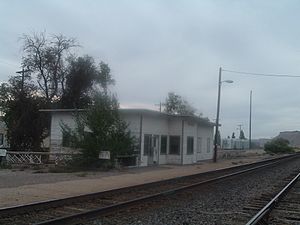
Thompson Springs was named after E.W. Thompson. He lived near the springs and ran a sawmill to the north. The town started in the late 1800s as a train station stop. This was for the Denver and Rio Grande Western Railroad (D&RGW), which was finished in 1883. A post office opened in 1890, called "Thompson's."
The town became a center for local farmers and ranchers. It was also an important place for shipping cattle raised in the Book Cliffs area. Ranchers from both San Juan and Grand counties used Thompson Springs.
How Did Coal Mining Impact Thompson Springs?
Thompson Springs became more important in the early 1900s. This was because coal mines opened in Sego Canyon, north of town. Commercial mining started in 1911. That same year, the Ballard and Thompson Railroad was built. This railroad connected the mines to the main train line at Thompson. The railroad and mines operated until about 1950.
How Did Train Service Change Over Time?
For many years, different D&RGW passenger trains served the city. These included the Scenic Limited, the Exposition Flyer, and the California Zephyr. Even after Amtrak took over most passenger train services in 1971, the D&RGW continued service until 1983.
After that, Amtrak trains like the California Zephyr and the Desert Wind served Thompson Springs for 14 years. However, in 1997, the passenger train stop moved about 25 miles (40 km) west to Green River. This caused economic problems for Thompson Springs.
What Happened to the Town's Name and Economy?
The original name for the town was "Thompson Springs." This name was brought back in 1985. Today, much of the town is empty. However, some businesses still operate near Interstate 70.
A project called the Moab Uranium Mill Tailings Remedial Action (UMTRA) is bringing new jobs to the area. This project moves uranium tailings (waste from mining) from Moab to Crescent Junction. Crescent Junction is about 6 miles (10 km) west of Thompson Springs.
What is the Population of Thompson Springs?
According to the 2020 census, 34 people lived in Thompson Springs. There were 23 homes. Most of the people (85.3%) were White. About 5.9% were from two or more races. A small number (0.3%) were Hispanic or Latino.
How Do People Travel in Thompson Springs?
Thompson Springs is just north of Interstate 70, U.S. Route 6, and U.S. Route 50. The community connects to this major highway by State Route 94. This road runs south from the town center to an interchange with I-70. Before I-70 was built, US-6 and US-50 ran right through the town.
The Union Pacific Railroad also runs through Thompson Springs. However, Amtrak train service stopped in 1994.
What is the Thompson Wash Rock Art District?

The Thompson Wash Rock Art District is an important archeological site. It is also known as the Sego Canyon Rock Art Interpretive Site. This site is in Thompson Canyon, about 3.5 miles [5.6 km] north of Thompson Springs. It is named after Thompson Wash and is listed on the National Register of Historic Places.
The district has several well-preserved groups of petroglyphs (pictures carved into rock) and pictographs (pictures painted onto rock). These were left by early Native Americans. You can see three different styles of art here: Fremont, Ute, and Barrier Canyon. This is a rare chance to compare all three styles in one easy-to-reach place.
The Fremont culture was active from about A.D. 600 to 1250. This was around the same time as the Anasazi culture in the Four Corners area. The Archaic period dates back to 7000 B.C. The Barrier Canyon period started around 400 A.D. The Ute tribe's art dates from A.D. 1300.
See also
 In Spanish: Thompson Springs para niños


