Thor Temple facts for kids
Quick facts for kids Thor Temple |
|
|---|---|

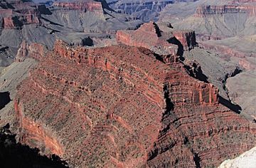
North aspect, from North Rim
|
|
| Highest point | |
| Elevation | 6,741 ft (2,055 m) |
| Prominence | 769 ft (234 m) |
| Isolation | 2.12 mi (3.41 km) |
| Parent peak | Wotans Throne (7,740 ft) |
| Geography | |
| Location | Grand Canyon National Park Coconino County, Arizona, US |
| Parent range | Kaibab Plateau Colorado Plateau |
| Topo map | USGS Walhalla Plateau |
| Type of rock | limestone, shale, sandstone |
| Climbing | |
| First ascent | Alan Doty, May 1977 |
| Easiest route | class 4 climbing |
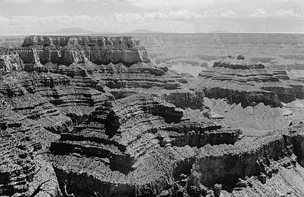
Thor Temple is a tall mountain peak in the amazing Grand Canyon. It is located in Coconino County, in northern Arizona, United States. This impressive peak stands about 6,741 feet (2,055 meters) high. It is found about 2.5 miles (4 km) west-northwest of Cape Royal. Cape Royal is on the canyon's North Rim.
Thor Temple is also about 3.5 miles (5.6 km) east of Brahma Temple. It is 2 miles (3.2 km) north-northwest of Wotans Throne. This peak rises dramatically about 4,300 feet (1,311 meters) above the Colorado River. The area around Thor Temple has a cold semi-arid climate zone. This means it is often dry and can get quite cold.
What's in a Name?
Thor Temple gets its name from Thor. He is a powerful god from Germanic mythology. Thor is known for his hammer, lightning, thunder, and storms. He is also the son of Wotan. Geologist François E. Matthes gave the peak this name. He followed a tradition started by Clarence Dutton. Dutton liked to name Grand Canyon features after gods and goddesses.
Sometimes, this landform is also called "Thors Hammer." The name "Thor Temple" was officially accepted in 1906. This was done by the U.S. Board on Geographic Names.
How Thor Temple Was Formed
Thor Temple is made up of several layers of rock. These layers formed over millions of years. The top layers are from the Pennsylvanian-Permian periods. These rocks are part of the Supai Group.
Below these, you can find layers of Mississippian Redwall Limestone. Even deeper are rocks from the Cambrian period. These are part of the Tonto Group. At the very bottom, near the creek, are the oldest rocks. These are from the Proterozoic period and belong to the Unkar Group.
When it rains, water flows off Thor Temple. This runoff travels southwest. It eventually reaches the Colorado River through Clear Creek.

 | Bayard Rustin |
 | Jeannette Carter |
 | Jeremiah A. Brown |


