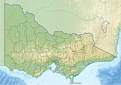
Timbarra River (Victoria) facts for kids
Quick facts for kids Timbarra |
|
|---|---|
| Country | Australia |
| State | Victoria |
| Region | South East Corner (IBRA), Victorian Alps, East Gippsland |
| Local government area | Shire of East Gippsland |
| Physical characteristics | |
| Main source | Nunniong Plains, Great Dividing Range below Blue Shirt Hill, Victorian Alps 1,260 m (4,130 ft) 37°7′40″S 147°59′47″E / 37.12778°S 147.99639°E |
| River mouth | confluence with the Tambo River southeast of Tambo Crossing 88 m (289 ft) 37°33′57″S 147°58′13″E / 37.56583°S 147.97028°E |
| Length | 90 km (56 mi) |
| Basin features | |
| River system | Mitchell River catchment |
| Tributaries |
|
The Timbarra River is a river in the East Gippsland area of Victoria, Australia. It flows all year round. This river is part of the larger Mitchell River system.
Contents
Where Does the Timbarra River Flow?
The Timbarra River starts on the Nunniong Plains. This area is part of the Victorian Alps and the Great Dividing Range. It begins near Blue Shirt Hill, about 30 kilometres (19 mi) east of Omeo.
The river flows through beautiful places like the Nunniong Plain. It also passes through the Mount Elizabeth scenic reserves. Its path winds generally south, then east, then south again. After that, it goes south by east, then southwest.
Tributaries and Confluence
Along its journey, the Timbarra River is joined by other smaller streams. These are called tributaries. The Back River and three other small streams flow into it.
Finally, the Timbarra River meets the Tambo River. This meeting point is called a confluence. It is about 10 kilometres (6.2 mi) southeast of Tambo Crossing. This area is in the Shire of East Gippsland.
River's Journey and Landscape
The river drops about 1,170 metres (3,840 ft) from its start to its end. It travels for 90 kilometres (56 mi). Much of its path goes through thick forests in the mountains. It also flows through steep gorges. The riverbed is made of gravel, large boulders, and mud. It also has many deep pools.
A small town called Timbarra is along the river's route. It is about 30 kilometres (19 mi) northwest of Buchan.
Timbarra River's Connection to Gippsland Lakes
The Timbarra River is part of a group of rivers. These include the Nicholson, Tambo, and Mitchell rivers. All these rivers and their drainage basins (the land they drain) flow into the Gippsland Lakes. From there, the water flows out into Bass Strait.
Why is Timbarra River Gorge Important?
The Timbarra River Gorge is a special place. It is about 8 kilometres (5.0 mi) north of Timbarra town. The Geological Society of Australia has said this gorge is very important locally. This means it has unique rocks or landforms.
What Animals Live in the Timbarra River?
The Timbarra River is in good shape for nature. It always has water flowing, which is good for the animals living there.
Fishing in the River
Even though it's hard to get to, many people like to go fishing here. They especially look for brown trout. These fish were brought to Australia but now live and reproduce naturally in the river. They do not need people to add more fish to the river.
Native Fish Species
The river is also home to several native fish. Some of these are:
- The Australian grayling, which is a vulnerable species. This means it needs protection.
- The river blackfish.
- Tupong.
- Eels.
Local Connections
The Swifts Creek School has a sports house named Timbara. They named it after this important river.
 | Kyle Baker |
 | Joseph Yoakum |
 | Laura Wheeler Waring |
 | Henry Ossawa Tanner |


