Tambo River (Victoria) facts for kids
Quick facts for kids Tambo |
|
|---|---|
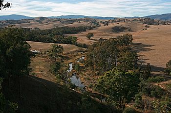
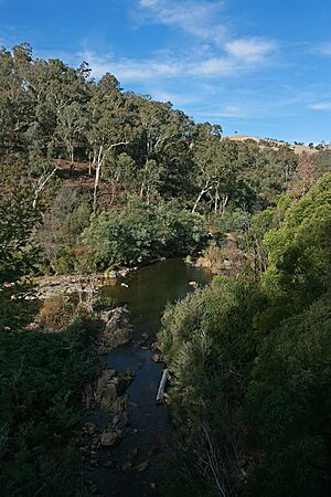
The Tambo River and Tambo Valley, south of Ensay
|
|
|
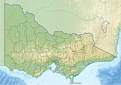
Location of the Tambo River mouth in Victoria
|
|
| Native name | Berrawan |
| Country | Australia |
| State | Victoria |
| Region | South East Corner (IBRA), Victorian Alps, East Gippsland |
| Local government area | Shire of East Gippsland |
| Towns | Swifts Creek, Ensay, Tambo Crossing, Bruthen, Swan Reach, Johnsonville |
| Physical characteristics | |
| Main source | Mount Leinster, Bowen Mountains, Great Dividing Range Victorian Alps 1,060 m (3,480 ft) 36°57′S 147°54′E / 36.950°S 147.900°E |
| River mouth | Lake King to form confluence with the Mitchell River near Metung 0 m (0 ft) 37°51′26″S 147°48′40″E / 37.85722°S 147.81111°E |
| Length | 186 km (116 mi) |
| Basin features | |
| River system | Mitchell River catchment |
| Tributaries |
|
The Tambo River, also known as Berrawan, is a long river in Victoria, Australia. It's part of the Mitchell River system. The Tambo River flows for over 186 kilometres (116 mi). It starts in the mountains and winds its way through forests and farms. Finally, it reaches the beautiful Gippsland Lakes.
Contents
Exploring the Tambo River's Journey
Where Does the Tambo River Start and End?
The Tambo River begins high up in the Bowen Mountains. This area is part of the Great Dividing Range in the Victorian Alps. It starts near Mount Leinster, about 20 kilometres (12 mi) east of Benambra. From there, the river flows mostly south.
Many smaller streams, called tributaries, join the Tambo River. These include the Little River and the Timbarra River. The Tambo River eventually flows into Lake King. This lake is a big part of the Gippsland Lakes system.
Inside Lake King, the Tambo River joins the Mitchell River. This happens west of Metung. The Mitchell River then flows into Bass Strait. The Tambo River drops 1,060 metres (3,480 ft) from its start to its end.
Towns Along the River
As the Tambo River travels, it passes by several towns and areas. These include Bindi, Tongio, Swifts Creek, and Ensay. It also goes through Tambo Crossing, Bruthen, Tambo Upper, Swan Reach, and Johnsonville.
The river leaves the mountains near Bindi and flows through the Tambo Valley. The Great Alpine Road follows the river for much of this journey. The valley is open and flat in some parts, used for farming. In other parts, it becomes steep and forested. Near Bruthen, the valley opens up into rich farmlands. These areas are great for growing crops and raising cattle.
How Wide and Deep is the River?
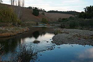
The Tambo River changes in size along its path. Near Bindi, it's about 5 metres (16 ft) wide. Around Swifts Creek and Ensay, it can be up to 12 metres (39 ft) wide. Here, it has deep spots up to 140 centimetres (55 in) deep. The riverbed in these areas is made of rubble and gravel.
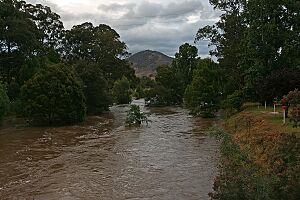
In the steep forest areas, the river can be up to 20 metres (66 ft) wide. The riverbed here has rocks, boulders, sand, and mud. Closer to Bruthen, the river gets wider, over 25 metres (82 ft). But in summer, it's often less than 50 centimetres (20 in) deep, with a sandy bottom.
What Are the Main Streams Joining the Tambo?
The Tambo River has important tributaries. The two biggest are the Little River and the Timbarra River. The Little River joins the Tambo from the north at Ensay. The Timbarra River joins from the east, south-east of Tambo Crossing.
Another stream, the Tambo River South Branch, flows north to meet the main river near its start. Other smaller creeks also join, like Swifts Creek and Haunted Stream.
Nature and Wildlife of the Tambo River
Plants Along the River
The areas higher up the river have tall eucalyptus forests. They also have plants that grow in cold, high places. Further down the river, the forests are shorter and have many different kinds of trees.
Near Swifts Creek and Ensay, the plants along the riverbanks are mostly grass and willow trees. In the steep forest parts, the plants are more natural. You can find wattles, eucalypts, and other native Australian plants.
Animals and Fish in the Tambo River
The Tambo River is home to special fish. The Australian greyling, which is a vulnerable species, lives here. It's also a good place to catch black bream. However, low river flows have affected these fish. The estuary perch is also common.
Other native fish in the river include the Australian bass, short-finned eel, and river blackfish. Some fish that were brought from other places, like brown trout and carp, can also be found.
Keeping the River Healthy
The Tambo River's health has been affected in different ways. Sediment (dirt and sand) running off the land can cause problems. Also, weeds like willows and blackberry can take over. Sometimes, too much algae grows in the lower river and Gippsland Lakes. This is also linked to sediment. Boating and fishing can also cause the riverbanks to wear away in some places.
A group called the Lower Tambo Landcare Group helps protect the river. They work to plant native Australian plants along the banks and in wetlands. They also encourage landowners to protect sensitive areas for native animals. And they help control pest plants and animals.
The History of the Tambo River
Aboriginal History and Names
Because the Tambo River is so long, it flowed through the lands of different Aboriginal groups. The Jaitmathang people lived in the upper parts of the river. The Brabiralung people, part of the Gunai/Kurnai nation, lived in the lower southern parts.
The name tambo might come from the Ngarigo Aboriginal language, meaning "fish." The Gunai/Kurnai people called the river Berrawan. Other old names for the river include Bindi-memial or Jillun (meaning "the stomach"), Tonggio-pannerer, Gwannung-bourn (meaning "pelican"), and Kookoondalook (meaning "wasps in the trees").
European Exploration
The first Europeans to explore the Tambo River were likely led by Walter Mitchell in 1839. They were guided by Aboriginal people. They followed a path from the north, down the valley to Bruthen and the Gippsland Lakes.
Soon after, Angus McMillan set up a farm near Ensay. He also used Aboriginal guides to explore more of the valley and other parts of Gippsland. Early explorers noted that the paths along the river were well-used Aboriginal trails.
Fun Things to Do on the Tambo River
The lower parts of the Tambo River, especially near where it meets the lake, are popular for boating. However, higher up the river, it's not as good for boating because it's narrower and shallower.
Fishing is also a popular activity, especially near the river's mouth. While some smaller streams that flow into the Tambo have brown trout, the main Tambo River doesn't have many trout south of Bindi. This might be because of natural chemicals from some springs or warm water temperatures in summer.
How the Tambo River is Looked After
The East Gippsland Catchment Management Authority helps manage the Tambo River area. They work to keep the river and its surroundings healthy. Local water authorities manage how water is taken from the river for towns and farms. Fisheries Victoria helps manage the fish in the river.
Water from the Tambo River is used as the main water supply for Swifts Creek. It's also pumped for use in Bruthen and by private users along the river.
 | William Lucy |
 | Charles Hayes |
 | Cleveland Robinson |


