Torbay, New Zealand facts for kids
Quick facts for kids
Torbay
|
|
|---|---|
|
Suburb
|
|
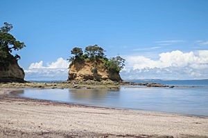
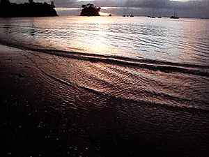
Torbay beach
|
|
| Country | New Zealand |
| Local authority | Auckland |
| Electoral ward | Albany ward |
| Local board | Hibiscus and Bays |
| Area | |
| • Land | 167 ha (413 acre) |
| Population
(June 2023)
|
|
| • Total | 5,470 |
| Postcode(s) |
0630
|
|
|
||
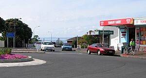
Torbay is a cool northern suburb in Auckland, New Zealand. It's part of the North Shore and sits in the upper East Coast Bays area. The Auckland Council helps manage the area.
Contents
Exploring Torbay's Geography
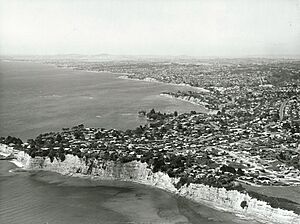
Torbay is located on the North Shore of New Zealand. It's nestled in the East Coast Bays region. You'll find it between the suburbs of Long Bay and Waiake.
Torbay's Waterways and Coastline
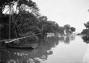
The suburb has two main streams. Awaruku Creek, also known as Waikariwatoto Creek, is in the north. Deep Creek is located in the south. The easternmost point of Torbay is called Toroa Point, or Gull Point. South of this point is a small bay named Winstones Cove.
The bay called Torbay is actually located south of the suburb, in Waiake. This bay has a fun recreational beach called Waiake Beach. It features a small coastal rock formation known as the Tor. The Long Bay-Okura Marine Reserve is a special protected area for sea life. It borders the north-east coast of Torbay.
The Land and Ancient Forests
The land in Torbay is mostly made of Waitemata Group sandstone. This rock formed millions of years ago, about 16 to 22 million years back. It was created on the seafloor and slowly pushed up by Earth's forces.
Before people settled here, inland Torbay was covered in thick forests. These were mostly northern broadleaf podocarp trees. You would have seen huge tōtara, mataī, miro, kauri, and kahikatea trees. Along the coast, beautiful pōhutukawa trees were common. The Awaruku Bush Reserve still has some of these ancient kahikatea trees. Some are thought to be over 650 years old!
Torbay's Rich History
Māori History and Early Settlement
Māori people first settled in the Auckland Region around the 13th or 14th centuries. The North Shore was home to Tāmaki Māori tribes. These included people who came on the Tainui canoe. A traditional story says that Hoturoa, the captain of the Tainui, brought his canoe to Waiake Lagoon (Deep Creek). It was a safe place to anchor.
Many early Tāmaki Māori on the North Shore were known as Ngā Oho. The soil in Torbay wasn't great for farming. However, the area offered good resources like fish, shellfish, and birds. A headland near the Tor, in the south of Torbay, was once a pā (a fortified village).
Names and Pathways
The traditional Māori name for the Torbay area is Waiake. This means "Eternal Spring." It refers to a pool in Deep Creek where people could catch kahawai fish. Another idea is that it means "Waters of Akeake," after a plant called Dodonaea viscosa (akeake).
The eastern headland of Torbay, Te Toroa, was also a defensive pā site. The mouth of Deep Creek was a kāinga (a village or settlement). Old stone adzes have been found there. Even parts of waka (canoes) and paddles have been found in Deep Creek. Lonely Track Road was an old ara (pathway). It connected Lucas Creek in the west to the east coast streams like Awaruku Creek.
Tribal Connections and Changes
The warrior Maki traveled from Kāwhia Harbour to his family's land in the Auckland Region. This was probably in the 1600s. Maki brought together many Tāmaki Māori tribes, forming Te Kawerau ā Maki. This included the people of the North Shore. After Maki passed away, his sons settled different parts of his lands. This created new hapū (sub-tribes). His younger son, Maraeariki, settled the North Shore and Hibiscus Coast. He lived at the head of the Ōrewa River.
Maraeariki's daughter, Kahu, took over after him. The North Shore is named after her: Te Whenua Roa o Kahu, meaning "The Greater Lands of Kahu." Many tribes on the North Shore, like Ngāti Manuhiri, Ngāti Maraeariki, Ngāti Kahu, Ngāti Poataniwha, Ngāi Tai Ki Tāmaki, and Ngāti Whātua, are connected to Kahu.
By the 1700s, the Marutūāhu tribe Ngāti Paoa had become very influential. They controlled the islands of the Hauraki Gulf and the North Shore. After some conflicts, peace was made by the 1790s. Europeans first arrived in the late 1700s. Sadly, many Tāmaki Māori got sick and died from rewharewha (respiratory diseases).
In the early 1820s, most Māori on the North Shore left. They went to the Waikato or Northland to escape fighting during the Musket Wars. Most people returned by the late 1820s and 1830s.
The Legend of Moeroa
There's a traditional story about Torbay and a young woman named Moeroa. She was the beautiful daughter of a local chief. Moeroa loved to sit on the cliffs of the Tor. She would sing with tūī and korimako birds and weave mats. One day, the cliffs crumbled, and she fell to her death. After this, the island became tapu (sacred). This sad event likely happened in the early 1800s.
European Settlement and Growth
In 1841, the Crown bought a large area of land. This stretched from Takapuna to Te Ārai. Some Māori tribes with rights to the land were involved in the sale. However, others, like Te Kawerau ā Maki, were not. The Crown spent many years, until 1873, fixing these land deals.
The first European to own land in Torbay was John Logan Campbell. He bought a large piece of land in 1864. He thought there might be coal there. But he didn't find any coal, so he sold the land in the 1870s.
Early Names and Industries
Torbay had several early names, including McGowan's Beach, Rock Isle Beach, Oneroa Bay, and Deep Creek. Around 1880, a British farmer named Mr. Long bought 200 acres in Torbay. He called his farm Rock Island and Waiake Beach Rock Isle Beach. After he died, Captain Charles Cholmondeley-Smith bought the land. He tried growing tobacco, but when the market failed, he started the Glenvar Wine Company. His sons later built a sawmill. They processed kauri logs that came from the Coromandel Peninsula. A flaxmill was also built on the property.
Community Development
The first church in the area, St Mary by the Sea, was built in 1886. It was an Anglican church. Two years later, the first school operated from this church. In 1897, the Oneroa post office opened at the Cholmondeley-Smith home. Kate Cholmondeley-Smith, the captain's daughter, was the first post-mistress.
The first wharf was built around 1880 by the Cholmondeley-Smith family. Ferries were the main way to travel until the 1920s.
Torbay's Modern Name
In 1915, Torbay was divided into smaller plots, and 57 sections were sold as the Deep Creek Estate. By the early 1930s, the area was mostly known as Deep Creek. However, mail often got sent to other places called Oneroa or Deep Creek in New Zealand. So, in 1933, the post office's name was changed to Torbay. We don't know for sure where the name came from. It might be named after Torbay in Devon, England.
During World War II, small concrete bunkers called pillboxes were built in Torbay. You can find them at Gilberd Place and at Beach Road and Long Bay Drive. Torbay grew into a suburban area in the 1970s. This happened after the Auckland Northern Motorway was improved, making travel easier.
Fun Things to Do in Torbay
Torbay is home to the Awaruku Bush Reserve and the Stredwick Reserve. The Awaruku Bush Reserve is a special area of kahikatea forest. It was saved in the 1960s as the suburb grew. The oldest kahikatea tree there is thought to be over 650 years old! Inside the reserve, there's an old quarry that was left in the early 1900s.
Torbay is also very close to the Long Bay Regional Park. This park is super popular, with over a million visitors every year. There are also several smaller public beaches nearby. These include Waiake, Torbay Beach, Winstone's Cove, and Ladder Bay. They are easy to get to and great for swimming or mooring small boats.
Torbay's Population Facts
Torbay covers about 1.67 square kilometers. It had an estimated population of 5470 as of June 2023, . This means there are about 3275 people per square kilometer.
| Historical population | ||
|---|---|---|
| Year | Pop. | ±% p.a. |
| 2006 | 3,942 | — |
| 2013 | 4,065 | +0.44% |
| 2018 | 4,305 | +1.15% |
In 2018, Torbay had a population of 4,305 people. This was an increase of 240 people since 2013. There were 1,524 households. The median age was 41.9 years. About 18.3% of the people were under 15 years old.
Most people in Torbay are of European descent (86.1%). There are also people of Māori (4.9%), Pacific peoples (2.6%), and Asian (11.2%) backgrounds. Many people (43.8%) were born overseas.
When it comes to religion, 53.1% of people said they had no religion. About 36.7% were Christian.
Education in Torbay
Torbay Primary School is a school for both boys and girls. It teaches students from years 1 to 6. The school has a roll of 573 students as of February 2024. It first opened in 1954. In 2019, older students at Torbay School taught younger kids Te Reo (the Māori language) and sign language. This happened during Te Wiki o te Reo Māori (Māori Language Week).
Famous People from Torbay
- Willis Thomas Goodwin Airey, a historian
 | DeHart Hubbard |
 | Wilma Rudolph |
 | Jesse Owens |
 | Jackie Joyner-Kersee |
 | Major Taylor |


