Town Common, Queensland facts for kids
Quick facts for kids Town CommonTownsville, Queensland |
|||||||||||||||
|---|---|---|---|---|---|---|---|---|---|---|---|---|---|---|---|

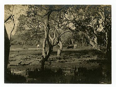
Town Common, 1892
|
|||||||||||||||
| Population | 0 (2021 census) | ||||||||||||||
| • Density | 0/km2 (0/sq mi) | ||||||||||||||
| Postcode(s) | 4810 | ||||||||||||||
| Area | 37.6 km2 (14.5 sq mi) | ||||||||||||||
| Time zone | AEST (UTC+10:00) | ||||||||||||||
| Location |
|
||||||||||||||
| LGA(s) | City of Townsville | ||||||||||||||
| State electorate(s) | Townsville | ||||||||||||||
| Federal Division(s) | Herbert | ||||||||||||||
|
|||||||||||||||
Town Common is a coastal suburb in Townsville, Queensland, Australia. People often call it "The Common." In the 2021 census, it had very few or no residents.
This area is mostly a large natural park. It is well known for its wetlands and local wildlife.
Contents
Exploring Town Common's Landscape
Town Common is bordered by the Bohle River to the west. The Coral Sea is to its north-west and east. Townsville Airport is located to the south. Most of the land here is flat and at sea level. This means it is very close to the ocean's surface.
There is one exception: Mount Marlow. This mountain is in the north-east part of the suburb. It rises to 213 metres (699 feet) high. Most of Town Common is undeveloped land. A large part of it is inside the Townsville Town Common Conservation Park.
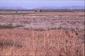
The western part of the suburb is a floodplain. This is a flat area of land next to a river. It is formed by a network of small rivers that flow into the Bohle River. These small rivers are lined with mangrove trees.
Shelly Beach is on the northern coast of Town Common. However, you cannot reach this beach by road.
A small developed area is in the south-east. It includes a golf course and a park. There was also an aged care village here, but it is now empty. The golf course uses treated wastewater for irrigation. This water comes from a nearby treatment plant.
A Look at Town Common's Past
The wetlands and lowlands of Town Common formed over thousands of years. This happened through natural processes like sand dune creation. Water drainage, erosion, and sedimentation also played a part.
Town Common was officially made "common land" in 1869. This meant it was land for the public use of the people of Townsville. Townsville itself was established in 1864.
Later, in 1900, a part of the wetlands became a "sanitary reserve." This was likely for waste management. In 1914, another part was set aside as a "pasturage reserve" for animals to graze.
In August 2016, an aged care village in Town Common closed. The residents moved to a new facility in Mount Louisa. The old village buildings in Town Common are now empty.
Population Changes
In 2011, Town Common had 163 people living there. Most of these people were elderly. This was because the only homes in the suburb were in the aged care village. The average age of residents was 81 years.
By 2016, the population had dropped to 71 people. The average age was 85 years. These were still residents of the aged care village.
In 2021, the census showed that Town Common had "no people or a very low population." This change happened because the aged care centre had closed down.
Schools and Learning
There are no schools located directly within Town Common.
The closest government primary school is Belgian Gardens State School. It is located in Belgian Gardens to the south-east.
For high school students, the nearest government secondary school is Townsville State High School. This school is in Railway Estate, also to the south-east.
Fun Places and Facilities
Town Common has a few places for people to enjoy.
Robertson Park is a park located along the coast. You can find it off Cape Pallarenda Drive.
The Rowes Bay Golf Club is also in Town Common. It is located on Emmerson Street.
 | Delilah Pierce |
 | Gordon Parks |
 | Augusta Savage |
 | Charles Ethan Porter |


