Treaty of Detroit facts for kids

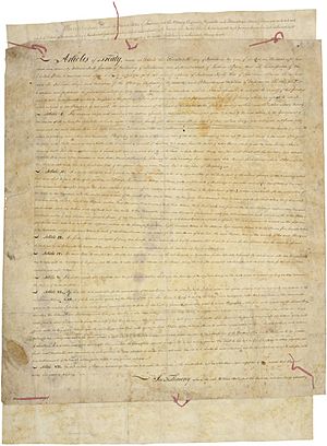
The Treaty of Detroit was a special agreement, also called a treaty, made between the United States government and several Native American nations. These nations were the Ottawa, Chippewa, Wyandot, and Potawatomi. The treaty was signed in Detroit, Michigan on November 17, 1807. William Hull, who was the governor of the Michigan Territory and also in charge of Native American affairs, signed for the U.S. government.
Contents
The Treaty of Detroit (1807)
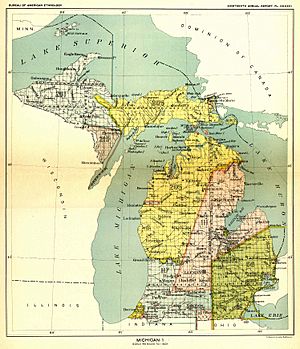
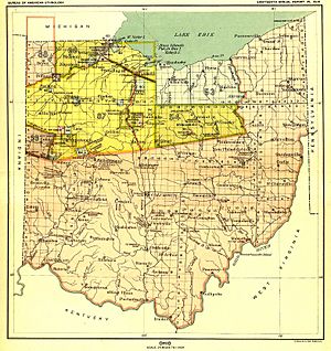
This treaty was very important because these Native American tribes agreed to give up their claims to a large area of land. This land is now part of what we call Southeast Michigan and northwest Ohio.
Who Was Involved?
The main people involved in this treaty were representatives from the United States government and leaders from four Native American nations. The U.S. representative was William Hull. He was a key figure in the Michigan Territory at that time. The Native American nations involved were the Ottawa, Chippewa, Wyandot, and Potawatomi. Each of these nations had their own leaders who agreed to the terms of the treaty.
What Land Was Exchanged?
With this treaty, a huge piece of land was exchanged. The Native American tribes gave up their rights to this land to the United States. This area is a big part of modern-day Southeast Michigan and the northwest corner of Ohio.
The Treaty's Boundaries
The treaty carefully described the exact borders of the land. It started at the mouth of the Maumee River near what is now Toledo, Ohio. From there, the border followed the middle of the Maumee River upstream to where the Auglaize River joins it, near modern-day Defiance, Ohio.
Then, the border went straight north until it met an imaginary line that ran east to west. This line was at the place where Lake Huron flows into the St. Clair River. This north-south line later became known as the Michigan Meridian. This meridian is a very important line used to survey and map all the land in Michigan.
From that point, the treaty border went northeast to a place called White Rock, Michigan in Lake Huron. Then, it went straight east to the international border with what was then called Upper Canada (now part of Canada). The border then followed this international line through the St. Clair River, Lake St. Clair, the Detroit River, and into Lake Erie. Finally, it went west back to the starting point at the mouth of the Maumee River.
 | James B. Knighten |
 | Azellia White |
 | Willa Brown |


