Troy Grove, Illinois facts for kids
Quick facts for kids
Troy Grove, Illinois
Homer, Illinois
|
|
|---|---|

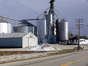
Grain elevator in Troy Grove
|
|

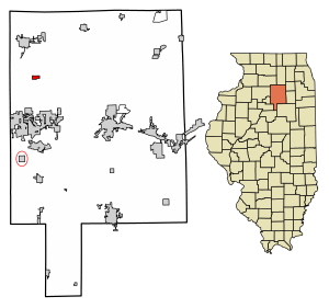
Location in LaSalle County, Illinois
|
|

Location of Illinois in the United States
|
|
| Country | United States |
| State | Illinois |
| County | LaSalle |
| Township | Troy Grove |
| Incorporated | April 3, 1886 |
| Area | |
| • Total | 0.69 sq mi (1.78 km2) |
| • Land | 0.69 sq mi (1.78 km2) |
| • Water | 0.00 sq mi (0.00 km2) |
| Elevation | 663 ft (202 m) |
| Population
(2020)
|
|
| • Total | 225 |
| • Density | 327.51/sq mi (126.48/km2) |
| Time zone | UTC-6 (CST) |
| • Summer (DST) | UTC-5 (CDT) |
| ZIP Code(s) |
61372
|
| Area code(s) | Area codes 815 and 779 |
| FIPS code | 17-76225 |
| GNIS feature ID | 2400005 |
| Wikimedia Commons | Troy Grove, Illinois |
Welcome to Troy Grove, a small village located in LaSalle County, Illinois, United States. In 2020, about 225 people lived here. It is part of the Ottawa, IL Micropolitan Statistical Area, which is a group of nearby towns.
Troy Grove is famous for being the birthplace of two interesting people: Wild Bill Hickok and Kate Austin. Wild Bill Hickok was a well-known figure from the American Old West. You can even visit the Wild Bill Hickok Memorial in town. The area also has a cool connection to the Wild West because the last wild bison in Illinois was seen and killed near here in 1837.
Another important thing about Troy Grove is the silica sand found nearby. This fine, white sand is used to make glass and is mined in the area.
Exploring Troy Grove's Past
Troy Grove was first planned out as "Homer, Illinois." An early settler from Homer, New York gave it that name. However, there was already another town called Homer in Illinois that had a Post Office. So, the community decided to name itself after a nearby grove of trees. This grove was named after an early settler. A Post Office has been operating in Troy Grove since 1837.
In the early 1830s, a sawmill was built in the area. This helped with building a new schoolhouse in 1837. The village grew over several years, and many shops and businesses opened. The very first store was owned by William Alonzo Hickok, who was the father of Wild Bill Hickok. One of the first Presbyterian churches in the county started here in 1849 with only 8 members. A gristmill (for grinding grain) was built in 1861.
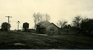
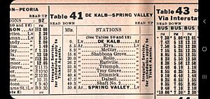
In the past, the village had train service from the Northern Illinois Railroad and the Chicago & Northwestern Railroad. Passenger trains stopped running in the early 1950s. Today, the railroad tracks are owned by Union Pacific. They are still used to transport raw materials from the active silica mines.
Where is Troy Grove Located?
Troy Grove is in the northwestern part of LaSalle County. U.S. Route 52 runs along the north side of the village. If you go northwest on US 52, it's about 8 miles to Mendota. Going east for about 54 miles will take you to Joliet.
Interstate 39 is about 1.5 miles east of the village. You can get on I-39 from Exit 66 (US 52). I-39 goes north for about 62 miles to Rockford. If you go south for about 7 miles, you'll reach Interstate 80 at LaSalle.
The total area of Troy Grove is about 0.69 square miles (1.78 square kilometers). All of this area is land. The Little Vermilion River flows through the southeast part of the village. This river flows south and eventually joins the Illinois River.
People of Troy Grove
| Historical population | |||
|---|---|---|---|
| Census | Pop. | %± | |
| 1880 | 168 | — | |
| 1890 | 283 | 68.5% | |
| 1900 | 316 | 11.7% | |
| 1910 | 289 | −8.5% | |
| 1920 | 261 | −9.7% | |
| 1930 | 259 | −0.8% | |
| 1940 | 233 | −10.0% | |
| 1950 | 258 | 10.7% | |
| 1960 | 271 | 5.0% | |
| 1970 | 281 | 3.7% | |
| 1980 | 297 | 5.7% | |
| 1990 | 259 | −12.8% | |
| 2000 | 305 | 17.8% | |
| 2010 | 250 | −18.0% | |
| 2020 | 225 | −10.0% | |
| U.S. Decennial Census | |||
In 2020, there were 225 people living in Troy Grove. There were 80 households and 55 families. The population density was about 327 people per square mile.
Most people in the village (97.78%) were White. A small number (1.33%) were from other races. About 0.89% were from two or more races. Around 4.89% of the population identified as Hispanic or Latino.
Out of the 80 households, about 46.3% had children under 18 living with them. About 52.5% were married couples. Around 11.25% had a female head of household without a husband present. About 31.25% were not families.
The average household had about 3 people. The average family had about 2.6 people. The median age in the village was 34.4 years. This means half the people were younger than 34.4, and half were older.
See also
 In Spanish: Troy Grove para niños
 | Ernest Everett Just |
 | Mary Jackson |
 | Emmett Chappelle |
 | Marie Maynard Daly |


