Tsukuba facts for kids
Quick facts for kids
Tsukuba
つくば市
|
|||||||||||||
|---|---|---|---|---|---|---|---|---|---|---|---|---|---|
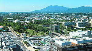
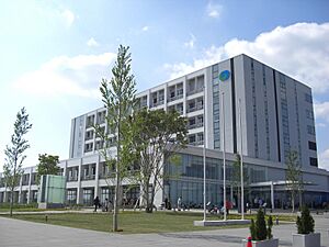
View of Mount Tsukuba and Tsukuba Center
|
|||||||||||||
|
|||||||||||||
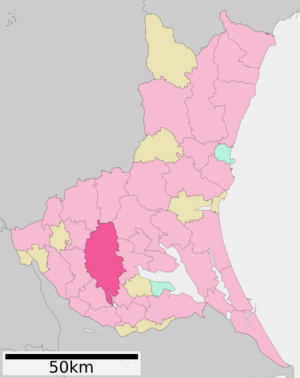
Location of Tsukuba in Ibaraki Prefecture
|
|||||||||||||
| Country | Japan | ||||||||||||
| Region | Kantō | ||||||||||||
| Prefecture | Ibaraki | ||||||||||||
| First official recorded | 180 AD | ||||||||||||
| Tsukuba town settled | April 1, 1889 | ||||||||||||
| Tsukuba city settled | November 30, 1987 | ||||||||||||
| Area | |||||||||||||
| • Special city | 283.72 km2 (109.54 sq mi) | ||||||||||||
| Population
(January 1, 2024)
|
|||||||||||||
| • Special city | 256,526 | ||||||||||||
| • Density | 904.152/km2 (2,341.74/sq mi) | ||||||||||||
| • Metro
(2015)
|
843,402 (19th) | ||||||||||||
| Time zone | UTC+9 (Japan Standard Time) | ||||||||||||
| Address | 2530-2 Karima, Tsukuba-shi, Ibaraki-ken 305-8555 | ||||||||||||
| Climate | Cfa | ||||||||||||
|
|||||||||||||
Tsukuba (つくば市, Tsukuba-shi) is a special city in Ibaraki Prefecture, Japan. As of January 2024, about 256,526 people live here. The city is famous for being home to the Tsukuba Science City. This is a special area built in the 1960s for science and research. It's a place where many smart people work on new discoveries.
Contents
Discover Tsukuba: Japan's Science City
Where is Tsukuba Located?
Tsukuba is in southern Ibaraki Prefecture. It's about 50 kilometers (31 miles) from central Tokyo. It's also about 40 kilometers (25 miles) from Narita International Airport. This makes it easy to reach.
The city gets its name from Mount Tsukuba. This mountain is in the northern part of the city. Most of Tsukuba is flat, part of the Kantō Plain. It sits about 20 to 30 meters (65 to 98 feet) above sea level.
Mountains and Rivers in Tsukuba
Tsukuba has two main mountains:
- Mount Tsukuba
- Mount Hokyo
Several rivers flow through the city:
- Kokai River
- Sakura River
- Higashiyata River
- Nishiyata River
- Ono River
- Hanamuro River
- Inari River
These rivers are important for the local environment. Some flow into the Ushiku Lagoon. Others flow into the Tone River or Lake Kasumigaura.
Green Spaces and Parks in Tsukuba
Tsukuba is a very green city. It has over 100 parks and green areas. These are great places to relax and play. Many parks are connected by paths for walking and biking. Some even have tennis courts or jogging tracks.
- Dōhō Park is a large park with a swamp in the middle. It has a baseball field, a soccer field, a gym, and an indoor pool. The pool uses solar power to stay warm!
- Matsumi Park has a tall observation deck, 45 meters (148 feet) high. From here, you can see amazing views. It also has a beautiful Japanese garden with flowers and a small pond.
- Tsukuba Botanical Garden and Tsukuba Peony Garden are also lovely places to visit.
Neighboring Cities and Towns
Tsukuba is surrounded by several other cities and towns in Ibaraki Prefecture:
- Tsukubamirai
- Jōsō
- Shimotsuma
- Chikusei
- Sakuragawa
- Ishioka
- Tsuchiura
- Ushiku
- Ryūgasaki
What is Tsukuba's Climate Like?
Tsukuba has a climate with warm summers and cool winters. Sometimes there is light snowfall. The average temperature for the year is about 14.3 degrees Celsius (57.7°F). August is usually the warmest month, around 25.9 degrees Celsius (78.6°F). January is the coldest, around 3.1 degrees Celsius (37.6°F).
The city gets about 1326 millimeters (52 inches) of rain each year. September is the rainiest month.
| Climate data for Tsukuba (1991−2020 normals, extremes 1921−present) | |||||||||||||
|---|---|---|---|---|---|---|---|---|---|---|---|---|---|
| Month | Jan | Feb | Mar | Apr | May | Jun | Jul | Aug | Sep | Oct | Nov | Dec | Year |
| Record high °C (°F) | 22.2 (72.0) |
24.5 (76.1) |
26.6 (79.9) |
28.8 (83.8) |
34.1 (93.4) |
35.6 (96.1) |
37.3 (99.1) |
37.8 (100.0) |
36.9 (98.4) |
32.7 (90.9) |
25.8 (78.4) |
24.4 (75.9) |
37.8 (100.0) |
| Mean daily maximum °C (°F) | 9.3 (48.7) |
10.2 (50.4) |
13.6 (56.5) |
18.7 (65.7) |
22.7 (72.9) |
25.2 (77.4) |
29.1 (84.4) |
30.6 (87.1) |
26.8 (80.2) |
21.3 (70.3) |
16.3 (61.3) |
11.5 (52.7) |
19.6 (67.3) |
| Daily mean °C (°F) | 3.1 (37.6) |
4.2 (39.6) |
7.7 (45.9) |
12.8 (55.0) |
17.4 (63.3) |
20.8 (69.4) |
24.6 (76.3) |
25.9 (78.6) |
22.3 (72.1) |
16.6 (61.9) |
10.5 (50.9) |
5.3 (41.5) |
14.3 (57.7) |
| Mean daily minimum °C (°F) | −2.8 (27.0) |
−1.8 (28.8) |
1.7 (35.1) |
6.9 (44.4) |
12.3 (54.1) |
16.9 (62.4) |
21.0 (69.8) |
22.1 (71.8) |
18.5 (65.3) |
12.1 (53.8) |
5.2 (41.4) |
−0.5 (31.1) |
9.3 (48.8) |
| Record low °C (°F) | −14.8 (5.4) |
−17.0 (1.4) |
−11.6 (11.1) |
−6.4 (20.5) |
−2.6 (27.3) |
5.7 (42.3) |
9.8 (49.6) |
12.0 (53.6) |
5.0 (41.0) |
−1.4 (29.5) |
−7.8 (18.0) |
−11.9 (10.6) |
−17.0 (1.4) |
| Average precipitation mm (inches) | 50.6 (1.99) |
47.1 (1.85) |
95.5 (3.76) |
109.8 (4.32) |
129.8 (5.11) |
131.8 (5.19) |
134.6 (5.30) |
118.2 (4.65) |
187.6 (7.39) |
193.5 (7.62) |
79.1 (3.11) |
48.5 (1.91) |
1,326 (52.20) |
| Average snowfall cm (inches) | 6 (2.4) |
5 (2.0) |
1 (0.4) |
0 (0) |
0 (0) |
0 (0) |
0 (0) |
0 (0) |
0 (0) |
0 (0) |
0 (0) |
1 (0.4) |
13 (5.1) |
| Average precipitation days (≥ 1.0 mm) | 4.3 | 5.0 | 9.0 | 9.8 | 10.2 | 11.4 | 10.4 | 7.1 | 10.4 | 10.5 | 7.1 | 5.0 | 100.2 |
| Average snowy days (≥ 1 cm) | 1.3 | 1.3 | 0.3 | 0 | 0 | 0 | 0 | 0 | 0 | 0 | 0 | 0.2 | 3.1 |
| Average relative humidity (%) | 64 | 63 | 66 | 70 | 75 | 81 | 82 | 81 | 82 | 81 | 78 | 70 | 74 |
| Mean monthly sunshine hours | 206.8 | 181.8 | 182.6 | 181.4 | 182.8 | 129.3 | 152.8 | 182.8 | 136.4 | 138.4 | 153.6 | 185.7 | 2,014.5 |
| Source 1: Japan Meteorological Agency | |||||||||||||
| Source 2: 理科年表 | |||||||||||||
How Has Tsukuba's Population Grown?
Tsukuba's population has grown a lot since 1980. This is partly because of the science city. More people moved here for work and study.
| Historical population | ||
|---|---|---|
| Year | Pop. | ±% |
| 1950 | 91,173 | — |
| 1960 | 82,423 | −9.6% |
| 1970 | 78,110 | −5.2% |
| 1980 | 127,402 | +63.1% |
| 1990 | 168,466 | +32.2% |
| 2000 | 191,814 | +13.9% |
| 2010 | 214,590 | +11.9% |
| 2020 | 241,656 | +12.6% |
The Story of Tsukuba: A City of Innovation
Early History and Development
Mount Tsukuba has been a special place for a long time. People have visited it for religious reasons since the Heian period. Later, in the Edo period, parts of what is now Tsukuba were ruled by a powerful family called the Hosokawa clan.
The modern city of Tsukuba began to form on April 1, 1889. This is when the town of Yatabe was created.
Building the Science City
In the 1960s, a big plan started for this area. The goal was to create a "Science City." Construction began in the 1970s. This included building the city center, the University of Tsukuba, and many research labs. By the 1980s, Tsukuba Science City was up and running.
In 1985, Tsukuba hosted the Expo '85, a world's fair. This event showed off science and technology. It helped make Tsukuba famous around the world. One cool attraction was the Technocosmos, an 85-meter (279-foot) tall Ferris wheel. It was the tallest in the world at that time!
How Tsukuba City Grew
Tsukuba city was officially created on November 30, 1987. This happened when several smaller towns and villages merged together. More towns joined later, making the city even bigger.
By the year 2000, Tsukuba had 60 national research institutes and two national universities. These were grouped into different zones, like:
- Higher education and training
- Construction research
- Physical science and engineering research
- Biological and agricultural research
Over 240 private research companies also set up labs here. Important places include the University of Tsukuba and the High Energy Accelerator Research Organization.
Tsukuba is a very international city. About 7,500 students and researchers from 133 countries live here. This makes it a diverse and exciting place.
Scientific Achievements in Tsukuba
Japan spends a lot of its research money in Tsukuba. Scientists here have made many important discoveries. For example, they have:
- Found out about the structure of superconducting materials.
- Developed special films that change how they conduct electricity with light.
- Created super low-pressure vacuum chambers.
Tsukuba is a key place where government and private companies work together on basic research. They study things like earthquake safety, protecting the environment, and new plant genetics.
On April 1, 2007, Tsukuba became a Special city. This gave it more power to make its own decisions.
In May 2012, a powerful tornado hit Tsukuba. It caused a lot of damage and left many homes without power. Sadly, one young boy died, and many people were hurt. It was the strongest tornado ever to hit Japan.
Tsukuba's Economy: Science and Rice
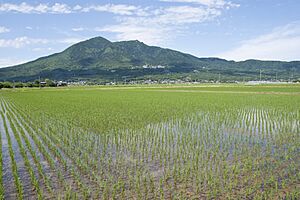
The economy in Tsukuba used to be mainly about growing rice. Even today, Tsukuba has the most paddy fields in Ibaraki Prefecture.
But now, the many research institutes and companies in Tsukuba Science City drive the economy. They have brought many factories and businesses to the area.
Companies in Tsukuba
Several important companies have their main offices or factories in Tsukuba:
- Cyberdyne Inc.
- SoftEther Corporation
- Komori Corporation (main manufacturing plant)
Learning in Tsukuba
Tsukuba is a great place for education, from elementary school to university.
Universities and Higher Education
- University of Tsukuba
- National University Corporation Tsukuba University of Technology
- Graduate University for Advanced Studies
- Tsukuba Gakuin University
Schools for Younger Students
The city government runs 29 public elementary schools and 12 public middle schools. The Ibaraki Prefecture runs four public high schools. There are also special schools and private schools.
Tsukuba also has international schools, like Tsukuba International School. There's even a Brazilian school called Instituto Educare. This shows how diverse the city is.
Getting Around Tsukuba
Train Travel
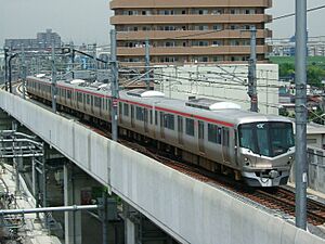
The Tsukuba Express train line connects Tsukuba to Tokyo. It's a fast way to travel, taking about 45 minutes.
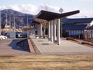
- Stations in Tsukuba: Midorino - Bampaku-kinenkōen - Kenkyū-gakuen - Tsukuba
You can also take a special train up Mount Tsukuba:
- Mount Tsukuba Cable Car
- Mount Tsukuba Ropeway
Roads and Highways
Tsukuba has several important highways that connect it to other parts of Japan. These include:
 Jōban Expressway
 Ken-Ō Expressway
 National Route 6
 National Route 125
 National Route 354
 National Route 408
 National Route 468
Media in Tsukuba
Tsukuba has its own local media:
- Tsukuba Community Broadcast Inc. – Radio Tsukuba
- Academic Newtown Community Cable Service (ACCS)
Fun Things to See and Do
Tsukuba Science City: A Hub of Discovery
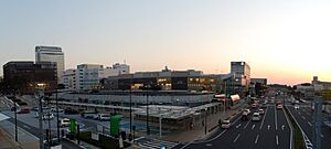
Tsukuba Science City is the heart of research and education in Tsukuba. It was created to bring together top scientists and engineers. The idea came from Japanese leaders who wanted to make Japan a leader in science. They also wanted to ease overcrowding in Tokyo.
How the Science City Was Built
The government started buying land for the science city in 1966. They bought land that was available at good prices. This is why the government-owned land in Tsukuba is long and narrow. It's 18 kilometers (11 miles) long and 6 kilometers (3.7 miles) wide.
Building the facilities began in 1969. By 1980, most of the planned buildings were ready. When researchers and their families first moved here, it was a big change from Tokyo. Tsukuba was mostly open fields back then!
At first, Tsukuba was designed for cars, not trains. It was one of Japan's first cities to encourage driving. But in 2005, the Tsukuba Express train line opened. Now, it's easy to get to Tokyo by train.
Tsukuba Expo 1985
The International Science and Technology Exposition in 1985 was a huge event for Tsukuba. It helped show the world what Tsukuba Science City was all about. The Expo attracted about 20 million visitors from Japan and other countries. It really put Tsukuba on the map!
The Impact of Leo Esaki
Leo Esaki became the president of the University of Tsukuba in 1992. He was a Nobel Prize winner and had worked at IBM. He was chosen because he had new ideas. He helped create stronger connections between the university, researchers, and private companies.
In 1994, Esaki started the Tsukuba Advanced Research Alliance (TARA). This program helps the university, foreign researchers, and companies work together. It has led to many joint research projects.
Museums and Learning Centers
Tsukuba has many museums where you can learn about science and more:
- Science Museum of Map and Survey
- Tsukuba Expo Center – It has a cool Planetarium!
- JAXA Tsukuba Space Center – Learn about space exploration.
- KEK Exhibition Hall – Discover high energy physics.
- Tsukuba Botanical Garden – See amazing plants.
- Geological Museum – Explore rocks and the Earth's history.
- Cyberdyne Studio – Learn about robotic technologies.
Other Fun Places to Visit
- Mount Tsukuba – You can hike or take a cable car up this beautiful mountain.
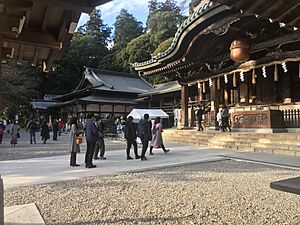
- Tsukubasan Shrine – A historic shrine on Mount Tsukuba.
- Hirasawa Kanga ruins archaeological site – See ancient history.
- Site of Oda Castle – Explore the remains of an old castle.
- Kanamura Wake Ikazuchi Shrine – Another important shrine.
Sister Cities Around the World
Tsukuba has special friendships with cities in other countries. These are called sister cities:
 Irvine, California, United States (since 1989)
 Milpitas, California, United States (since 1996)
 Cambridge, Massachusetts, United States (since 1984)
 Grenoble, France (since 2013)
 Bochum, Germany (since 2019)
 Shenzhen, China (friendship city)
Famous People from Tsukuba
Many talented people have come from Tsukuba:
- Leo Esaki, a Nobel Prize winner for physics.
- Hideki Shirakawa, another Nobel Prize winner for chemistry.
- Susumu Hirasawa, a musician known for electronic music.
- Mitsuhiro Ishida, a mixed martial artist.
- Yasuaki Kurata, an actor.
- Haruka Sunada, a volleyball player.
- Minanogawa Tōzō, a sumo wrestler.
- Hiroki Yamada, a baseball player.
- Hitoshi Igarashi, a literary scholar and translator.
Images for kids
See also
 In Spanish: Tsukuba (Ibaraki) para niños


