Turtle Mountain (plateau) facts for kids
Quick facts for kids Turtle Mountain |
|
|---|---|

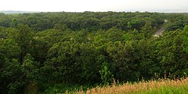
View across Turtle Mountain in Turtle Mountain State Forest, North Dakota
|
|
| Location | North Dakota (U.S.) and Manitoba (Canada) |
| Coordinates | 48°58′00″N 100°07′30″W / 48.96667°N 100.12500°W |
| Elevation | 600 metres (1,969 ft) |
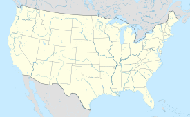
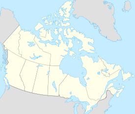
Turtle Mountain, also known as the Turtle Mountains, is a special area in the middle of North America. It's located in the northern part of North Dakota in the United States and the southwestern part of Manitoba, Canada. This area is about 100 kilometers south of Brandon.
Turtle Mountain is like a flat-topped hill, called a plateau. It stands about 600 meters (2,000 feet) above sea level. This means it's 90 to 120 meters (300 to 400 feet) higher than the land around it. The plateau stretches about 32 kilometers (20 miles) from north to south and 64 kilometers (40 miles) from east to west. The highest point in North Dakota, Boundary Butte, is on the western edge of this plateau.
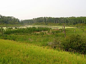
The area is full of trees and many lakes. One of the biggest lakes is Lake Metigoshe, which is split by the border between Canada and the U.S. Turtle Mountain is home to Turtle Mountain Provincial Park, a state park, and places where you can go hunting and fishing.
This land has been important for a long time to the Plains Ojibwe people. It's also part of the traditional homeland of the Métis people.
Contents
History of Turtle Mountain
The Plains Ojibwe people have lived in the Turtle Mountain area for a very long time. Another group, the Métis, also hunted and fished here. They moved west from a place called Pembina to find buffalo.
In the 1800s, as more people moved into the area and the border between Canada and the United States was decided, many Indigenous people had to move. The U.S. government recognized some of these groups, like the Pembina Band. However, this didn't include all the Ojibwe people already living at Turtle Mountain.
Over time, many Indigenous groups, including the Turtle Mountain Chippewa and the Little Shell Tribe of Chippewa, lost their lands as the government opened the area for new settlers.
Nature and Wildlife

Plants and Trees
The Turtle Mountain area is covered by a forest with many different kinds of trees. You can find green ash, aspen, Manitoba maple, American elm, and paper birch. There are also bur oak and balsam poplar trees.
Underneath the trees, you'll see many shrubs. These include beaked hazel, chokecherry, saskatoon berry, and nannyberry. You might also spot dogwood, highbush cranberry, and pincherry. Near Mary Lake, there are special orchids like the spotted coralroot and calypso orchids.
Animals of Turtle Mountain
Many animals live in Turtle Mountain. You might see large animals like moose and white-tailed deer. Smaller animals like beaver, raccoon, and mink also make their homes here.
The area is also a great place for birds. You can spot loons, great blue herons, and black-crowned night herons. Double-crested cormorants and red-necked grebes are also common.
The many small lakes are home to painted turtles and different kinds of frogs, like wood frogs and Northern Leopard Frogs. You might even find the barred tiger salamander.
Climate
| Climate data for Turtle Mountain Station 6 | |||||||||||||
|---|---|---|---|---|---|---|---|---|---|---|---|---|---|
| Month | Jan | Feb | Mar | Apr | May | Jun | Jul | Aug | Sep | Oct | Nov | Dec | Year |
| Record high °C (°F) | 6.0 (42.8) |
15.5 (59.9) |
19.5 (67.1) |
33.0 (91.4) |
36.5 (97.7) |
38.0 (100.4) |
37.5 (99.5) |
41.0 (105.8) |
34.5 (94.1) |
33.0 (91.4) |
22.0 (71.6) |
8.5 (47.3) |
41.0 (105.8) |
| Mean daily maximum °C (°F) | −9.4 (15.1) |
−6.2 (20.8) |
0.5 (32.9) |
11.9 (53.4) |
19.3 (66.7) |
23.1 (73.6) |
25.8 (78.4) |
25.7 (78.3) |
19.6 (67.3) |
11.3 (52.3) |
−0.3 (31.5) |
−7.5 (18.5) |
9.5 (49.1) |
| Daily mean °C (°F) | −14.6 (5.7) |
−11.7 (10.9) |
−4.8 (23.4) |
5.2 (41.4) |
12.0 (53.6) |
16.6 (61.9) |
19.0 (66.2) |
18.4 (65.1) |
12.6 (54.7) |
4.9 (40.8) |
−5.1 (22.8) |
−12.4 (9.7) |
3.4 (38.1) |
| Mean daily minimum °C (°F) | −19.7 (−3.5) |
−17.1 (1.2) |
−10.2 (13.6) |
−1.6 (29.1) |
4.6 (40.3) |
10.0 (50.0) |
12.2 (54.0) |
11.1 (52.0) |
5.5 (41.9) |
−1.4 (29.5) |
−9.8 (14.4) |
−17.2 (1.0) |
−2.8 (27.0) |
| Record low °C (°F) | −43.0 (−45.4) |
−43.0 (−45.4) |
−36.5 (−33.7) |
−24.0 (−11.2) |
−14.0 (6.8) |
−1.0 (30.2) |
2.5 (36.5) |
−0.5 (31.1) |
−6.5 (20.3) |
−23.5 (−10.3) |
−33.0 (−27.4) |
−41.5 (−42.7) |
−43.0 (−45.4) |
| Average precipitation mm (inches) | 19.0 (0.75) |
14.7 (0.58) |
25.5 (1.00) |
26.1 (1.03) |
61.2 (2.41) |
85.6 (3.37) |
82.0 (3.23) |
66.7 (2.63) |
41.5 (1.63) |
37.3 (1.47) |
24.3 (0.96) |
21.2 (0.83) |
504.9 (19.88) |
| Average rainfall mm (inches) | 0.0 (0.0) |
0.5 (0.02) |
6.1 (0.24) |
15.4 (0.61) |
56.6 (2.23) |
85.6 (3.37) |
82.0 (3.23) |
66.7 (2.63) |
41.1 (1.62) |
28.7 (1.13) |
4.5 (0.18) |
1.1 (0.04) |
388.0 (15.28) |
| Average snowfall cm (inches) | 19.1 (7.5) |
14.2 (5.6) |
19.2 (7.6) |
10.6 (4.2) |
4.6 (1.8) |
0.0 (0.0) |
0.0 (0.0) |
0.0 (0.0) |
0.3 (0.1) |
8.7 (3.4) |
19.9 (7.8) |
20.3 (8.0) |
116.9 (46.0) |
| Source: Environment Canada | |||||||||||||
Towns and Cities Nearby
- Belcourt, North Dakota
- Boissevain, Manitoba
- Bottineau, North Dakota
- Deloraine, Manitoba
- Dunseith, North Dakota
- East Dunseith, North Dakota
- Green Acres, North Dakota
- Rolla, North Dakota
- St. John, North Dakota
- Shell Valley, North Dakota
Local Government Areas
- Bottineau County, North Dakota
- Rolette County, North Dakota
- Rural Municipality of Morton, Manitoba
- Rural Municipality of Turtle Mountain, Manitoba
- Rural Municipality of Winchester, Manitoba
Parks to Explore
- International Peace Garden
- Lake Metigoshe State Park
- Rabb Lake National Wildlife Refuge
- School Section Lake National Wildlife Refuge
- Turtle Mountain Provincial Park
- William Lake Provincial Park
- Willow Lake National Wildlife Refuge
Fun Places to Visit
- International Peace Garden
- Bottineau Winter Park is a ski area where you can go skiing. It has a drop of about 250 feet.
 | Laphonza Butler |
 | Daisy Bates |
 | Elizabeth Piper Ensley |


