
Uniontown, Alabama facts for kids
Quick facts for kids
Uniontown
|
|
|---|---|

Aerial view of Uniontown, Alabama. View is looking to the northeast. Uniontown Municipal Building (City Hall) and Uniontown's Historic Water Tower is visible slightly left of center in the picture.
|
|

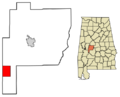
Location of Uniontown in Perry County, Alabama
|
|
| Country | United States |
| State | Alabama |
| County | Perry |
| Area | |
| • Total | 15.19 sq mi (39.35 km2) |
| • Land | 15.18 sq mi (39.31 km2) |
| • Water | 0.02 sq mi (0.04 km2) |
| Elevation | 299 ft (91 m) |
| Population
(2020)
|
|
| • Total | 2,107 |
| • Density | 138.83/sq mi (53.60/km2) |
| Time zone | UTC-6 (Central (CST)) |
| • Summer (DST) | UTC-5 (CDT) |
| ZIP code |
36786
|
| Area code(s) | 334 |
| FIPS code | 01-77904 |
| GNIS feature ID | 0153806 |
| Website | uniontownal.com |
Uniontown is a city located in Perry County, Alabama. It's in the western part of central Alabama. In 2020, about 2,107 people lived there. This was a good increase from 2010! Among all the cities in Alabama, Uniontown is the 207th largest by population.
This city is special because it has four places listed on the National Register of Historic Places. These are Fairhope Plantation, Pitts' Folly, the Uniontown Historic District, and Westwood. These sites help tell the story of the area's past.
Contents
History of Uniontown
Uniontown was first settled in 1818. It was originally called Woodville, named after the first family who lived there. The town officially became a city on December 23, 1836.
Early Roads and Railroads
Woodville was important for transportation. In 1848, one of Alabama's first plank roads was built here. This road, made of wooden planks, connected Woodville to Demopolis. Later, in 1857, the Alabama and Mississippi Railroad came through the town. This helped the town grow even more.
Growth and Name Change
By 1860, Woodville was a busy place. It had schools for both boys and girls. The main street was full of businesses, including two large department stores. The town's economy was strongly linked to the nearby farms and plantations.
In 1861, the town's name changed to Uniontown. This idea came from a local farmer named Philip Weaver. His hometown was Uniontown, Maryland, and he suggested the new name.
Uniontown During the Civil War
During the Civil War, many men from Uniontown joined the fight. Some were part of the Canebrake Rifle Guards. This unit was named after the local area where Uniontown is located. Others joined a group called the Independent Troop of Uniontown. After the war, the area continued to rely on farming.
Industry and Challenges
In 1897, the Uniontown Cotton Oil Company opened. This was one of the first factories of its kind in Alabama. It made oil and meal from cotton seeds. It was also one of the first industrial businesses in Perry County.
By 1900, Uniontown had many cotton-related businesses. These included cotton gins, warehouses, and a cotton mill. The city also had electricity and telephone services. However, less than 20 years later, Uniontown's population started to shrink. Many people left the farms because tiny insects called boll weevils ruined the cotton crops. Today, the town still depends a lot on farming, including raising animals.
Environmental Note
In 2008, a lot of coal ash was moved to a landfill in Uniontown. This landfill is allowed to take certain types of waste from many states.
Geography of Uniontown
Uniontown is located at 32°26′56″N 87°30′44″W / 32.44889°N 87.51222°W.
The U.S. Census Bureau says the city covers about 15.19 square miles (39.35 square kilometers). Most of this area is land, with a very small part being water.
Climate in Uniontown
Uniontown has a climate with hot, humid summers. Winters are usually mild to cool. This type of weather is called a humid subtropical climate. On climate maps, it's often shown as "Cfa."
Population and People
| Historical population | |||
|---|---|---|---|
| Census | Pop. | %± | |
| 1850 | 290 | — | |
| 1870 | 1,444 | — | |
| 1880 | 810 | −43.9% | |
| 1890 | 854 | 5.4% | |
| 1900 | 1,047 | 22.6% | |
| 1910 | 1,836 | 75.4% | |
| 1920 | 1,359 | −26.0% | |
| 1930 | 1,424 | 4.8% | |
| 1940 | 1,869 | 31.3% | |
| 1950 | 1,798 | −3.8% | |
| 1960 | 1,993 | 10.8% | |
| 1970 | 2,133 | 7.0% | |
| 1980 | 2,112 | −1.0% | |
| 1990 | 1,730 | −18.1% | |
| 2000 | 1,623 | −6.2% | |
| 2010 | 1,775 | 9.4% | |
| 2020 | 2,107 | 18.7% | |
| U.S. Decennial Census 2013 Estimate |
|||
What the 2010 Census Showed
In 2010, there were 2,684 people living in Uniontown. There were 720 households, and 530 of those were families. The city had about 1,365 people per square mile.
Most people in Uniontown were Black or African American (90.6%). About 9.1% were White. A small number (0.5%) were Hispanic or Latino.
Many households (36.8%) had children under 18. About 20.2% were married couples. Many households (44.2%) had a female head of household without a husband. About 28.5% of households were just one person.
The average age in Uniontown was 28.4 years old. About 35.8% of the people were under 18.
What the 2020 Census Showed
| Race | Num. | Perc. |
|---|---|---|
| White (non-Hispanic) | 162 | 7.69% |
| Black or African American (non-Hispanic) | 1,903 | 90.32% |
| Native American | 4 | 0.19% |
| Other/Mixed | 27 | 1.28% |
| Hispanic or Latino | 11 | 0.52% |
As of the 2020 United States census, Uniontown had 2,107 people. There were 704 households and 319 families living in the town.
Local Events and Sports
Uniontown is well-known for its high school basketball teams. They have won eleven state championships! The last championship team had a player named Frankie Sullivan. He later played for Auburn University. In his championship game, he scored an amazing 51 points!
Famous People from Uniontown
Many interesting people have come from Uniontown, including:
- Juanita Abernathy – A civil rights activist who worked for equal rights.
- Augusta Clark – A politician from Pennsylvania.
- Tony Cox – An actor born in Uniontown in 1958.
- Erwin Dudley – A professional basketball player.
- Morris Ernst – A lawyer who helped start the American Civil Liberties Union.
- Eugene Lipscomb – A football player born in Uniontown in 1931.
- Zeke Smith – An NFL football player.
- Martha Goodwin Tunstall – A suffragist born in Uniontown in 1838. Suffragists worked for women's right to vote.
- Holland Dai'mon Witherspoon – A musician.
Images for kids
-

Aerial view of Uniontown, Alabama.
-
Location of Uniontown in Perry County, Alabama
See also
 In Spanish: Uniontown (Alabama) para niños
