
Vaudreuil-Dorion facts for kids
Quick facts for kids
Vaudreuil-Dorion
|
||
|---|---|---|
|
City
|
||

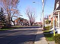
Avenue Saint-Jean-Baptiste in Dorion
|
||
|
||

Location within Vaudreuil-Soulanges RCM
|
||

Vaudreuil-Dorion
Location in Southern Quebec
|
||
| Country | Canada | |
| Province | Quebec | |
| Region | Montérégie | |
| RCM | Vaudreuil-Soulanges | |
| Constituted | 16 March 1994 | |
| Area | ||
| • Total | 92.56 km2 (35.74 sq mi) | |
| • Land | 72.65 km2 (28.05 sq mi) | |
| Population
(2021)
|
||
| • Total | 43,268 | |
| • Density | 595.5/km2 (1,542/sq mi) | |
| • Pop 2016-2021 | ||
| • Dwellings | 17,260 | |
| Time zone | UTC−5 (EST) | |
| • Summer (DST) | UTC−4 (EDT) | |
| Postal code(s) |
J7T to J7V
|
|
| Area code(s) | 450, 579 and 354 | |
| Highways |
||

Vaudreuil-Dorion is a city in southwestern Quebec, Canada. It's like a neighborhood of Greater Montreal. This city was formed when two smaller towns, Vaudreuil and Dorion, joined together. It is part of the Vaudreuil-Soulanges Regional County Municipality.
Contents
History of Vaudreuil-Dorion
Early Days and Growth
On November 23, 1702, the governor of New France, Louis-Hector de Callière, gave land to Philippe de Vaudreuil. He was the governor of Montreal at that time. Later, Rigaud de Vaudreuil became the governor of all New France.
In 1725, only 38 people lived in this area. Around 1742, more people started to move there. By 1765, Vaudreuil had 381 residents.
The Rise of Dorion
When the Grand Trunk Railway was built, people started to live in a new area. This area was called Vaudreuil Station, and it later became known as Dorion. Dorion officially became a village in 1891.
Autoroute 20 was built through Dorion. This highway connects Downtown Montreal to Toronto. The main train lines between Toronto and Montreal also run through Dorion. Many new houses were built in Dorion from the 1950s to the 1970s. More homes continued to appear north and east of Dorion in the 1980s and 1990s.
Joining Together: Vaudreuil-Dorion
In 1994, the towns of Vaudreuil and Dorion merged. They became one larger city, which is now known as Vaudreuil-Dorion.
Geography of Vaudreuil-Dorion
Vaudreuil-Dorion is located on the south side of the Lake of Two Mountains. This is where the Saint Lawrence and Ottawa Rivers meet. It's also just west of Île Perrot.
The city has two main parts that are not connected. The larger eastern part is along the Lake of Two Mountains. This is where the main towns of Vaudreuil and Dorion are. The smaller western part is a rural area. It is next to Rigaud and is separated from the eastern part by Saint-Lazare and Hudson.
Population and Languages
How Many People Live Here?
In 2021, the city of Vaudreuil-Dorion had a population of 43,268 people. This was a 13.5% increase from 2016. The city has a land area of about 72.65 square kilometers. This means there are about 595.5 people living in each square kilometer.
Languages Spoken
The main language spoken in Vaudreuil-Dorion is French. However, many people also speak English. In 2021, about 48.5% of people spoke French as their first language. About 22.8% spoke English as their first language. Some people speak both French and English, or other languages. The number of people speaking English and other languages has been growing.
Getting Around Vaudreuil-Dorion
Major Highways
Vaudreuil-Dorion is an important spot for travel. Three of Canada's busiest highways meet here:
- Autoroute 40 / Autoroute 30 / Autoroute 20 connect to the Quebec City-Windsor Corridor.
- Highway 417 connects to Ottawa.
- Autoroute 20 and Highway 401 connect Toronto to Montreal.
- Autoroute 30 is a bypass route south of Montreal.
Local Transportation
Local buses are run by Exo La Presqu'Île. These buses connect to the Vaudreuil and Dorion train stations. These stations are part of the Vaudreuil-Hudson commuter train line.
Local Media
CJVD-FM is a radio station that has its studios in Vaudreuil-Dorion. It broadcasts on 100.1 FM. You can hear it in Vaudreuil-Soulanges, the West Island, and Valleyfield. CJVD started broadcasting in 2008. It plays French and English hit songs from the 1960s to 1995.
Schools in Vaudreuil-Dorion
French Public Schools
The Commission scolaire des Trois-Lacs operates French public schools in the area:
- École Brind'Amour Pavillon P
- École Sainte-Madeleine
- École Saint-Michel
- École Harwood (serves the Dorion-Garden area)
- École du Papillon-Bleu (pavillon St-Jean-Baptiste and pavillon Sainte-Trinité)
- École Hymne-au-Printemps
- École Secondaire de la Cité-des-Jeunes (a high school)
English Public Schools
The Lester B. Pearson School Board operates English public schools:
- Pierre Elliott Trudeau Elementary School
- Other parts of the city are served by Mount Pleasant Elementary School in Hudson, St. Patrick Elementary School in Pincourt, and Birchwood Elementary School and Evergreen Elementary School in Saint-Lazare.
Famous People from Vaudreuil-Dorion
- Christian Chagnon - a handball player who competed in the 1976 Summer Olympics.
- André Hainault - a soccer player for the Canadian national team and Houston Dynamo.
- Constant Montpellier - a jockey (horse racer).
- Norbert Murphy - an archer who won a bronze medal at the Paralympics.
- Hormisdas Pilon - a Quebec politician.
- Sasha Pokulok - an ice hockey defenceman.
- Marc-André Servant - an ice dancer.
- Maxime Deschamps - a figure skater.
- Lionel Groulx - a famous Quebec nationalist.
Images for kids
-
Avenue Saint-Jean-Baptiste in Dorion
See also
 In Spanish: Vaudreuil-Dorion para niños
