Warfield, Kentucky facts for kids
Quick facts for kids
Warfield, Kentucky
|
|
|---|---|

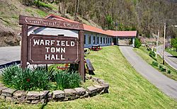
Town Hall in Warfield
|
|

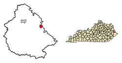
Location in Martin County, Kentucky
|
|
| Country | United States |
| State | Kentucky |
| County | Martin |
| Incorporated | May 5, 1982 |
| Government | |
| • Type | City Commission |
| Area | |
| • Total | 0.84 sq mi (2.17 km2) |
| • Land | 0.82 sq mi (2.14 km2) |
| • Water | 0.01 sq mi (0.03 km2) |
| Elevation | 702 ft (214 m) |
| Population
(2020)
|
|
| • Total | 264 |
| • Density | 320.00/sq mi (123.55/km2) |
| Time zone | UTC-5 (Eastern (EST)) |
| • Summer (DST) | UTC-4 (EDT) |
| ZIP code |
41267
|
| Area code(s) | 606 |
| FIPS code | 21-80616 |
| GNIS feature ID | 2405671 |
Warfield is a small city located in Martin County, Kentucky, in the United States. It is known as a "home rule-class city," which means it has the power to manage its own local affairs. According to the 2020 census, about 264 people live there.
History of Warfield
Warfield started as a small town in the early 1850s. This happened after a salt works was built by two men, George Rogers Clark Floyd and John Warfield. They were from Virginia.
The town's post office opened on April 15, 1856. It was named after John Warfield. George Rogers Clark Floyd also helped the town grow. He made it a place where coal from his mine could be shipped out. This was the first coal mine to open in what would become Martin County.
For a short time, from 1870 to 1873, Warfield was the county seat for Martin County. This means it was the main government center. However, the county seat was later moved to Inez.
Warfield's Geography
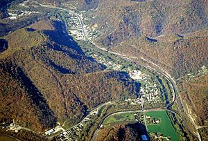
Warfield is located in the eastern part of Martin County. The town sits on the west side of the Tug Fork river. This river forms the border between Kentucky and West Virginia.
Right across the river to the east is the town of Kermit, West Virginia. Warfield and Kermit are connected by a bridge for cars and an old railroad bridge that is no longer used. Just west of Warfield, you'll find the community of Beauty.

The city of Warfield is mainly located around where two roads meet: Kentucky Route 40 and Kentucky Route 292.
- KY 40 goes west about 9 miles (14 km) to Inez. It continues about 32 miles (51 km) to Paintsville.
- KY 292 runs north and south along the Tug Fork river. If you go north, Louisa is about 31 miles (50 km) away. If you go southeast, Williamson, West Virginia, is about 20 miles (32 km) away.
The United States Census Bureau says that Warfield covers a total area of about 0.84 square miles (2.17 square kilometers). Most of this area is land, with only a very small part (about 0.01 square miles or 0.03 square kilometers) being water.
Population and People
| Historical population | |||
|---|---|---|---|
| Census | Pop. | %± | |
| 1880 | 54 | — | |
| 1940 | 296 | — | |
| 1950 | 324 | 9.5% | |
| 1960 | 295 | −9.0% | |
| 1970 | 236 | −20.0% | |
| 1990 | 364 | — | |
| 2000 | 284 | −22.0% | |
| 2010 | 269 | −5.3% | |
| 2020 | 264 | −1.9% | |
| U.S. Decennial Census | |||
The word "demographics" means facts about the people who live in a place, like how many there are, their ages, and how they live.
In the year 2000, there were 284 people living in Warfield. These people lived in 120 different homes. All the people counted in the city were White. A very small number, about 0.35%, were of Hispanic or Latino background.
The people in Warfield were of different ages:
- About 20.4% were under 18 years old.
- About 10.6% were between 18 and 24 years old.
- About 28.9% were between 25 and 44 years old.
- About 26.1% were between 45 and 64 years old.
- About 14.1% were 65 years old or older.
The average age of people in Warfield was 41 years old.
See also
 In Spanish: Warfield (Kentucky) para niños
 | Percy Lavon Julian |
 | Katherine Johnson |
 | George Washington Carver |
 | Annie Easley |

