Warren County, Georgia facts for kids
Quick facts for kids
Warren County
|
|
|---|---|

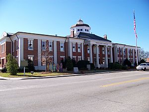
Warren County courthouse in Warrenton
|
|

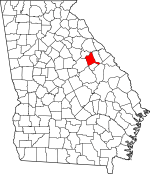
Location within the U.S. state of Georgia
|
|
 Georgia's location within the U.S. |
|
| Country | |
| State | |
| Founded | December 19, 1793 |
| Named for | Joseph Warren |
| Seat | Warrenton |
| Largest city | Warrenton |
| Area | |
| • Total | 287 sq mi (740 km2) |
| • Land | 284 sq mi (740 km2) |
| • Water | 2.4 sq mi (6 km2) 0.8%% |
| Population
(2020)
|
|
| • Total | 5,215 |
| • Density | 21/sq mi (8/km2) |
| Time zone | UTC−5 (Eastern) |
| • Summer (DST) | UTC−4 (EDT) |
| Congressional district | 12th |
Warren County is a place in the state of Georgia, USA. In 2020, about 5,215 people lived there. This number was a bit lower than in 2010.
The main town, or 'county seat,' is Warrenton. Warren County was started a long time ago, on December 19, 1793. It's named after General Joseph Warren. He was a brave soldier who died in a famous battle called the Battle of Bunker Hill.
Contents
About Warren County's Land
Warren County covers about 287 square miles. Most of this area, about 284 square miles, is land. Only a small part, about 2.4 square miles, is water. That's less than 1% of the total area.
The northern and northeastern parts of Warren County are near the Little River. This river flows into the larger Savannah River. The southeastern part of the county is close to Brier Creek, which also flows into the Savannah River. The western half of the county is part of the Ogeechee River area.
Main Roads in Warren County
Neighboring Counties
Warren County shares borders with these other counties:
- Wilkes County (to the north)
- McDuffie County (to the east)
- Glascock County (to the south)
- Jefferson County (to the southeast)
- Hancock County (to the southwest)
- Taliaferro County (to the northwest)
Towns and Communities
Warren County has a few different types of communities.
Cities
Towns
Other Communities
These are smaller places that are not officially cities or towns:
People in Warren County
The United States government counts how many people live in different areas every ten years. This is called a census.
In 2020, the census showed that 5,215 people lived in Warren County. There were 2,244 households, which are groups of people living together. There were also 1,456 families.
Here's a look at the different groups of people living in Warren County in 2020:
| Race | Number of People | Percentage |
|---|---|---|
| White (not Hispanic or Latino) | 1,974 | 37.85% |
| Black or African American (not Hispanic or Latino) | 3,047 | 58.43% |
| Native American | 18 | 0.35% |
| Asian | 15 | 0.29% |
| Pacific Islander | 1 | 0.02% |
| Other/Mixed (people who chose more than one race) | 107 | 2.05% |
| Hispanic or Latino | 53 | 1.02% |
See also
 In Spanish: Condado de Warren (Georgia) para niños
 | Jessica Watkins |
 | Robert Henry Lawrence Jr. |
 | Mae Jemison |
 | Sian Proctor |
 | Guion Bluford |

