Ogeechee River facts for kids
Quick facts for kids Ogeechee River |
|
|---|---|

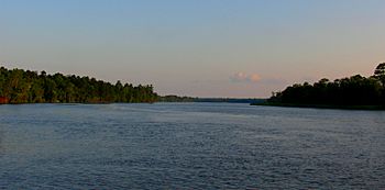
The Ogeechee River near Savannah, Georgia
|
|
| Country | United States |
| State | Georgia (U.S. state) |
| Physical characteristics | |
| Main source | United States |
| Basin features | |
| Tributaries |
|

The Ogeechee River is a 294-mile-long (473 km) blackwater river in the U.S. state of Georgia. Blackwater rivers get their dark color from decaying plants in swamps.
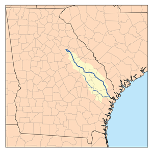
The river starts where its North and South Forks meet. This is about 2.5 miles (4.0 km) southwest of Crawfordville. It then flows mostly southeast towards Ossabaw Sound, which is about 16 miles (26 km) south of Savannah.
The biggest river that flows into the Ogeechee is the Canoochee River. This river drains about 1,400 square miles (3,600 km2) of land. The Ogeechee River and its branches form a large area called a watershed, which covers 5,540 square miles (14,300 km2). This means all the rain that falls in this area eventually flows into the Ogeechee River. It is special because it is one of Georgia's few rivers that flows freely without many dams.
Contents
The River's Journey
The Ogeechee River begins in the Piedmont region of Georgia. This area has rolling hills. It then crosses the Fall Line, where the land drops down. After that, it flows through the Sandhills region.
Finally, the river crosses the flat Coastal Plain of Georgia. It then empties into the Atlantic Ocean. At its start, the Ogeechee is a clear, shallow stream. It has small waterfalls and fast-moving sections called rapids.
Below Louisville, the river changes. It becomes a slow, winding channel. It flows through large cypress swamps and many miles of untouched forests.
River Rocks and Soil
What the Land is Made Of
The Ogeechee River area includes parts of two main land types. These are the Piedmont and the Coastal Plain. The Piedmont has older, hard rocks. The Coastal Plain has younger, softer sediments like sand and clay.
The rocks in the river basin include metamorphic rocks. These are rocks that have changed due to heat and pressure. You can also find schists and phyllites, which are types of metamorphic rock. Other rocks include felsic and mafic metavolcanic rocks, which come from ancient volcanoes, and amphibolite.
The Soils Along the River
The Ogeechee River watershed crosses four main types of land areas in Georgia. About 6% of the land is in the Southern Piedmont area. This area has soils that are often sandy on top with a clay-like layer underneath.
About 4% is in the Carolina and Georgia Sand Hills. Another 48% is in the Southern Coastal Plain. The last 42% is in the Atlantic Coast Flatwoods. The soils in the Southern Coastal Plain are quite varied. They can differ a lot in how sandy or clay-like they are, and how deep the water table is.
River History
People called Paleo-Indians first arrived near the Ogeechee River about 11,500 years ago. Later, the river area was home to the Mississippian people and the Yuchi for many centuries. This was before Europeans came to the area.
The name "Ogeechee" might come from a Muskogee word. It could mean "river of the Uchees," referring to the Yuchi people. Some experts also think the river's name is connected to the name Gullah Geechee. This name is used for the Gullah people who live along the coast of Georgia.
See also
 In Spanish: Río Ogeechee para niños
 | Janet Taylor Pickett |
 | Synthia Saint James |
 | Howardena Pindell |
 | Faith Ringgold |


