Warrior Peak facts for kids
Quick facts for kids Warrior Peak |
|
|---|---|

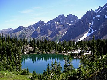
Warrior Peak (centered) beyond Home Lake
|
|
| Highest point | |
| Elevation | 7,320+ ft (2,230+ m) |
| Prominence | 760 ft (230 m) |
| Geography | |
| Location | Jefferson County, Washington, USA |
| Parent range | Olympic Mountains |
| Topo map | USGS Mount Deception |
| Geology | |
| Age of rock | Eocene |
| Type of rock | pillow basalt |
| Climbing | |
| First ascent | 1945 Fred Beckey (solo) |
| Easiest route | Scrambling class 3 |
Warrior Peak is a tall mountain located in Olympic National Park in Jefferson County, Washington. It stands about 7,320 feet (2,231 meters) high. This mountain has two peaks, like two tops close together! The one facing southeast is a little bit taller.
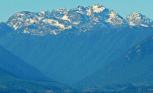
Warrior Peak is the 11th highest mountain in the Olympic Mountains. You can easily spot it from Seattle. It looks like the first big mountain just north of Mount Constance. Mount Constance is the main peak you see on the horizon. Warrior Peak's closest taller neighbor is Mount Constance, which is about 0.8 miles (1.3 km) to the south-southeast.
The first person to climb Warrior Peak was Fred Beckey in 1945. He climbed both peaks by himself and gave the mountain its name.
Weather at Warrior Peak
Warrior Peak is in a "marine west coast" climate zone. This means it gets a lot of weather from the Pacific Ocean. Most storms travel northeast towards the Olympic Mountains. When these storms hit the tall peaks, the air is forced upwards. This causes the clouds to drop their moisture as rain or snow.
Because of this, the Olympic Mountains get a lot of rain and snow, especially in winter. Winters are often cloudy. But in summer, high pressure systems over the Pacific Ocean bring clear skies. The snow here tends to be wet and heavy, which can sometimes lead to avalanche danger.
The best time to climb Warrior Peak is from June to September. This is when the weather is usually the nicest. Water from the west side of the mountain flows into Home Creek. This creek then joins the Dungeness River. Water from the east side flows into Tunnel Creek, which joins the Big Quilcene River.
How Warrior Peak Was Formed
The Olympic Mountains are made of special rocks. These rocks were pushed up from the ocean floor a long, long time ago. They are mostly sandstone, turbidite, and basalt. These rocks formed during a time called the Eocene epoch.
Later, during the Pleistocene era, huge sheets of ice called glaciers moved across the land. These glaciers carved out the mountains we see today. They moved forward and backward many times, shaping the landscape with their power.
 | Sharif Bey |
 | Hale Woodruff |
 | Richmond Barthé |
 | Purvis Young |


